Chest opened
+${chestReward.xp} XP
Explorer
NOUVEAU ×${chestReward.collectible.quantity}
tapez pour fermer
Chest locked

Open chests in the app

Around Us is built for your phone — chests unlock when you walk, explore and capture nearby places.

Enable Location

We need your location to show you interesting places around you

Discover nearby places

Find interesting locations and hidden gems around you

Precise directions

Get accurate directions and distances to places

Your location is never shared with other users. It's only used when you tap the location button.

Log in to your account

Start exploring — it's free

Trusted by 73,103 travelers worldwide

Continue with Google
Continue with Apple
or

We will send you a code to connect

By continuing, you accept our Terms and Conditions and our Privacy Policy

Check your inbox

We've sent a pincode in your inbox. Please enter the code below.

Нефтяное месторождение имени Россихина
Discussion Reviews Photo
2.1k Popularity

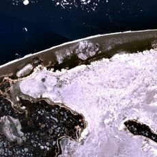
Нефтяное месторождение имени Россихина, Oil field in Khanty-Mansi Autonomous Okrug, Russia.

The Rossikhina oil field is an extraction facility in western Siberia with numerous wells and pipelines distributed across the plain. The infrastructure connects dozens of production points and transports extracted crude to processing stations.

The field was discovered in the 1970s and became an important production site during the Soviet development of Siberian resources. Its development significantly increased Soviet crude output during that era.

The oil field provides employment opportunities for local communities in western Siberia, supporting regional development and economic stability.

The area is difficult to access and mainly visited by energy industry specialists. Extreme cold in winter and marshy ground in summer significantly affect site conditions.

Environmental monitoring stations around the field track the impact on the arctic ecosystem while maintaining continuous extraction operations.

The community of curious travelers

AroundUs brings together thousands of curated places, local tips, and hidden gems, enriched daily by 60,000 contributors worldwide.

Start exploring
GPS coordinates
67.94639,56.93639
Latest update
December 13, 2025 17:02
Around this place
Mount Narodnaya
Russian Federation

Mount Narodnaya

353.4 km
Virgin Komi Forests
Russian Federation

Virgin Komi Forests

350.7 km
Varandey
Russian Federation

Varandey

108.2 km
Manaraga
Russian Federation

Manaraga

346.3 km
Nenets Nature Reserve
Russian Federation

Nenets Nature Reserve

153.4 km
Богоявленский собор
Russian Federation

Богоявленский собор

168.7 km
Памятник Яку-7Б (Нарьян-Мар)
Russian Federation

Памятник Яку-7Б (Нарьян-Мар)

168.7 km
Inta water tower
Russian Federation

Inta water tower

253.6 km
Dvorets Kultury Shakterov
Russian Federation

Dvorets Kultury Shakterov

304.1 km
Ненецький краєзнавчий музей
Russian Federation

Ненецький краєзнавчий музей

168.6 km
Здание почты (Нарьян-Мар)
Russian Federation

Здание почты (Нарьян-Мар)

168.8 km
Peter and Paul Church
Russian Federation

Peter and Paul Church

444.4 km
Харнаурды-Кеу
Russian Federation

Харнаурды-Кеу

383.4 km
Здание администрации Ненецкого автономного округа
Russian Federation

Здание администрации Ненецкого автономного округа

168.9 km
Russian Federation

Обелиск Победы в Нарьян-Маре

168.8 km
Дом культуры речников (Печора)
Russian Federation

Дом культуры речников (Печора)

315.3 km
Дом Шевелевых
Russian Federation

Дом Шевелевых

168.7 km
Памятник Нарьян-Марским портовикам
Russian Federation

Памятник Нарьян-Марским портовикам

169 km
Преображенская церковь (Ижма)
Russian Federation

Преображенская церковь (Ижма)

353.5 km
Здание инородческих управ, в котором была провозглашена советская власть в Обдорске (Салехард)
Russian Federation

Здание инородческих управ, в котором была провозглашена советская власть в Обдорске (Салехард)

444.5 km
Торговый дом купца И.Н. Корнилова (Салехард)
Russian Federation

Торговый дом купца И.Н. Корнилова (Салехард)

444.6 km
Polar circle monument
Russian Federation

Polar circle monument

444.6 km
Obdorsky ostrog
Russian Federation

Obdorsky ostrog

444.5 km
Gorky Cinema
Russian Federation

Gorky Cinema

311.5 km
Дом купца И.А. Рочева-Моторова (Салехард)
Russian Federation

Дом купца И.А. Рочева-Моторова (Салехард)

444.6 km
Matveev Island Lighthouse
Russian Federation

Matveev Island Lighthouse

181.6 km
Церковь Николая Чудотворца — первый православный самоедский (ненецкий) храм в Большеземельской тундре (Колва)
Russian Federation

Церковь Николая Чудотворца — первый православный самоедский (ненецкий) храм в Большеземельской тундре (Колва)

221 km
Дом священника и церковно-приходская школа (Колва)
Russian Federation

Дом священника и церковно-приходская школа (Колва)

221 km
Show the full map
Reviews
Share your experience

No review yet

Discussions
Start a discussion...

No discussion yet

« Нефтяное месторождение имени Россихина - Oil field in Khanty-Mansi Autonomous Okrug, Russia » is provided by Around Us (aroundus.com). Images and texts are derived from Wikimedia project under a Creative Commons license. You are allowed to copy, distribute, and modify copies of this page, under the conditions set by the license, as long as this note is clearly visible.

Discover hidden gems everywhere you go!

From secret cafés to breathtaking viewpoints, skip the crowded tourist spots and find places that match your style. Our app makes it easy with voice search, smart filtering, route optimization, and insider tips from travelers worldwide. Download now for the complete mobile experience.

Around Us App Screenshot

A unique approach to discovering new places

Le Figaro

All the places worth exploring

France Info

A tailor-made excursion in just a few clicks

20 Minutes

Around Us
Travel Guide & Maps
Download

Send to your phone

QR Code
1

Open the camera app on your mobile.

2

Point at the QR code with your camera. A notification will appear.

3

Tap the notification to open the link.