Chest opened
+${chestReward.xp} XP
Explorer
NOUVEAU ×${chestReward.collectible.quantity}
tapez pour fermer
Chest locked

Open chests in the app

Around Us is built for your phone — chests unlock when you walk, explore and capture nearby places.

Enable Location

We need your location to show you interesting places around you

Discover nearby places

Find interesting locations and hidden gems around you

Precise directions

Get accurate directions and distances to places

Your location is never shared with other users. It's only used when you tap the location button.

Brunkebergsåsen

Log in to your account

Start exploring — it's free

Trusted by 72,880 travelers worldwide

Continue with Google
Continue with Apple
or

We will send you a code to connect

By continuing, you accept our Terms and Conditions and our Privacy Policy

Check your inbox

We've sent a pincode in your inbox. Please enter the code below.

Brunkebergsåsen
Discussion Reviews 1 Photos
17.3k Popularity

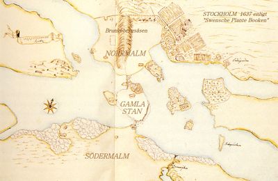
Brunkebergsåsen, Glacial esker in Norrmalm district, Sweden.

Brunkebergsåsen is an esker that forms a long ridge running north to south through Stockholm's Norrmalm district, part of the larger Stockholmsåsen geological formation. The ridge creates a noticeable height change across the urban landscape that shapes how the area is built and accessed.

The esker was created during the last ice age when glaciers shaped the landscape and left this distinctive ridge behind. Since the 1600s, urban development has substantially altered the formation through major excavations and restructuring to accommodate the city's growth.

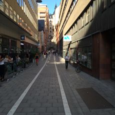
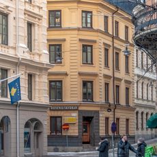
The ridge forms a physical boundary within Norrmalm that locals navigate around daily, creating distinct zones with different characters and uses. Walking through the area, you notice how the terrain influences where buildings sit and how streets connect.

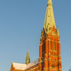
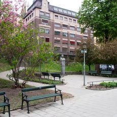
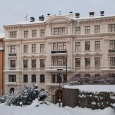
The remaining visible parts of the ridge are easiest to see near Johannes Church, in Observatorielunden park, and in Vanadislunden, which are connected by walking paths. These green spaces offer good vantage points to understand the height differences and how the terrain shapes the district.

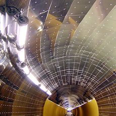
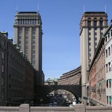
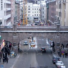
The Brunkebergstunneln tunnel and Kungsgatan street cut directly through the esker, showing how engineers designed infrastructure that worked with the geological barrier rather than removing it entirely. These projects demonstrate clever adaptation to a landscape that proved difficult to change.

The community of curious travelers

AroundUs brings together thousands of curated places, local tips, and hidden gems, enriched daily by 60,000 contributors worldwide.

Start exploring
Part of
Stockholmsåsen
GPS coordinates
59.33806,18.06417
Latest update
December 10, 2025 15:47
Reviews
Share your experience

No review yet

Discussions
Start a discussion...

No discussion yet

« Brunkebergsåsen - Glacial esker in Norrmalm district, Sweden » is provided by Around Us (aroundus.com). Images and texts are derived from Wikimedia project under a Creative Commons license. You are allowed to copy, distribute, and modify copies of this page, under the conditions set by the license, as long as this note is clearly visible.

Discover hidden gems everywhere you go!

From secret cafés to breathtaking viewpoints, skip the crowded tourist spots and find places that match your style. Our app makes it easy with voice search, smart filtering, route optimization, and insider tips from travelers worldwide. Download now for the complete mobile experience.

Around Us App Screenshot

A unique approach to discovering new places

Le Figaro

All the places worth exploring

France Info

A tailor-made excursion in just a few clicks

20 Minutes

Around Us
Travel Guide & Maps
Download

Send to your phone

QR Code
1

Open the camera app on your mobile.

2

Point at the QR code with your camera. A notification will appear.

3

Tap the notification to open the link.