
Nam Tok Tat San, Wasserfall in Thailand
Location: Loei
Elevation above the sea: 738 m
GPS coordinates: 17.35333,101.40667
Latest update: July 6, 2025 17:08

Phu Kradueng National Park
70.7 km
Phra That Si Song Rak
29.6 km
Wat Phra That Pha Son Kaeo
73.4 km
Phu Soi Dao National Park
60.4 km
Phu Hin Rong Kla National Park
57.3 km
Phu Phra Bat Historical Park
109.5 km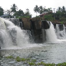
Thung Salaeng Luang National Park
81.8 km
Nam Nao National Park
71 km
Phu Ruea National Park
19.1 km
Wat Mahathat
107.2 km
Wat Pa Phu Kon
98.7 km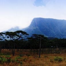
Phu Soi Dao
59.6 km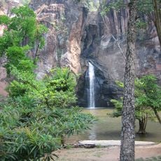
Namtok Chat Trakan National Park
63.6 km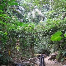
Tat Mok National Park
98.6 km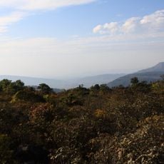
Phu Luang Wildlife Sanctuary
29.8 km
Phu Khiao wildlife sanctuary
98.9 km
Wat Phra Phutthabat Buabok
109.1 km
Wat Pa Huai Lat
10.7 km
Wat Si Khun Mueang
65.5 km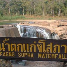
Kaeng Sopha waterfall
81.1 km
Erawan cave
69.2 km
Kaeng Song waterfall
98.6 km
Wat Sontikon Pracharam
105.2 km
Namtok Si Dit
94.6 km
Wat Tha Khaek
68.1 km
Wat Chiang Khan
67.8 km
Wat Pa Santisuk Wanaram
89.4 km
Ton Sak Yai forest park
95.2 kmReviews
Visited this place? Tap the stars to rate it and share your experience / photos with the community! Try now! You can cancel it anytime.
Discover hidden gems everywhere you go!
From secret cafés to breathtaking viewpoints, skip the crowded tourist spots and find places that match your style. Our app makes it easy with voice search, smart filtering, route optimization, and insider tips from travelers worldwide. Download now for the complete mobile experience.

A unique approach to discovering new places❞
— Le Figaro
All the places worth exploring❞
— France Info
A tailor-made excursion in just a few clicks❞
— 20 Minutes