Bayburt, Provincial capital in northeastern Turkey.
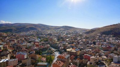
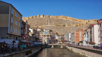
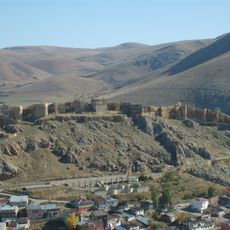
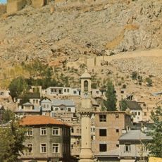
Bayburt lies in northeastern Anatolia at 1555 meters elevation in the Çoruh valley, surrounded by mountains and plateaus. The settlement spreads on both sides of the river and shows a mix of older quarters with low houses and newer buildings at the edges.
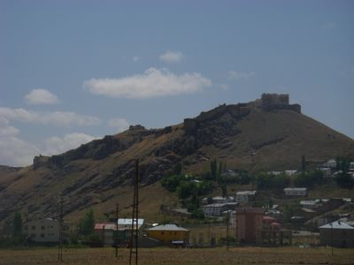
The area has been inhabited since ancient times and served for centuries as a stopover on the route between the Black Sea and the eastern plateaus. During the medieval period, control changed hands repeatedly among Byzantine, Armenian, and Turkish dynasties before the Ottomans finally incorporated the region.
The settlement's name likely comes from an Armenian word for rock, fitting the rugged terrain all around. Many residents keep small workshops and shops along the main street, where visitors find handmade goods and local produce.
Summer and autumn are usually comfortable for a visit, while winters turn cold and snow is common. Most shops and restaurants are found in the center, where visitors can walk to everything.
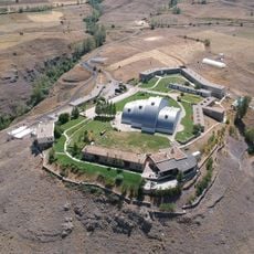
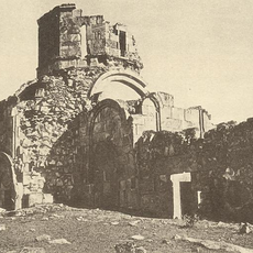
An underground complex near the town displays vaulted chambers and passages carved directly from the rock. These spaces likely served as storage or refuge and remain accessible today.
The community of curious travelers
AroundUs brings together thousands of curated places, local tips, and hidden gems, enriched daily by 60,000 contributors worldwide.