Westminster Bridge

Log in to your account

AroundUs is a community-driven map of interesting places, built by curious explorers like you. It grows with every review, story, and photo you share.
Connect to save your favorite spots, contribute locations, and create personalized routes.
Continue with Google
Continue with Apple
Continue with X
Continue with Facebook
Continue with email
By continuing, you accept our Terms and Conditions and our Privacy Policy
Create an account
Add to collection
Map
Suggest a change
Share

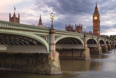
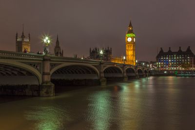
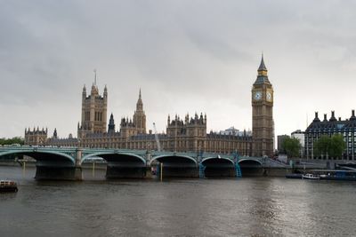
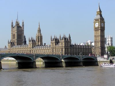
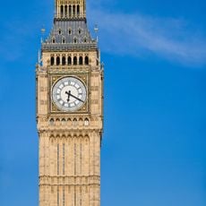
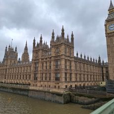
Westminster Bridge, Arch bridge in Westminster, England

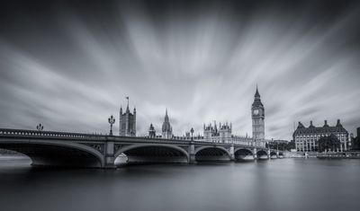
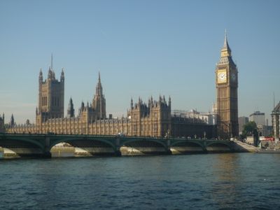
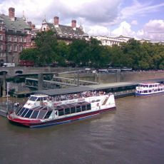
Westminster Bridge is a 250-meter crossing over the Thames that runs through seven wrought iron arches between the Palace of Westminster and County Hall. The structure measures 26 meters wide and provides space for both vehicle and pedestrian traffic on either side of the roadway.

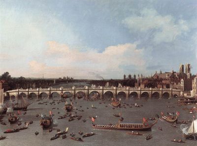
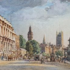
Thomas Page designed this construction, which opened in 1862 to replace an earlier crossing from 1750 that showed concerning movement. It stands as the oldest crossing point in the central section of the London Thames.

This crossing carries a particular shade of green that matches the leather seats in the House of Commons chamber at the nearby parliament building. Pedestrians use the wide pavements to move between both banks of the Thames while double-decker buses and taxis roll across its roadway.

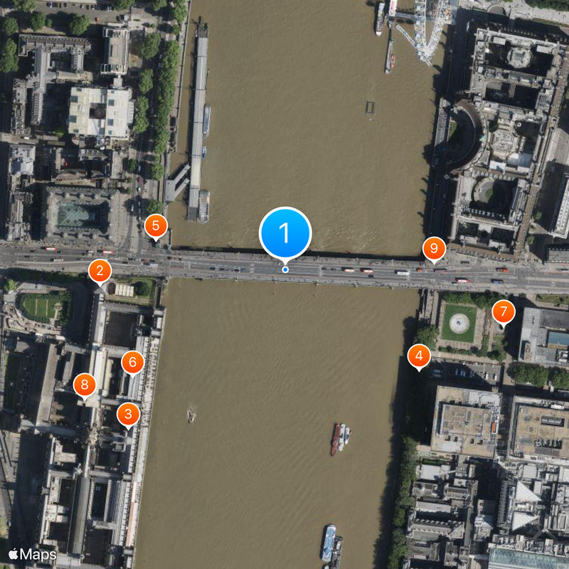
The structure offers wide pavements on both sides of the roadway that work well for photography or viewing the parliament building. Traffic on the roadway flows in both directions, so pedestrians should keep to the marked areas.

The structure carries Grade II listed building protection. Its green color was chosen to symbolize the House of Commons building on the north bank, while Lambeth Bridge downstream is kept red.

Location: City of Westminster

Location: London Borough of Lambeth

Inception: May 24, 1862

Architects: Thomas Page

Official opening: May 24, 1862

Length: 250 m

Width: 26 m

Accessibility: Wheelchair accessible

Made from material: wrought iron

GPS coordinates: 51.50083,-0.12194

Latest update: December 13, 2025 17:03

Photos
Around this place
Big Ben
United Kingdom

Big Ben

183 m
Palace of Westminster
United Kingdom

Palace of Westminster

218 m
National Covid Memorial Wall
United Kingdom

National Covid Memorial Wall

163 m
Boadicea and Her Daughters
United Kingdom

Boadicea and Her Daughters

131 m
House of Commons Library
United Kingdom

House of Commons Library

182 m
Statue of Mary Seacole
United Kingdom

Statue of Mary Seacole

220 m
Statue of Margaret Thatcher, Houses of Parliament
United Kingdom

Statue of Margaret Thatcher, Houses of Parliament

233 m
South Bank Lion
United Kingdom

South Bank Lion

145 m
Statue of Winston Churchill
United Kingdom

Statue of Winston Churchill

234 m
Strangers' Gallery
United Kingdom

Strangers' Gallery

212 m
Westminster Millennium Pier
United Kingdom

Westminster Millennium Pier

148 m
Statue of Robert Clayton
United Kingdom

Statue of Robert Clayton

227 m
Revolving Torsion
United Kingdom

Revolving Torsion

176 m
Gates And Piers Between Norman Shaw North And South Buildings, Former New Scotland Yard
United Kingdom

Gates And Piers Between Norman Shaw North And South Buildings, Former New Scotland Yard

208 m
Norman Shaw North Building
United Kingdom

Norman Shaw North Building

235 m
Fifteen Public Benches On Embankment Footpath Between Lambeth Bridge And Westminster Bridge
United Kingdom

Fifteen Public Benches On Embankment Footpath Between Lambeth Bridge And Westminster Bridge

197 m
United Kingdom

Norman Shaw South Building

207 m
River Wall With 36 Lamp Standards Between Lambeth Bridge And Westminster Bridge
United Kingdom

River Wall With 36 Lamp Standards Between Lambeth Bridge And Westminster Bridge

139 m
Approximately 250 Metres Of River Wall With 19 Lamp Standards Immediately West Of The County Hall
United Kingdom

Approximately 250 Metres Of River Wall With 19 Lamp Standards Immediately West Of The County Hall

200 m
United Kingdom

2, Bridge Street Sw1

233 m
United Kingdom

K6 Telephone Kiosk, Outside County Hall, One Of A Pair This One Is The Nearer To Westminster Bridge

225 m
United Kingdom

K6 Telephone Kiosk, Outside County Hall One Of A Pair This One Is The Nearer To The County Hall Island Block

227 m
United Kingdom

1 and 1B, Bridge Street Sw1

188 m
United Kingdom

House of Commons

211 m
United Kingdom

Speaker's House

140 m
United Kingdom

The Paddington Bear Experience

174 m

LDN_58

129 m
United Kingdom

Scenic viewpoint

142 m
Show the full map
Reviews

Visited this place? Tap the stars to rate it and share your experience / photos with the community! Try now! You can cancel it anytime.

« Westminster Bridge - Arch bridge in Westminster, England » is provided by Around Us (aroundus.com). Images and texts are derived from Wikimedia project under a Creative Commons license. You are allowed to copy, distribute, and modify copies of this page, under the conditions set by the license, as long as this note is clearly visible.

Discover hidden gems everywhere you go!

From secret cafés to breathtaking viewpoints, skip the crowded tourist spots and find places that match your style. Our app makes it easy with voice search, smart filtering, route optimization, and insider tips from travelers worldwide. Download now for the complete mobile experience.

Around Us App Screenshot

A unique approach to discovering new places

Le Figaro

All the places worth exploring

France Info

A tailor-made excursion in just a few clicks

20 Minutes