Renville County

Log in to your account

AroundUs is a community-driven map of interesting places, built by curious explorers like you. It grows with every review, story, and photo you share.
Connect to save your favorite spots, contribute locations, and create personalized routes.
Continue with Google
Continue with Apple
Continue with X
Continue with Facebook
Continue with email
By continuing, you accept our Terms and Conditions and our Privacy Policy
Create an account
Add to collection
Map
Suggest a change
Share

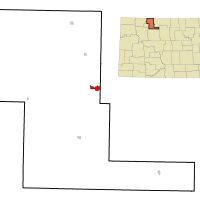
Renville County, Administrative county in North Dakota, United States

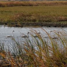
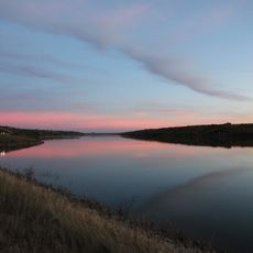
Renville County is an administrative division in northern North Dakota covering roughly 893 square miles. The Souris River winds through rolling terrain, and several small towns including Mohall, Sherwood, and Glenburn serve as local centers for the region's residents and services.

The Dakota Territory legislature established the county in 1873 and named it after Joseph Renville, a key figure who helped mediate between European settlers and Sioux communities. This creation was part of organizing the territory during the settlement era.

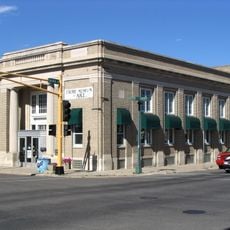
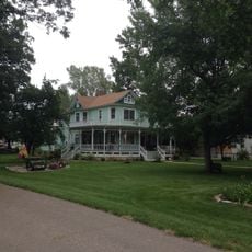
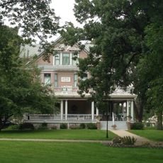
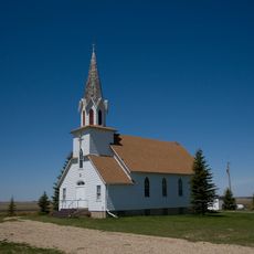
Agriculture shapes daily life and community identity throughout the county, with farming practices defining how people interact with the land. Local gatherings and seasonal events in towns like Mohall reflect this deep connection to farming traditions.

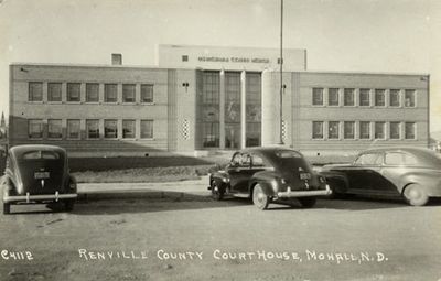
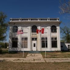
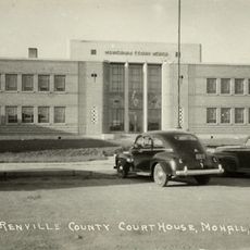
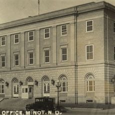
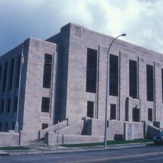
The courthouse in Mohall, built in 1937, serves as the main hub for county administrative services. Visitors planning to conduct business there should check ahead for office hours, as services are geared toward the small, dispersed population.

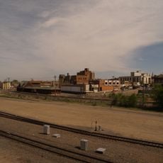
The region generates significant oil production, adding an industrial dimension that visitors often overlook given its agricultural character. This blend of farming and mineral extraction shapes the local economy in ways that are not immediately obvious.

Location: North Dakota

Inception: 1873

Capital city: Mohall

Shares border with: Bottineau County, Burke County, Ward County, McHenry County

Website: http://renvillecountynd.org

GPS coordinates: 48.71000,-101.66000

Latest update: December 10, 2025 15:49

Photos
Around this place
United States of America

91st Missile Wing LGM-30 Minuteman Missile Launch Sites

7.1 km
Scandinavian Heritage Park
United States of America

Scandinavian Heritage Park

60.1 km
740th Missile Squadron
United States of America

740th Missile Squadron

39.6 km
741st Missile Squadron
United States of America

741st Missile Squadron

39.6 km
Maysa Arena
United States of America

Maysa Arena

59.8 km
Canada

Alida

76.5 km
Dakota Territory Air Museum
United States of America

Dakota Territory Air Museum

55.9 km
J. Clark Salyer National Wildlife Refuge
United States of America

J. Clark Salyer National Wildlife Refuge

71.3 km
Des Lacs National Wildlife Refuge
United States of America

Des Lacs National Wildlife Refuge

35.2 km
742d Missile Squadron
United States of America

742d Missile Squadron

39.6 km
Taube Museum of Art
United States of America

Taube Museum of Art

59.3 km
United States of America

Lostwood Wilderness

58.4 km
State Bank of Antler
United States of America

State Bank of Antler

40.1 km
Westland Oil Filling Station
United States of America

Westland Oil Filling Station

59.6 km
Old Main (Minot State University)
United States of America

Old Main (Minot State University)

58 km
Renville County Courthouse
United States of America

Renville County Courthouse

12.6 km
Eastwood Park Bridge
United States of America

Eastwood Park Bridge

59.6 km
Granville State Bank
United States of America

Granville State Bank

78.4 km
Minot Carnegie Library
United States of America

Minot Carnegie Library

59.5 km
Bruce M. Van Sickle Federal Building and U.S. Courthouse
United States of America

Bruce M. Van Sickle Federal Building and U.S. Courthouse

59.5 km
Mountrail County Courthouse
United States of America

Mountrail County Courthouse

69.1 km
Union National Bank and Annex
United States of America

Union National Bank and Annex

59.3 km
Tufveson House
United States of America

Tufveson House

58.6 km
Andrew Carr, Sr., House
United States of America

Andrew Carr, Sr., House

58.6 km
Ward County Courthouse
United States of America

Ward County Courthouse

59.8 km
First English Free Lutheran Church (Lostwood)
United States of America

First English Free Lutheran Church (Lostwood)

61.9 km
Scandinavian Heritage Association
United States of America

Scandinavian Heritage Association

60.2 km
Minot Industrial Historic District
United States of America

Minot Industrial Historic District

59.2 km
Show the full map
Reviews

Visited this place? Tap the stars to rate it and share your experience / photos with the community! Try now! You can cancel it anytime.

Administrative divisions
« Renville County - Administrative county in North Dakota, United States » is provided by Around Us (aroundus.com). Images and texts are derived from Wikimedia project under a Creative Commons license. You are allowed to copy, distribute, and modify copies of this page, under the conditions set by the license, as long as this note is clearly visible.

Discover hidden gems everywhere you go!

From secret cafés to breathtaking viewpoints, skip the crowded tourist spots and find places that match your style. Our app makes it easy with voice search, smart filtering, route optimization, and insider tips from travelers worldwide. Download now for the complete mobile experience.

Around Us App Screenshot

A unique approach to discovering new places

Le Figaro

All the places worth exploring

France Info

A tailor-made excursion in just a few clicks

20 Minutes