Chest opened
+${chestReward.xp} XP
Explorer
NOUVEAU ×${chestReward.collectible.quantity}
tapez pour fermer
Chest locked

Open chests in the app

Around Us is built for your phone — chests unlock when you walk, explore and capture nearby places.

Enable Location

We need your location to show you interesting places around you

Discover nearby places

Find interesting locations and hidden gems around you

Precise directions

Get accurate directions and distances to places

Your location is never shared with other users. It's only used when you tap the location button.

Log in to your account

Start exploring — it's free

Trusted by 72,884 travelers worldwide

Continue with Google
Continue with Apple
or

We will send you a code to connect

By continuing, you accept our Terms and Conditions and our Privacy Policy

Check your inbox

We've sent a pincode in your inbox. Please enter the code below.

Ted Williams Tunnel
Discussion Reviews Photo
28.8k Popularity

Ted Williams Tunnel, Road tunnel in Boston, United States

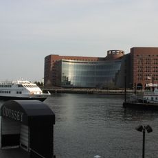
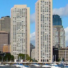
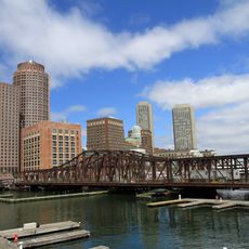
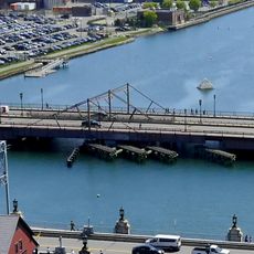
The Ted Williams Tunnel is a road crossing beneath Boston Harbor that links South Boston to East Boston. The crossing accommodates traffic through four lanes running underground below the water.

The crossing opened in 1995 after nearly 35 years of planning, initially restricted to commercial vehicles. Public use began in 2003.

The tunnel carries the name of Ted Williams, a Boston Red Sox player who left a lasting mark on the city's identity. Visitors encounter this connection to local sports heritage whenever they see signage or read about the crossing.

Drivers can pay through electronic toll systems, with lower rates for East Boston residents who register for E-ZPass. Knowing these systems in advance helps avoid delays when crossing.

Twelve steel sections fabricated in Baltimore form the underwater structure beneath the harbor. This made the crossing one of the deepest underwater road connections in North America when it opened.

The community of curious travelers

AroundUs brings together thousands of curated places, local tips, and hidden gems, enriched daily by 60,000 contributors worldwide.

Start exploring
Location
Inception
1995
Official opening
1995
Length
2,600 m
GPS coordinates
42.35330,-71.02830
Latest update
December 20, 2025 12:12
Around this place
New England Aquarium
United States of America

New England Aquarium

1.9 km
Rose Fitzgerald Kennedy Greenway
United States of America

Rose Fitzgerald Kennedy Greenway

1.9 km
Institute of Contemporary Art, Boston
United States of America

Institute of Contemporary Art, Boston

1.2 km
Leader Bank Pavilion
United States of America

Leader Bank Pavilion

880 m
Boston Children's Museum
United States of America

Boston Children's Museum

1.8 km
John Joseph Moakley United States Courthouse
United States of America

John Joseph Moakley United States Courthouse

1.5 km
The Computer Museum, Boston
United States of America

The Computer Museum, Boston

1.8 km
United States lightship Nantucket
United States of America

United States lightship Nantucket

1 km
One International Place
United States of America

One International Place

2 km
Boston Tea Party Ships and Museum
United States of America

Boston Tea Party Ships and Museum

1.9 km
Two International Place
United States of America

Two International Place

2 km
125 High Street
United States of America

125 High Street

2 km
Harbor Towers
United States of America

Harbor Towers

1.9 km
Roseway
United States of America

Roseway

1.3 km
Statue of Christopher Columbus
United States of America

Statue of Christopher Columbus

2.1 km
Northern Avenue Bridge
United States of America

Northern Avenue Bridge

1.7 km
The Partisans
United States of America

The Partisans

1.3 km
Russia Wharf
United States of America

Russia Wharf

2 km
Fort Winthrop
United States of America

Fort Winthrop

1.4 km
Our Lady of Mount Carmel Church
United States of America

Our Lady of Mount Carmel Church

2 km
Statue of David Farragut
United States of America

Statue of David Farragut

2 km
Fort Point Channel Historic District
United States of America

Fort Point Channel Historic District

1.8 km
Custom House Block
United States of America

Custom House Block

1.9 km
Chart House
United States of America

Chart House

1.9 km
Summer Street Bridge
United States of America

Summer Street Bridge

2 km
Congress Street Fire Station
United States of America

Congress Street Fire Station

1.7 km
Harrison Loring House
United States of America

Harrison Loring House

2 km
Gridley Street Historic District
United States of America

Gridley Street Historic District

2.1 km
Show the full map
Reviews
Share your experience

No review yet

Discussions
Start a discussion...

No discussion yet

« Ted Williams Tunnel - Road tunnel in Boston, United States » is provided by Around Us (aroundus.com). Images and texts are derived from Wikimedia project under a Creative Commons license. You are allowed to copy, distribute, and modify copies of this page, under the conditions set by the license, as long as this note is clearly visible.

Discover hidden gems everywhere you go!

From secret cafés to breathtaking viewpoints, skip the crowded tourist spots and find places that match your style. Our app makes it easy with voice search, smart filtering, route optimization, and insider tips from travelers worldwide. Download now for the complete mobile experience.

Around Us App Screenshot

A unique approach to discovering new places

Le Figaro

All the places worth exploring

France Info

A tailor-made excursion in just a few clicks

20 Minutes

Around Us
Travel Guide & Maps
Download

Send to your phone

QR Code
1

Open the camera app on your mobile.

2

Point at the QR code with your camera. A notification will appear.

3

Tap the notification to open the link.