Chest opened
+${chestReward.xp} XP
Explorer
NOUVEAU ×${chestReward.collectible.quantity}
tapez pour fermer
Chest locked

Open chests in the app

Around Us is built for your phone — chests unlock when you walk, explore and capture nearby places.

Enable Location

We need your location to show you interesting places around you

Discover nearby places

Find interesting locations and hidden gems around you

Precise directions

Get accurate directions and distances to places

Your location is never shared with other users. It's only used when you tap the location button.

Baltimore–Washington Parkway

Log in to your account

Start exploring — it's free

Trusted by 72,986 travelers worldwide

Continue with Google
Continue with Apple
or

We will send you a code to connect

By continuing, you accept our Terms and Conditions and our Privacy Policy

Check your inbox

We've sent a pincode in your inbox. Please enter the code below.

Baltimore–Washington Parkway
Discussion Reviews 1 Photos
25.6k Popularity

Baltimore–Washington Parkway, Transportation parkway between Baltimore and Washington DC, United States

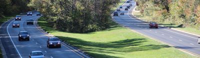
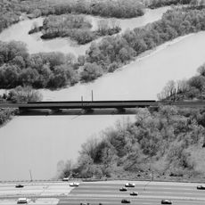
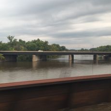
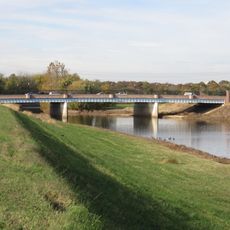
The Baltimore-Washington Parkway is a 29-mile limited-access highway that winds through Maryland's rolling landscape with gentle hills and dense forests. The road connects the two cities through a network of long curves and wooded sections.

Built between 1947 and 1954, it was Maryland's first limited-access divided highway. The National Park Service and Bureau of Public Roads partnered to complete this pioneering project.

The section named after Congresswoman Gladys Noon Spellman honors her service to Maryland's 5th district. This naming reflects how the region marks the contributions of political figures important to its history.

Large trucks are not permitted on the section south of MD 175, though buses and limousines can travel through. Plan for longer driving time on this winding route, particularly when weather conditions are poor.

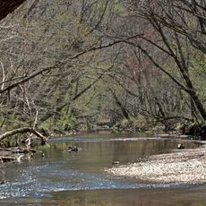
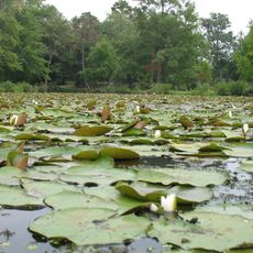
The road was designed with a protective corridor ranging from 400 to 800 feet wide, shielding the area from urban sprawl. These generous margins preserve forests and meadows throughout the entire route.

The community of curious travelers

AroundUs brings together thousands of curated places, local tips, and hidden gems, enriched daily by 60,000 contributors worldwide.

Start exploring
Location
Location
Inception
1942
Elevation above the sea
32 m
GPS coordinates
38.91867,-76.93811
Latest update
December 7, 2025 09:27
Around this place
United States National Arboretum
United States of America

United States National Arboretum

2.6 km
National Capitol Columns
United States of America

National Capitol Columns

2.7 km
Peace Cross
United States of America

Peace Cross

2.3 km
Deanwood
United States of America

Deanwood

1.6 km
Goshin
United States of America

Goshin

2.3 km
H.D. Woodson High School
United States of America

H.D. Woodson High School

2.8 km
Bladensburg Dueling Grounds
United States of America

Bladensburg Dueling Grounds

753 m
Northwest Branch Anacostia River
United States of America

Northwest Branch Anacostia River

2.7 km
Kenilworth Park and Aquatic Gardens
United States of America

Kenilworth Park and Aquatic Gardens

741 m
Northwest Branch Trail
United States of America

Northwest Branch Trail

3 km
Bostwick
United States of America

Bostwick

2.2 km
George Washington House
United States of America

George Washington House

2.5 km
Amtrak Railroad Anacostia Bridge
United States of America

Amtrak Railroad Anacostia Bridge

513 m
Mayfair Mansions Apartments
United States of America

Mayfair Mansions Apartments

2 km
William Hilleary House
United States of America

William Hilleary House

2.3 km
Strand Theater
United States of America

Strand Theater

2.5 km
Market Master's House
United States of America

Market Master's House

2.3 km
Hilltop Manor
United States of America

Hilltop Manor

2.8 km
New York Avenue Bridge
United States of America

New York Avenue Bridge

377 m
Benning / Dorothy I. Height Neighborhood Library
United States of America

Benning / Dorothy I. Height Neighborhood Library

2.9 km
Bladensburg Road Bridge
United States of America

Bladensburg Road Bridge

2.3 km
Deanwood Neighborhood Library
United States of America

Deanwood Neighborhood Library

1.2 km
Mount Rainier Historic District
United States of America

Mount Rainier Historic District

3.1 km
Fairmount Heights Historic District
United States of America

Fairmount Heights Historic District

2.8 km
Bladensburg Park Pedestrian Bridge
United States of America

Bladensburg Park Pedestrian Bridge

2 km
National Bonsai and Penjing Museum
United States of America

National Bonsai and Penjing Museum

2.8 km
Nannie Helen Burroughs School
United States of America

Nannie Helen Burroughs School

2.6 km
Fort Mahan
United States of America

Fort Mahan

2.7 km
Show the full map
Reviews
Share your experience

No review yet

Discussions
Start a discussion...

No discussion yet

« Baltimore–Washington Parkway - Transportation parkway between Baltimore and Washington DC, United States » is provided by Around Us (aroundus.com). Images and texts are derived from Wikimedia project under a Creative Commons license. You are allowed to copy, distribute, and modify copies of this page, under the conditions set by the license, as long as this note is clearly visible.

Discover hidden gems everywhere you go!

From secret cafés to breathtaking viewpoints, skip the crowded tourist spots and find places that match your style. Our app makes it easy with voice search, smart filtering, route optimization, and insider tips from travelers worldwide. Download now for the complete mobile experience.

Around Us App Screenshot

A unique approach to discovering new places

Le Figaro

All the places worth exploring

France Info

A tailor-made excursion in just a few clicks

20 Minutes

Around Us
Travel Guide & Maps
Download

Send to your phone

QR Code
1

Open the camera app on your mobile.

2

Point at the QR code with your camera. A notification will appear.

3

Tap the notification to open the link.