Harrison County

Log in to your account

AroundUs is a community-driven map of interesting places, built by curious explorers like you. It grows with every review, story, and photo you share.
Connect to save your favorite spots, contribute locations, and create personalized routes.
Continue with Google
Continue with Apple
Continue with X
Continue with Facebook
Continue with email
By continuing, you accept our Terms and Conditions and our Privacy Policy
Create an account
Add to collection
Map
Suggest a change
Share

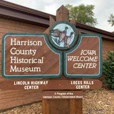
Harrison County, County in western Iowa, United States

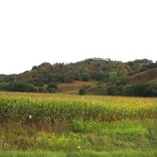
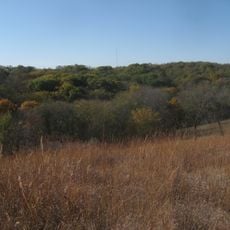
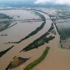
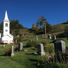
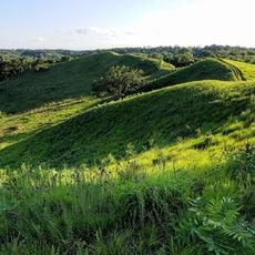
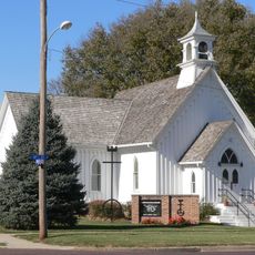
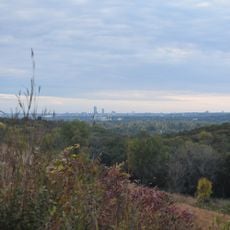
Harrison County is a county in western Iowa that stretches across farmland, small communities, and the Missouri River along its western edge. The landscape is marked by wide fields and river valley areas that run through the region.

The area was officially founded in 1851 and named after William Henry Harrison, the ninth US president. This naming reflects the importance of early American history to the territory's establishment.

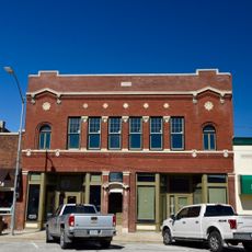
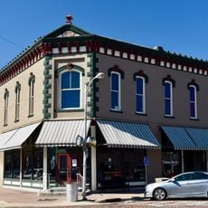
The residents shape the landscape through their agricultural work, which has defined the region for generations. Visitors see fields everywhere, grain storage facilities, and small villages built around the needs of farming families.

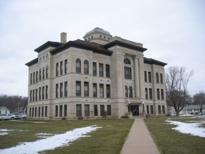
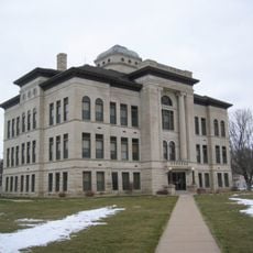
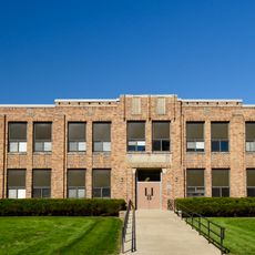
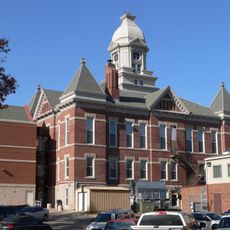
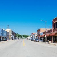
Logan, the county seat, offers basic administrative services and infrastructure for visitors and residents. Interstate 29 runs directly through the area and connects it quickly to nearby larger cities like Omaha and Council Bluffs.

DeSoto National Wildlife Refuge extends partially into the county and provides habitats for migratory birds along the Missouri River. This protected area serves as a critical stopover point for waterfowl during their seasonal migrations.

Location: Iowa

Inception: 1851

Capital city: Logan

Shares border with: Monona County, Pottawattamie County, Shelby County, Crawford County, Washington County, Burt County

Website: http://harrisoncountyia.org

GPS coordinates: 41.68222,-95.82417

Latest update: December 8, 2025 13:41

Photos
Around this place
Loess Hills
United States of America

Loess Hills

19.4 km
Fort Atkinson State Historical Park
United States of America

Fort Atkinson State Historical Park

29.8 km
Fort Atkinson
United States of America

Fort Atkinson

30 km
DeSoto National Wildlife Refuge
United States of America

DeSoto National Wildlife Refuge

23.9 km
Neale Woods
United States of America

Neale Woods

34.2 km
Blair Bridge
United States of America

Blair Bridge

26.9 km
Blair Bridge
United States of America

Blair Bridge

26.9 km
Harrison County Courthouse
United States of America

Harrison County Courthouse

5.2 km
Ingemann Danish Lutheran Church
United States of America

Ingemann Danish Lutheran Church

29.8 km
Hitchcock Nature Center
United States of America

Hitchcock Nature Center

30.1 km
H.S.M. Spielman House
United States of America

H.S.M. Spielman House

34.3 km
United States of America

South Jordan Cemetery

33.5 km
Woodbine Normal and Grade School
United States of America

Woodbine Normal and Grade School

11.5 km
Congregational Church of Blair
United States of America

Congregational Church of Blair

30.4 km
I.O.O.F. Hall
United States of America

I.O.O.F. Hall

26.6 km
Washington County Courthouse
United States of America

Washington County Courthouse

30.3 km
Siebels' Department Store-Boyer Valley Bank
United States of America

Siebels' Department Store-Boyer Valley Bank

11.8 km
Woodbine Public Library
United States of America

Woodbine Public Library

11.7 km
Woodbine Lincoln Highway and Brick Street Historic District
United States of America

Woodbine Lincoln Highway and Brick Street Historic District

11.7 km
Woodbine Savings Bank
United States of America

Woodbine Savings Bank

11.9 km
State Savings Bank
United States of America

State Savings Bank

5.3 km
Alfred H. and Sarah Frahm House
United States of America

Alfred H. and Sarah Frahm House

30.6 km
Mann School No. 2
United States of America

Mann School No. 2

29.6 km
Abraham Castetter House
United States of America

Abraham Castetter House

30.6 km
C.C. Crowell Jr. House
United States of America

C.C. Crowell Jr. House

30.8 km
Neale Woods
United States of America

Neale Woods

33.3 km
Harrison County Historical Village & Iowa Welcome Center
United States of America

Harrison County Historical Village & Iowa Welcome Center

11.2 km
Phoenix Theatre
United States of America

Phoenix Theatre

31.3 km
Show the full map
Reviews

Visited this place? Tap the stars to rate it and share your experience / photos with the community! Try now! You can cancel it anytime.

Administrative divisions
« Harrison County - County in western Iowa, United States » is provided by Around Us (aroundus.com). Images and texts are derived from Wikimedia project under a Creative Commons license. You are allowed to copy, distribute, and modify copies of this page, under the conditions set by the license, as long as this note is clearly visible.

Discover hidden gems everywhere you go!

From secret cafés to breathtaking viewpoints, skip the crowded tourist spots and find places that match your style. Our app makes it easy with voice search, smart filtering, route optimization, and insider tips from travelers worldwide. Download now for the complete mobile experience.

Around Us App Screenshot

A unique approach to discovering new places

Le Figaro

All the places worth exploring

France Info

A tailor-made excursion in just a few clicks

20 Minutes