Enable Location

We need your location to show you interesting places around you

Discover nearby places

Find interesting locations and hidden gems around you

Precise directions

Get accurate directions and distances to places

Your location is never shared with other users. It's only used when you tap the location button.

DeSoto National Wildlife Refuge

Log in to your account

Start exploring — it's free

Trusted by 62,475 travelers worldwide

Continue with Google
Continue with Apple
or

We will send you a code to connect

By continuing, you accept our Terms and Conditions and our Privacy Policy

Check your inbox

We've sent a pincode in your inbox. Please enter the code below.

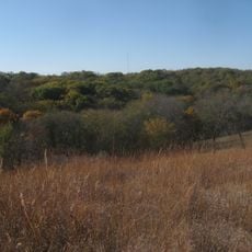
DeSoto National Wildlife Refuge, Wildlife refuge on Missouri River banks in Nebraska and Iowa.

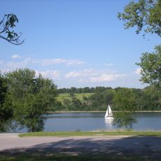
DeSoto National Wildlife Refuge spans the Missouri River banks between Nebraska and Iowa and protects an important wetland area. The central DeSoto Lake stretches through the refuge and provides habitat for various mammal species and bird populations that use the site throughout the year.

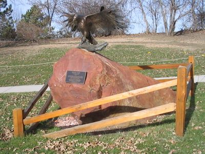
The refuge was established in the 1950s to protect natural habitats along the Missouri River. A significant discovery in 1968 revealed the remains of the Bertrand steamboat, which sank in 1865 and preserved thousands of artifacts from that era.

The refuge sits along a crucial migration corridor where flocks of snow geese gather during spring and fall movements between their breeding and wintering areas. This stopping point shapes how visitors experience the landscape, with seasonal shifts in bird activity marking the passage of months.

The refuge offers driving and walking trails that let visitors explore different habitats and waterways throughout the site. The best time to visit is during migration season when most bird species are active and easy to observe.

In the 1960s the Missouri River channel was deliberately diverted westward, turning the old river bend into what is now DeSoto Lake. This engineering project was designed for flood control but created an unexpected benefit for wildlife habitat.

The community of curious travelers

AroundUs brings together thousands of curated places, local tips, and hidden gems, enriched daily by 60,000 contributors worldwide.

Start exploring
Location
Inception
March 12, 1958
Operator
United States Fish and Wildlife Service
GPS coordinates
41.52370,-96.01790
Latest update
December 9, 2025 18:40
Around this place
Fort Atkinson State Historical Park
United States of America

Fort Atkinson State Historical Park

7.7 km
Fort Atkinson
United States of America

Fort Atkinson

8 km
Hummel Park
United States of America

Hummel Park

17.7 km
Fort Omaha
United States of America

Fort Omaha

24.7 km
Glenn Cunningham Lake
United States of America

Glenn Cunningham Lake

19.5 km
Florence Mill
United States of America

Florence Mill

20.6 km
General Crook House
United States of America

General Crook House

21.3 km
Bank of Florence Museum
United States of America

Bank of Florence Museum

21.3 km
Neale Woods
United States of America

Neale Woods

15.9 km
Ackerhurst Dairy Barn
United States of America

Ackerhurst Dairy Barn

23.7 km
Blair High School
United States of America

Blair High School

10.1 km
Blair Bridge
United States of America

Blair Bridge

7.2 km
Blair Bridge
United States of America

Blair Bridge

7.2 km
Harrison County Courthouse
United States of America

Harrison County Courthouse

23.2 km
Hitchcock Nature Center
United States of America

Hitchcock Nature Center

17.7 km
Henry B. Neef House
United States of America

Henry B. Neef House

22.8 km
Congregational Church of Blair
United States of America

Congregational Church of Blair

10.1 km
Washington County Courthouse
United States of America

Washington County Courthouse

9.9 km
State Savings Bank
United States of America

State Savings Bank

23.3 km
Alfred H. and Sarah Frahm House
United States of America

Alfred H. and Sarah Frahm House

7.8 km
Abraham Castetter House
United States of America

Abraham Castetter House

10.3 km
C.C. Crowell Jr. House
United States of America

C.C. Crowell Jr. House

10.8 km
Neale Woods
United States of America

Neale Woods

15.3 km
Winter Quarters Mill Museum
United States of America

Winter Quarters Mill Museum

20.6 km
Florence Mill Museum
United States of America

Florence Mill Museum

20.6 km
Harrison County Historical Village & Iowa Welcome Center
United States of America

Harrison County Historical Village & Iowa Welcome Center

15.6 km
Notre Dame Academy and Convent
United States of America

Notre Dame Academy and Convent

21.5 km
General Crook House Museum
United States of America

General Crook House Museum

24.2 km
Show the full map
« DeSoto National Wildlife Refuge - Wildlife refuge on Missouri River banks in Nebraska and Iowa » is provided by Around Us (aroundus.com). Images and texts are derived from Wikimedia project under a Creative Commons license. You are allowed to copy, distribute, and modify copies of this page, under the conditions set by the license, as long as this note is clearly visible.

Discover hidden gems everywhere you go!

From secret cafés to breathtaking viewpoints, skip the crowded tourist spots and find places that match your style. Our app makes it easy with voice search, smart filtering, route optimization, and insider tips from travelers worldwide. Download now for the complete mobile experience.

Around Us App Screenshot

A unique approach to discovering new places

Le Figaro

All the places worth exploring

France Info

A tailor-made excursion in just a few clicks

20 Minutes

Around Us
Travel Guide & Maps
Download

Send to your phone

QR Code
1

Open the camera app on your mobile.

2

Point at the QR code with your camera. A notification will appear.

3

Tap the notification to open the link.