Lee County

Log in to your account

AroundUs is a community-driven map of interesting places, built by curious explorers like you. It grows with every review, story, and photo you share.
Connect to save your favorite spots, contribute locations, and create personalized routes.
By continuing, you accept our Terms and Conditions and our Privacy Policy
Add to collection
Map
Suggest a change
Share

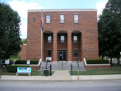
Lee County, Administrative county in eastern Kentucky, United States.
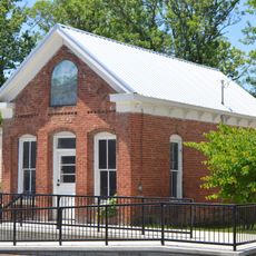
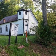
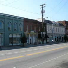
Lee County spans across 547 square kilometers of land in Kentucky, with Beattyville serving as its administrative center at coordinates 37.59°N and 83.72°W.

The Kentucky General Assembly established Lee County on January 29, 1870, marking a period of territorial reorganization in the eastern part of the state.

The residents of Lee County maintain their local traditions through regular community gatherings and events at the Beattyville central square.

Visitors to Lee County can find accommodation options in nearby cities, including hotels in Hazard and Winchester that provide standard amenities.

Lee County operates under dry county regulations, which means the sale of alcoholic beverages remains prohibited within its administrative boundaries.

Location: Kentucky

Inception: January 29, 1870

Capital city: Beattyville

Shares border with: Powell County, Wolfe County, Breathitt County, Owsley County, Jackson County, Estill County

Website: http://leecounty.ky.gov

GPS coordinates: 37.59000,-83.72000

Latest update: March 3, 2025 02:25

Around this place
Show the full map
Red River Gorge
United States of America

Red River Gorge

28.9 km
Daniel Boone National Forest
United States of America

Daniel Boone National Forest

36.3 km
Roy Kidd Stadium
United States of America

Roy Kidd Stadium

53.4 km
Pilot Knob State Nature Preserve
United States of America

Pilot Knob State Nature Preserve

40.5 km
Furnace Mountain
United States of America

Furnace Mountain

22.7 km
Robinson Forest
United States of America

Robinson Forest

52.5 km
Clifty Wilderness
United States of America

Clifty Wilderness

30 km
Mt. Zion Christian Church
United States of America

Mt. Zion Christian Church

48 km
Lincoln Hall, Berea College
United States of America

Lincoln Hall, Berea College

50 km
Buckhorn Presbyterian Church and the Greer Gymnasium
United States of America

Buckhorn Presbyterian Church and the Greer Gymnasium

34.5 km
Jackson Post Office
United States of America

Jackson Post Office

29.7 km
Ravenna Motor Vehicle Service Building
United States of America

Ravenna Motor Vehicle Service Building

23 km
Madison County Courthouse
United States of America

Madison County Courthouse

52.6 km
St. Thomas Episcopal Church
United States of America

St. Thomas Episcopal Church

1.9 km
Breathitt County Jail
United States of America

Breathitt County Jail

29.9 km
M.E. Church, South
United States of America

M.E. Church, South

29.9 km
St. Therese Catholic Church
United States of America

St. Therese Catholic Church

5.4 km
William L. Hurst Law Office
United States of America

William L. Hurst Law Office

22.1 km
Corinth Christian Methodist Episcopal Church
United States of America

Corinth Christian Methodist Episcopal Church

54.3 km
Annville Institute
United States of America

Annville Institute

37.4 km
Irvine Historic Business District
United States of America

Irvine Historic Business District

25.6 km
Peabody-Fordson Historic District
United States of America

Peabody-Fordson Historic District

51.5 km
Irvine Grade School
United States of America

Irvine Grade School

25 km
Beattyville Grade School
United States of America

Beattyville Grade School

2.3 km
Clay City National Bank Building
United States of America

Clay City National Bank Building

34.9 km
Jackson Commercial District
United States of America

Jackson Commercial District

29.8 km
Natural Bridge State Resort Park
United States of America

Natural Bridge State Resort Park

21 km
Double Arch
United States of America

Double Arch

27.7 km
Show the full map

Reviews

Visited this place? Tap the stars to rate it and share your experience / photos with the community! Try now! You can cancel it anytime.

« Lee County - Administrative county in eastern Kentucky, United States » is provided by Around Us (aroundus.com). Images and texts are derived from Wikimedia project under a Creative Commons license. You are allowed to copy, distribute, and modify copies of this page, under the conditions set by the license, as long as this note is clearly visible.

Discover hidden gems everywhere you go!

From secret cafés to breathtaking viewpoints, skip the crowded tourist spots and find places that match your style. Our app makes it easy with voice search, smart filtering, route optimization, and insider tips from travelers worldwide. Download now for the complete mobile experience.

Around Us App Screenshot

A unique approach to discovering new places

Le Figaro

All the places worth exploring

France Info

A tailor-made excursion in just a few clicks

20 Minutes