Enable Location

We need your location to show you interesting places around you

Discover nearby places

Find interesting locations and hidden gems around you

Precise directions

Get accurate directions and distances to places

Your location is never shared with other users. It's only used when you tap the location button.

Daniel Boone National Forest

Log in to your account

Start exploring — it's free

Trusted by 62,796 travelers worldwide

Continue with Google
Continue with Apple
or

We will send you a code to connect

By continuing, you accept our Terms and Conditions and our Privacy Policy

Check your inbox

We've sent a pincode in your inbox. Please enter the code below.

Daniel Boone National Forest, National forest in Kentucky, United States.

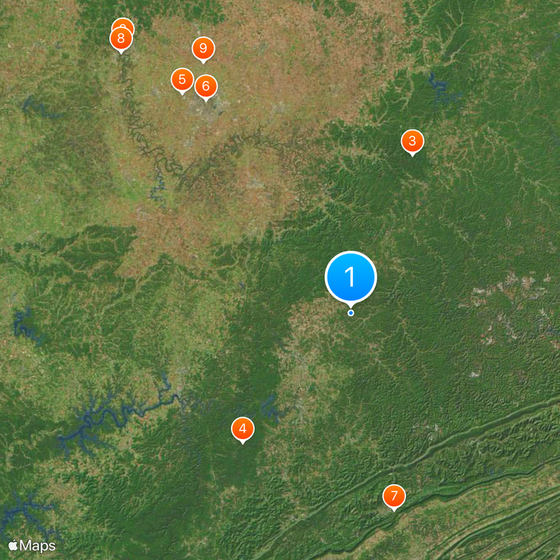
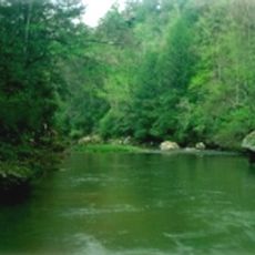
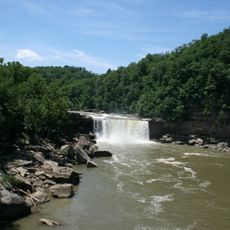
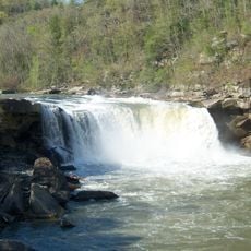
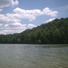
Daniel Boone National Forest is a large wooded area in eastern Kentucky with steep ridges, narrow ravines, and extensive sandstone formations. The area includes several reservoirs for fishing and boating as well as hundreds of hiking trails for visitors of different abilities.

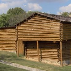
The forest received its current name in 1966 to honor Daniel Boone, an explorer who established settlements in Kentucky during the 18th century. The naming reflects his influence on European settlement in the region.

Indigenous peoples like the Cherokee and Shawnee hunted and traveled through this land, leaving traces in rock shelters that visitors can still see today. These sites connect the forest to the people who lived here long ago.

The forest covers a large area, so it helps to choose a specific section before arriving. Trails are suited to different abilities, ranging from easy walks to challenging hikes.

One section of the forest is a wildlife management area where hunters must use only traditional muzzle-loading firearms, bows, or crossbows. This rule keeps old hunting methods alive and creates a special experience for visitors interested in hunting history.

The community of curious travelers

AroundUs brings together thousands of curated places, local tips, and hidden gems, enriched daily by 60,000 contributors worldwide.

Start exploring
Location
Operator
United States Forest Service
GPS coordinates
37.28810,-83.87530
Latest update
December 20, 2025 14:05
Around this place
Buffalo Trace Distillery
United States of America

Buffalo Trace Distillery

135.5 km
Red River Gorge
United States of America

Red River Gorge

65.2 km
Cumberland Falls
United States of America

Cumberland Falls

65.1 km
Keeneland
United States of America

Keeneland

106.3 km
Kroger Field
United States of America

Kroger Field

98.8 km
Cumberland Gap National Historical Park
United States of America

Cumberland Gap National Historical Park

77.9 km
Kentucky State Capitol
United States of America

Kentucky State Capitol

133.3 km
Kentucky Horse Park
United States of America

Kentucky Horse Park

111.5 km
Frankfort Cemetery
United States of America

Frankfort Cemetery

133.7 km
Fort Boonesborough State Park
United States of America

Fort Boonesborough State Park

76.5 km
Cave Run Lake
United States of America

Cave Run Lake

94.6 km
Boone Tavern
United States of America

Boone Tavern

48.3 km
Pleasant Hill
United States of America

Pleasant Hill

96.5 km
Kentucky Governor's Mansion
United States of America

Kentucky Governor's Mansion

133.2 km
Mary Todd Lincoln House
United States of America

Mary Todd Lincoln House

101.4 km
Ashland
United States of America

Ashland

98.2 km
High Bridge of Kentucky
United States of America

High Bridge of Kentucky

95 km
Cumberland Falls State Resort Park
United States of America

Cumberland Falls State Resort Park

64.3 km
Herrington Lake
United States of America

Herrington Lake

88.6 km
Roy Kidd Stadium
United States of America

Roy Kidd Stadium

62.1 km
Tombstone Junction
United States of America

Tombstone Junction

66.2 km
Old Friends Equine
United States of America

Old Friends Equine

117.8 km
White Hall
United States of America

White Hall

73.8 km
Pine Mountain State Resort Park
United States of America

Pine Mountain State Resort Park

61.6 km
Hensley Settlement
United States of America

Hensley Settlement

75.5 km
Old Fort Harrod State Park
United States of America

Old Fort Harrod State Park

100.8 km
John Hunt Morgan Memorial
United States of America

John Hunt Morgan Memorial

102.5 km
Lexington Financial Center
United States of America

Lexington Financial Center

100.8 km
Show the full map
« Daniel Boone National Forest - National forest in Kentucky, United States » is provided by Around Us (aroundus.com). Images and texts are derived from Wikimedia project under a Creative Commons license. You are allowed to copy, distribute, and modify copies of this page, under the conditions set by the license, as long as this note is clearly visible.

Discover hidden gems everywhere you go!

From secret cafés to breathtaking viewpoints, skip the crowded tourist spots and find places that match your style. Our app makes it easy with voice search, smart filtering, route optimization, and insider tips from travelers worldwide. Download now for the complete mobile experience.

Around Us App Screenshot

A unique approach to discovering new places

Le Figaro

All the places worth exploring

France Info

A tailor-made excursion in just a few clicks

20 Minutes

Around Us
Travel Guide & Maps
Download

Send to your phone

QR Code
1

Open the camera app on your mobile.

2

Point at the QR code with your camera. A notification will appear.

3

Tap the notification to open the link.