Centralia

Log in to your account

AroundUs is a community-driven map of interesting places, built by curious explorers like you. It grows with every review, story, and photo you share.
Connect to save your favorite spots, contribute locations, and create personalized routes.
Continue with Google
Continue with Apple
Continue with X
Continue with Facebook
Continue with email
By continuing, you accept our Terms and Conditions and our Privacy Policy
Create an account
Add to collection
Map
Suggest a change
Share

Centralia, Ghost town in Columbia County, Pennsylvania, US.

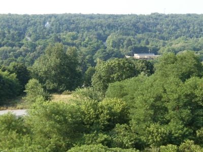
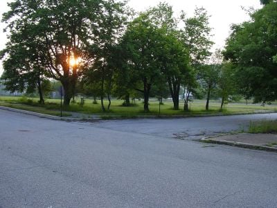
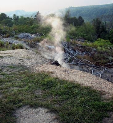
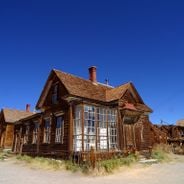
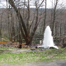
Centralia is a ghost town in Columbia County, Pennsylvania, that became uninhabitable due to an underground coal fire. The abandoned streets show empty lots, demolished structures, and steam vents releasing gases from the fire that has burned since the early 1960s.

The settlement emerged in the 19th century as a mining community and reached its largest population near the end of that century with several thousand people. A fire that began at a dump site in the early 1960s spread into the coal seams beneath the town and forced nearly all residents to relocate.

The empty landscape attracted artists and filmmakers who found material here for horror movies and video games. The few remaining residents live among the smoke plumes and memories of a lost community, while travelers often leave graffiti on abandoned road sections.

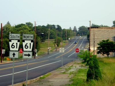
Travelers should keep away from steam vents and unstable ground areas, as the fire beneath the surface remains active. Most buildings were demolished, so only a few structures and grassy lots remain visible, while the roads are mostly still accessible.

The underground coal fire burns through multiple coal seams and could continue for over a century more. The zip code for the town was officially revoked, though a few residents have chosen to stay in their homes.

Location: Columbia County

Inception: 1841

Elevation above the sea: 447 m

Part of: Coal Region

Shares border with: Conyngham Township

Website: http://centraliapa.com

GPS coordinates: 40.80333,-76.34167

Latest update: December 18, 2025 16:34

Photos
Pennsylvania : waterfalls, coal mines, colonial architecture

Pennsylvania offers visitors a notable mix of stories from the past and natural sights. You will see waterfalls tumbling down the sides of the Pocono Mountains, underground museums in old coal mines, and colonial houses that tell the story of the first settlers. Many parks, lakes, and forests invite...

The 100 notable ghost towns in the United States

The United States have hundreds of abandoned towns. This selection includes 100 of these places where time seems to stand still. Most grew rich in the 19th century through gold or silver finds. They attracted miners, traders, and whole families. When the veins were empty, people left. They left...

Around this place
Assumption of the Blessed Virgin Mary Ukrainian Catholic Church
United States of America

Assumption of the Blessed Virgin Mary Ukrainian Catholic Church

617 m
United States of America

State Game Lands Number 58

12.8 km
United States of America

State Game Lands Number 329

4.7 km
Wagner Covered Bridge No. 19
United States of America

Wagner Covered Bridge No. 19

10.3 km
St. Paul's Union Church and Cemetery
United States of America

St. Paul's Union Church and Cemetery

12.7 km
Lake Glory
United States of America

Lake Glory

15 km
Davis Covered Bridge
United States of America

Davis Covered Bridge

14.6 km
Kreigbaum Covered Bridge
United States of America

Kreigbaum Covered Bridge

14.9 km
Richards Covered Bridge
United States of America

Richards Covered Bridge

15.7 km
Johnson Covered Bridge No. 28
United States of America

Johnson Covered Bridge No. 28

14.6 km
Furnace Covered Bridge No. 11
United States of America

Furnace Covered Bridge No. 11

15.2 km
Snyder Covered Bridge No. 17
United States of America

Snyder Covered Bridge No. 17

11.8 km
Pioneer Tunnel Coal Mine
United States of America

Pioneer Tunnel Coal Mine

3 km
Big Mine Run Geyser
United States of America

Big Mine Run Geyser

2.7 km
Pioneer Tunnel Coal Mine & Steam Train
United States of America

Pioneer Tunnel Coal Mine & Steam Train

3 km
United States of America

Temple Theater

2.8 km
United States of America

Theatorium

6.1 km
United States of America

Valentine Theatre

6.1 km
United States of America

Capitol Theatre

12 km
United States of America

Victoria Theatre

9.5 km
United States of America

Minersville Reservoir

8.1 km
United States of America

Locust Summit Retention Pond

6.8 km
United States of America

Shamokin Reservoir

12.5 km
United States of America

Shamokin Reservoir

6.7 km
United States of America

St. Joseph's Fine Art Studio

5.7 km
United States of America

Anthony P. Domato Mural

12 km
United States of America

Swatara Falls

14.8 km
United States of America

Un-named Falls

14.7 km
Show the full map
Reviews

Visited this place? Tap the stars to rate it and share your experience / photos with the community! Try now! You can cancel it anytime.

« Centralia - Ghost town in Columbia County, Pennsylvania, US » is provided by Around Us (aroundus.com). Images and texts are derived from Wikimedia project under a Creative Commons license. You are allowed to copy, distribute, and modify copies of this page, under the conditions set by the license, as long as this note is clearly visible.

Discover hidden gems everywhere you go!

From secret cafés to breathtaking viewpoints, skip the crowded tourist spots and find places that match your style. Our app makes it easy with voice search, smart filtering, route optimization, and insider tips from travelers worldwide. Download now for the complete mobile experience.

Around Us App Screenshot

A unique approach to discovering new places

Le Figaro

All the places worth exploring

France Info

A tailor-made excursion in just a few clicks

20 Minutes