Log in to your account

AroundUs is a community-driven map of interesting places, built by curious explorers like you. It grows with every review, story, and photo you share.
Connect to save your favorite spots, contribute locations, and create personalized routes.
Continue with Google
Continue with Apple
Continue with X
Continue with Facebook
Continue with email
By continuing, you accept our Terms and Conditions and our Privacy Policy
Create an account
Add to collection
Map
Suggest a change
Share

State Game Lands Number 58, park in Columbia County, Pennsylvania, United States of America

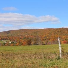
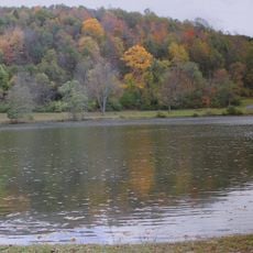
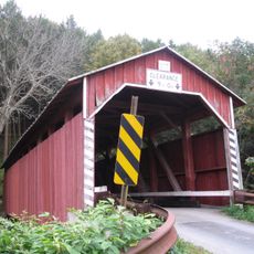
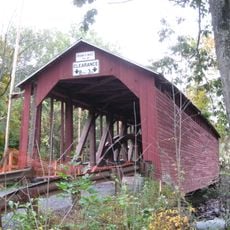
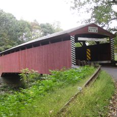
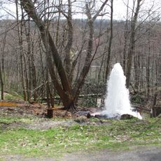
State Game Lands Number 58 is a wildlife management area spanning about 12,600 acres (5,100 hectares) of forested mountains, streams, and natural habitats in northeastern Pennsylvania. The property has multiple access points from township roads and includes a long hiking trail that reaches up to a fire tower.

These lands were established as part of the Pennsylvania Game Commission's strategy to protect over 1.5 million acres of wildlife habitat across the state. The acquisition happened over time to create connected spaces where animals could move and thrive.

Hunters and outdoor enthusiasts use these grounds year-round during regulated seasons for deer, bear, wild turkey, and grouse. The place holds importance for local communities as a key recreation area woven into the region's way of life.

Multiple township roads lead to parking areas where you can access trails throughout the grounds and reach the fire tower. Come prepared for uneven ground, wet spots, and seasonal changes, especially during active hunting periods.

These lands contain three of only a handful of public forest tracts within the Catawissa Creek watershed, forming an ecological corridor from Moosic Mountain down to the Susquehanna River. This connection makes the area a key pathway for wildlife movement across the broader region.

Location: Pennsylvania

Location: Columbia County

GPS coordinates: 40.91667,-76.31639

Latest update: December 14, 2025 11:24

Photos
Around this place
Knoebels Amusement Resort
United States of America

Knoebels Amusement Resort

16.4 km
Flying Turns
United States of America

Flying Turns

16.4 km
Impulse
United States of America

Impulse

16.1 km
Twister
United States of America

Twister

16.4 km
United States of America

Bloomsburg–Berwick metropolitan area

9.4 km
Assumption of the Blessed Virgin Mary Ukrainian Catholic Church
United States of America

Assumption of the Blessed Virgin Mary Ukrainian Catholic Church

12.2 km
Buck Mountain
United States of America

Buck Mountain

9.9 km
High Speed Thrill Coaster
United States of America

High Speed Thrill Coaster

16.2 km
Rupert Covered Bridge No. 56
United States of America

Rupert Covered Bridge No. 56

15 km
Catawissa Friends Meetinghouse
United States of America

Catawissa Friends Meetinghouse

12.9 km
Bloomsburg Historic District
United States of America

Bloomsburg Historic District

15 km
Wagner Covered Bridge No. 19
United States of America

Wagner Covered Bridge No. 19

5.6 km
St. Paul's Union Church and Cemetery
United States of America

St. Paul's Union Church and Cemetery

11 km
Lake Glory
United States of America

Lake Glory

12 km
Davis Covered Bridge
United States of America

Davis Covered Bridge

10.4 km
Mountain Grove Campground
United States of America

Mountain Grove Campground

11.3 km
Parr's Mill Covered Bridge No. 10
United States of America

Parr's Mill Covered Bridge No. 10

13.2 km
Hollingshead Covered Bridge No. 40
United States of America

Hollingshead Covered Bridge No. 40

11.7 km
Johnson Covered Bridge No. 28
United States of America

Johnson Covered Bridge No. 28

14.7 km
East Bloomsburg Bridge
United States of America

East Bloomsburg Bridge

13.3 km
Furnace Covered Bridge No. 11
United States of America

Furnace Covered Bridge No. 11

12.2 km
Fowlersville Covered Bridge
United States of America

Fowlersville Covered Bridge

15.5 km
Snyder Covered Bridge No. 17
United States of America

Snyder Covered Bridge No. 17

6.8 km
Benjamin Evans House
United States of America

Benjamin Evans House

16.2 km
Kozmo's Kurves
United States of America

Kozmo's Kurves

16.2 km
Pioneer Tunnel Coal Mine
United States of America

Pioneer Tunnel Coal Mine

15.7 km
Big Mine Run Geyser
United States of America

Big Mine Run Geyser

14.5 km
Pioneer Tunnel Coal Mine & Steam Train
United States of America

Pioneer Tunnel Coal Mine & Steam Train

15.7 km
Show the full map
Reviews

Visited this place? Tap the stars to rate it and share your experience / photos with the community! Try now! You can cancel it anytime.

« State Game Lands Number 58 - park in Columbia County, Pennsylvania, United States of America » is provided by Around Us (aroundus.com). Images and texts are derived from Wikimedia project under a Creative Commons license. You are allowed to copy, distribute, and modify copies of this page, under the conditions set by the license, as long as this note is clearly visible.

Discover hidden gems everywhere you go!

From secret cafés to breathtaking viewpoints, skip the crowded tourist spots and find places that match your style. Our app makes it easy with voice search, smart filtering, route optimization, and insider tips from travelers worldwide. Download now for the complete mobile experience.

Around Us App Screenshot

A unique approach to discovering new places

Le Figaro

All the places worth exploring

France Info

A tailor-made excursion in just a few clicks

20 Minutes