Enable Location

We need your location to show you interesting places around you

Discover nearby places

Find interesting locations and hidden gems around you

Precise directions

Get accurate directions and distances to places

Your location is never shared with other users. It's only used when you tap the location button.

Huntington County

Log in to your account

Start exploring — it's free

Trusted by 61,584 travelers worldwide

Continue with Google
Continue with Apple
or

We will send you a code to connect

By continuing, you accept our Terms and Conditions and our Privacy Policy

Check your inbox

We've sent a pincode in your inbox. Please enter the code below.

Huntington County, Administrative county in Indiana, US.

Description

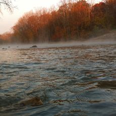
Huntington County is an administrative county located in central Indiana with multiple municipalities and townships spread across its area. The Wabash River runs through the land, creating natural boundaries between different sections of the county.

History

The Indiana legislature created this county in 1832 as part of the early settlement of the state. Over time, multiple townships and communities developed here and shaped the region's growth.

Culture

Farming remains central to life across this area, shaping how communities gather and share knowledge. Local residents take pride in their agricultural heritage and maintain strong connections to the land through seasonal events.

Practical

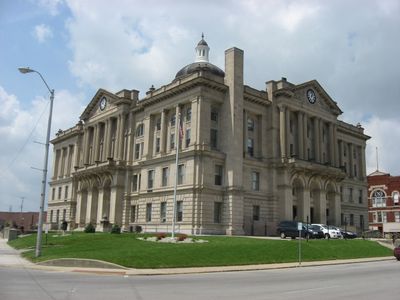
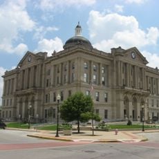
The county administration building in Huntington city serves as the main hub for government services and official documents. Visitors seeking permits or licenses can complete their requests at this location.

Did you know?

The area preserves a network of hiking trails that follow original Native American paths through forests and along waterways. These routes connect visitors to the region's earlier history in a tangible way.

Location
Inception
February 2, 1832
Capital city
Huntington
Shares border with
Whitley County, Allen County, Wells County, Grant County, Wabash County
GPS coordinates
40.83000,-85.49000
Latest update
December 7, 2025 20:43

AroundUs brings together thousands of curated places, local tips, and hidden gems, enriched daily by 60,000 contributors worldwide. Discover all places nearby (Indiana).

Around this place
United States Vice Presidential Museum
United States of America

United States Vice Presidential Museum

6.1 km
Lincoln Monument of Wabash, Indiana
United States of America

Lincoln Monument of Wabash, Indiana

28.1 km
Salamonie River State Forest
United States of America

Salamonie River State Forest

17.7 km
United States of America

J. Edward Roush Lake

2.6 km
Hanging Rock and Wabash Reef National Natural Landmark
United States of America

Hanging Rock and Wabash Reef National Natural Landmark

18.3 km
St. Patrick's Roman Catholic Church
United States of America

St. Patrick's Roman Catholic Church

20.2 km
Vermilyea Inn Historic District
United States of America

Vermilyea Inn Historic District

25 km
Huntington Courthouse Square Historic District
United States of America

Huntington Courthouse Square Historic District

5.8 km
William Street School
United States of America

William Street School

4.9 km
Taylor-Zent House
United States of America

Taylor-Zent House

6.1 km
David Alonzo and Elizabeth Purviance House
United States of America

David Alonzo and Elizabeth Purviance House

6.2 km
Hominy Ridge Shelter House
United States of America

Hominy Ridge Shelter House

16.4 km
J.E. Roush Fish and Wildlife Area
United States of America

J.E. Roush Fish and Wildlife Area

11.5 km
East Wabash Historic District
United States of America

East Wabash Historic District

27.8 km
Drover Town Historic District
United States of America

Drover Town Historic District

5.3 km
St. Peter's First Community Church
United States of America

St. Peter's First Community Church

5.3 km
LaFontaine Historic District
United States of America

LaFontaine Historic District

26.2 km
James M. Amoss Building
United States of America

James M. Amoss Building

28.1 km
Solomon Wilson Building
United States of America

Solomon Wilson Building

28.1 km
Old Plat Historic District
United States of America

Old Plat Historic District

6 km
Samuel Purviance House
United States of America

Samuel Purviance House

5.3 km
McNamee-Ford House
United States of America

McNamee-Ford House

28 km
Rangeline Road Bridge
United States of America

Rangeline Road Bridge

7.1 km
Hawley Heights Historic District
United States of America

Hawley Heights Historic District

6.7 km
Victory Noll-St. Felix Friary Historic District
United States of America

Victory Noll-St. Felix Friary Historic District

6.7 km
Young-Yentes-Mattern Farm
United States of America

Young-Yentes-Mattern Farm

13.1 km
Forks of the Wabash
United States of America

Forks of the Wabash

6.4 km
North Jefferson Street Historic District
United States of America

North Jefferson Street Historic District

6.3 km
Show the full map
« Huntington County - Administrative county in Indiana, US » is provided by Around Us (aroundus.com). Images and texts are derived from Wikimedia project under a Creative Commons license. You are allowed to copy, distribute, and modify copies of this page, under the conditions set by the license, as long as this note is clearly visible.

Discover hidden gems everywhere you go!

From secret cafés to breathtaking viewpoints, skip the crowded tourist spots and find places that match your style. Our app makes it easy with voice search, smart filtering, route optimization, and insider tips from travelers worldwide. Download now for the complete mobile experience.

Around Us App Screenshot

A unique approach to discovering new places

Le Figaro

All the places worth exploring

France Info

A tailor-made excursion in just a few clicks

20 Minutes

Around Us
Travel Guide & Maps
Download

Send to your phone

QR Code
1

Open the camera app on your mobile.

2

Point at the QR code with your camera. A notification will appear.

3

Tap the notification to open the link.