Montmorency County

Log in to your account

AroundUs is a community-driven map of interesting places, built by curious explorers like you. It grows with every review, story, and photo you share.
Connect to save your favorite spots, contribute locations, and create personalized routes.
By continuing, you accept our Terms and Conditions and our Privacy Policy
Add to collection
Map
Suggest a change
Share

Montmorency County, County in northern Michigan, United States.

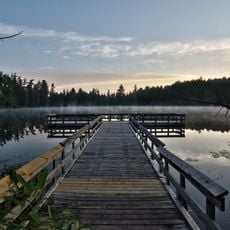
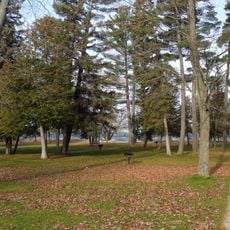
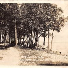
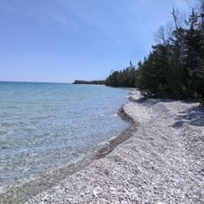
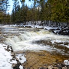
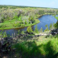
Montmorency County is an administrative division in northern Michigan that encompasses dense forests, numerous lakes, and flowing streams across its landscape. The area is dominated by state forest lands that create a mix of wooded terrain and water bodies throughout the region.

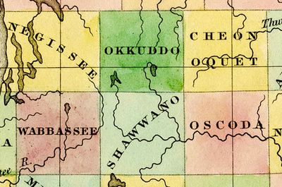
The area was established by the Michigan Legislature in 1840 as Cheonoquet County, named after a Chippewa Chief, then renamed to its current name in 1843. This change in naming reflected shifting administrative practices in the region.

The area maintains strong outdoor hunting and fishing traditions that shape life throughout the year among locals and visitors alike. These practices reflect how the community has long depended on and connected with the natural surroundings.

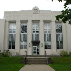
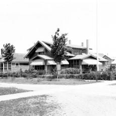
The town of Atlanta serves as the administrative center offering public services to the region. Visitors should expect scattered settlements and limited public transportation, making travel through the area more time-consuming than in densely populated zones.

The area protects two of only five known global habitats for the endangered Hungerford's crawling water beetle, a small aquatic insect found nowhere else in such concentrations. This critical role in species survival makes the region a key conservation location.

Location: Michigan

Inception: 1881

Capital city: Atlanta

Shares border with: Presque Isle County, Alcona County, Alpena County, Oscoda County, Crawford County, Otsego County, Cheboygan County

Website: http://montmorencycountymichigan.us

GPS coordinates: 45.03000,-84.13000

Latest update: December 7, 2025 20:44

Photos
Around this place
Show the full map
Hartwick Pines State Park
United States of America

Hartwick Pines State Park

52.9 km
Burt Lake State Park
United States of America

Burt Lake State Park

56.8 km
Hoeft State Park
United States of America

Hoeft State Park

52.2 km
Forty Mile Point Light
United States of America

Forty Mile Point Light

53.5 km
Onaway State Park
United States of America

Onaway State Park

45.4 km
Alpena Light
United States of America

Alpena Light

55.7 km
St. Mary, Our Lady of Mount Carmel Cathedral
United States of America

St. Mary, Our Lady of Mount Carmel Cathedral

43.5 km
Thompson's Harbor State Park
United States of America

Thompson's Harbor State Park

56.1 km
Temple Beth El
United States of America

Temple Beth El

54.7 km
Alpena County Courthouse
United States of America

Alpena County Courthouse

54.3 km
Edward E. Hartwick Memorial Building
United States of America

Edward E. Hartwick Memorial Building

52.4 km
Douglas House
United States of America

Douglas House

37.6 km
Oscoda County Courthouse
United States of America

Oscoda County Courthouse

42.4 km
Frank A. and Rae E. Harris Kramer House
United States of America

Frank A. and Rae E. Harris Kramer House

42.8 km
Call of the Wild Museum
United States of America

Call of the Wild Museum

43.6 km
Presque Isle County Courthouse
United States of America

Presque Isle County Courthouse

37.3 km
Leer Lutheran Church
United States of America

Leer Lutheran Church

37.2 km
Katherine V.
United States of America

Katherine V.

53.8 km
Bingham School
United States of America

Bingham School

54.3 km
James A. and Lottie J.
United States of America

James A. and Lottie J.

42.8 km
Dinosaur Gardens
United States of America

Dinosaur Gardens

55.6 km
Radka-Bradley House
United States of America

Radka-Bradley House

49.9 km
Great Lakes Maritime Heritage Center
United States of America

Great Lakes Maritime Heritage Center

54.9 km
Ocqueoc Falls
United States of America

Ocqueoc Falls

41.1 km
CoopersVille USA
United States of America

CoopersVille USA

37.2 km
Great Lakes Lore Maritime Museum
United States of America

Great Lakes Lore Maritime Museum

50 km
Au Sable National Scenic River
United States of America

Au Sable National Scenic River

44.5 km
Second Avenue Bridge
United States of America

Second Avenue Bridge

55.1 km
Show the full map
Reviews

Visited this place? Tap the stars to rate it and share your experience / photos with the community! Try now! You can cancel it anytime.

Administrative divisions
« Montmorency County - County in northern Michigan, United States » is provided by Around Us (aroundus.com). Images and texts are derived from Wikimedia project under a Creative Commons license. You are allowed to copy, distribute, and modify copies of this page, under the conditions set by the license, as long as this note is clearly visible.

Discover hidden gems everywhere you go!

From secret cafés to breathtaking viewpoints, skip the crowded tourist spots and find places that match your style. Our app makes it easy with voice search, smart filtering, route optimization, and insider tips from travelers worldwide. Download now for the complete mobile experience.

Around Us App Screenshot

A unique approach to discovering new places

Le Figaro

All the places worth exploring

France Info

A tailor-made excursion in just a few clicks

20 Minutes