Enable Location

We need your location to show you interesting places around you

Discover nearby places

Find interesting locations and hidden gems around you

Precise directions

Get accurate directions and distances to places

Your location is never shared with other users. It's only used when you tap the location button.

Cass County

Log in to your account

Start exploring — it's free

Trusted by 62,119 travelers worldwide

Continue with Google
Continue with Apple
or

We will send you a code to connect

By continuing, you accept our Terms and Conditions and our Privacy Policy

Check your inbox

We've sent a pincode in your inbox. Please enter the code below.

Cass County, County seat in Indiana, United States

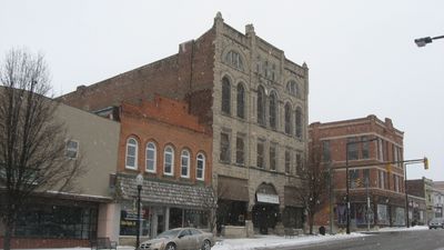
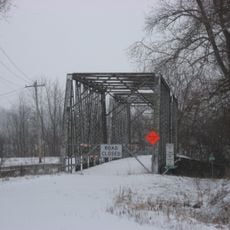
Cass County is a county in north-central Indiana with the Wabash River running through its territory. Logansport serves as the administrative hub where county government operations take place.

The county was founded in 1829 by the Indiana State Legislature and named for General Lewis Cass, who served as Governor of Michigan Territory. This establishment reflected the region's role in early settlement and growth.

Rural farming traditions shape daily life throughout the region, visible in how people use the land and organize community events. These agricultural roots remain central to how residents connect with their surroundings.

Visitors can reach county administrative offices in Logansport during regular business hours for information or documents. The region consists of several smaller towns with reasonable driving distances between them.

The Norfolk Southern Railway and Winamac Southern Railroad intersect in this area. These rail lines have made Logansport an important transportation junction in northern Indiana.

The community of curious travelers

AroundUs brings together thousands of curated places, local tips, and hidden gems, enriched daily by 60,000 contributors worldwide.

Start exploring
Location
Inception
1829
Capital city
Logansport
Shares border with
Fulton County, Miami County, Howard County, Carroll County, White County, Pulaski County
GPS coordinates
40.76000,-86.35000
Latest update
December 7, 2025 19:31
Around this place
Spencer Park Dentzel Carousel
United States of America

Spencer Park Dentzel Carousel

475 m
Terrell Jacobs Circus Winter Quarters
United States of America

Terrell Jacobs Circus Winter Quarters

21 km
44-83690
United States of America

44-83690

21.2 km
James Omar Cole House
United States of America

James Omar Cole House

23.9 km
Andrew Thomas House
United States of America

Andrew Thomas House

23.3 km
Willard B. Place House
United States of America

Willard B. Place House

878 m
Wilson Bridge
United States of America

Wilson Bridge

29.6 km
Carrollton Bridge
United States of America

Carrollton Bridge

28.7 km
Miami County Courthouse
United States of America

Miami County Courthouse

23.7 km
Pollard-Nelson House
United States of America

Pollard-Nelson House

1.2 km
Eikenberry Bridge
United States of America

Eikenberry Bridge

27 km
Pipe Creek Falls Resort
United States of America

Pipe Creek Falls Resort

11.8 km
Ferguson House
United States of America

Ferguson House

991 m
Bankers Row Historic District
United States of America

Bankers Row Historic District

1.8 km
Courthouse Historic District
United States of America

Courthouse Historic District

1.4 km
Kendrick-Baldwin House
United States of America

Kendrick-Baldwin House

1.2 km
Peru High School Historic District
United States of America

Peru High School Historic District

23.3 km
Shirk-Edwards House
United States of America

Shirk-Edwards House

23.2 km
Jerolaman-Long House
United States of America

Jerolaman-Long House

751 m
John Keip House
United States of America

John Keip House

1.1 km
Thompson Barnett House
United States of America

Thompson Barnett House

2.7 km
Point Historic District
United States of America

Point Historic District

1.8 km
Deer Creek Valley Rural Historic District
United States of America

Deer Creek Valley Rural Historic District

30.1 km
Henry Tousley House
United States of America

Henry Tousley House

423 m
District School No. 3
United States of America

District School No. 3

20.1 km
Wabash and Erie Canal Culvert No. 100
United States of America

Wabash and Erie Canal Culvert No. 100

19.4 km
Circus City Festival Museum
United States of America

Circus City Festival Museum

23.5 km
Burnett's Creek Arch
United States of America

Burnett's Creek Arch

19.6 km
Show the full map
Administrative divisions
« Cass County - County seat in Indiana, United States » is provided by Around Us (aroundus.com). Images and texts are derived from Wikimedia project under a Creative Commons license. You are allowed to copy, distribute, and modify copies of this page, under the conditions set by the license, as long as this note is clearly visible.

Discover hidden gems everywhere you go!

From secret cafés to breathtaking viewpoints, skip the crowded tourist spots and find places that match your style. Our app makes it easy with voice search, smart filtering, route optimization, and insider tips from travelers worldwide. Download now for the complete mobile experience.

Around Us App Screenshot

A unique approach to discovering new places

Le Figaro

All the places worth exploring

France Info

A tailor-made excursion in just a few clicks

20 Minutes

Around Us
Travel Guide & Maps
Download

Send to your phone

QR Code
1

Open the camera app on your mobile.

2

Point at the QR code with your camera. A notification will appear.

3

Tap the notification to open the link.