Wayne County, Administrative county in southwestern West Virginia, US
Wayne County is an administrative division in southwestern West Virginia that spans river valleys, rolling hills, and extensive forests in the Appalachian mountain region. The county administrative offices in the town of Wayne handle land records, marriage licenses, and vehicle registrations for local residents.
The county was established in 1842 by the Virginia General Assembly and named after General Anthony Wayne, a military leader from the American Revolution. This naming honors a significant figure from the nation's early history.
The community maintains long-standing ties to farming, with families continuing to work small plots of land across the region. Today, the local economy also centers around craftwork and service jobs that shape daily routines.
The landscape features mountains and valleys, making a car the most practical way to explore the region. Most services and amenities are concentrated in towns, while rural areas remain sparsely settled.
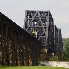
Three waterways form the boundaries of the region: the Ohio River and the Big Sandy River separate it from Kentucky, while Twelvepole Creek creates another natural dividing line. These waterways held historical importance for trade and travel.
Location: West Virginia
Inception: January 18, 1842
Capital city: Wayne
Shares border with: Lawrence County, Cabell County, Lincoln County, Mingo County, Martin County, Boyd County
Website: https://waynecountywv.org
GPS coordinates: 38.15000,-82.43000
Latest update: December 7, 2025 10:08
Camden Park
29.3 km
Fairfield Stadium
29 km
Huntington Museum of Art
27.1 km
Keith-Albee Theatre
30.2 km
Beech Fork State Park
19.2 km
Chesapeake and Ohio 1308
28.7 km
Beech Fork Lake
18.9 km
East Lynn Lake
4.1 km
Thunderbolt Express
29 km
Heritage Farm Museum and Village
25.4 km
Big Dipper
28.9 km
Hermitage of the Holy Cross
10.5 km
Ritter Park Historic District
28.3 km
Cabwaylingo State Forest
20.6 km
Cabell County Courthouse
30.1 km
Z. D. Ramsdell House
29.6 km
Norfolk Southern Bridge
31.1 km
Pink Bridge
28.6 km
Memorial Arch
28.7 km
Ohev Sholom Temple
29.2 km
Rotary Park Bridge
30.1 km
Carnegie Public Library
30.1 km
Fred M. Vinson Birthplace
15.5 km
United States Post Office and Court House
30 km
West Virginia Colored Children's Home
29.3 km
Thornburg House
31.2 km
Campbell-Hicks House
30.1 km
First United Methodist Church
32.2 kmVisited this place? Tap the stars to rate it and share your experience / photos with the community! Try now! You can cancel it anytime.
Discover hidden gems everywhere you go!
From secret cafés to breathtaking viewpoints, skip the crowded tourist spots and find places that match your style. Our app makes it easy with voice search, smart filtering, route optimization, and insider tips from travelers worldwide. Download now for the complete mobile experience.
A unique approach to discovering new places❞
— Le Figaro
All the places worth exploring❞
— France Info
A tailor-made excursion in just a few clicks❞
— 20 Minutes