Jackson County

Log in to your account

AroundUs is a community-driven map of interesting places, built by curious explorers like you. It grows with every review, story, and photo you share.
Connect to save your favorite spots, contribute locations, and create personalized routes.
By continuing, you accept our Terms and Conditions and our Privacy Policy
Add to collection
Map
Suggest a change
Share

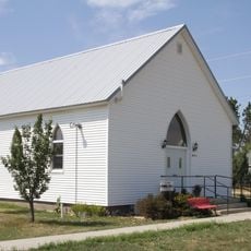
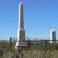
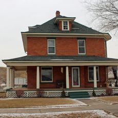
Jackson County, County in South Dakota, United States

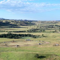
Jackson County is a rural county in South Dakota that encompasses rolling terrain, mountain ridges, and the White River running through its landscape. The county includes grasslands, forested areas, and distinctive geological formations that define its natural character.

The county was established in 1883 and received formal organization as an administrative division in 1915. In 1983, a neighboring county merged into its territory, significantly expanding the land area.

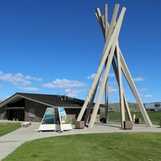
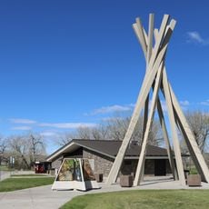
The county includes portions of the Pine Ridge Indian Reservation, with American Indian residents representing 52 percent of the total population in 2010.

The county is accessible via several major highways that connect the main communities across the region. Roads pass through open terrain and provide access to different parts of the county.

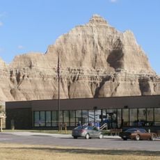
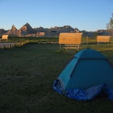
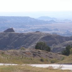
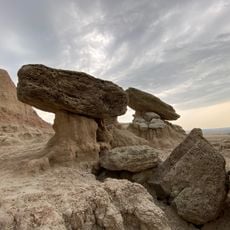
The Badlands National Park spans across the eastern portion of the county, displaying distinctive rock formations and deep canyons. These geological features were shaped over millions of years through natural erosion and sediment layering.

Location: South Dakota

Inception: 1914

Capital city: Kadoka

Shares border with: Haakon County, Jones County, Mellette County, Bennett County, Oglala Lakota County, Pennington County, Todd County

GPS coordinates: 43.70000,-101.64000

Latest update: December 10, 2025 15:56

Photos
Around this place
Wall Drug
United States of America

Wall Drug

58.3 km
Minuteman Missile National Historic Site
United States of America

Minuteman Missile National Historic Site

49.1 km
Wounded Knee National Historic Landmark
United States of America

Wounded Knee National Historic Landmark

85.4 km
St. Francis Mission
United States of America

St. Francis Mission

80 km
Lacreek National Wildlife Refuge
United States of America

Lacreek National Wildlife Refuge

67.1 km
Badlands Observatory
United States of America

Badlands Observatory

51 km
Prairie Homestead
United States of America

Prairie Homestead

24.2 km
Verendrye Site
United States of America

Verendrye Site

124.5 km
Wasta Rest Stop Tipis
United States of America

Wasta Rest Stop Tipis

75.8 km
Inland Theater
United States of America

Inland Theater

58.9 km
Mt. Moriah Masonic Lodge No. 155
United States of America

Mt. Moriah Masonic Lodge No. 155

18.4 km
Quinn Methodist Church
United States of America

Quinn Methodist Church

50.7 km
Spotted Tail Gravesite
United States of America

Spotted Tail Gravesite

81.6 km
Fort Pierre Congregational Church
United States of America

Fort Pierre Congregational Church

124.7 km
Freier Round Barn
United States of America

Freier Round Barn

97.1 km
Lee and Gottliebe Fritz House
United States of America

Lee and Gottliebe Fritz House

109.7 km
Jefferson Davis Carr House
United States of America

Jefferson Davis Carr House

124.7 km
Murdo State Bank
United States of America

Murdo State Bank

77.3 km
Wounded Knee cemetery
United States of America

Wounded Knee cemetery

85.3 km
Ben Reifel Visitor Center
United States of America

Ben Reifel Visitor Center

24.9 km
Wasta Rest Stop Tip–Eastbound
United States of America

Wasta Rest Stop Tip–Eastbound

75.8 km
Minuteman Missile National Historic Site Visitor Center
United States of America

Minuteman Missile National Historic Site Visitor Center

26.5 km
Wasta Rest Stop Tipi–Westbound
United States of America

Wasta Rest Stop Tipi–Westbound

75.6 km
Cedar Pass Campground
United States of America

Cedar Pass Campground

25.4 km
Sage Creek Campground
United States of America

Sage Creek Campground

65.8 km
Ancient Hunters Overlook
United States of America

Ancient Hunters Overlook

50.7 km
Yellow Mounds Overlook
United States of America

Yellow Mounds Overlook

47.3 km
Saddle Pass Trailhead
United States of America

Saddle Pass Trailhead

27.7 km
Show the full map
Reviews

Visited this place? Tap the stars to rate it and share your experience / photos with the community! Try now! You can cancel it anytime.

Administrative divisions
« Jackson County - County in South Dakota, United States » is provided by Around Us (aroundus.com). Images and texts are derived from Wikimedia project under a Creative Commons license. You are allowed to copy, distribute, and modify copies of this page, under the conditions set by the license, as long as this note is clearly visible.

Discover hidden gems everywhere you go!

From secret cafés to breathtaking viewpoints, skip the crowded tourist spots and find places that match your style. Our app makes it easy with voice search, smart filtering, route optimization, and insider tips from travelers worldwide. Download now for the complete mobile experience.

Around Us App Screenshot

A unique approach to discovering new places

Le Figaro

All the places worth exploring

France Info

A tailor-made excursion in just a few clicks

20 Minutes