Enable Location

We need your location to show you interesting places around you

Discover nearby places

Find interesting locations and hidden gems around you

Precise directions

Get accurate directions and distances to places

Your location is never shared with other users. It's only used when you tap the location button.

Worcester County

Log in to your account

Start exploring — it's free

Trusted by 62,387 travelers worldwide

Continue with Google
Continue with Apple
or

We will send you a code to connect

By continuing, you accept our Terms and Conditions and our Privacy Policy

Check your inbox

We've sent a pincode in your inbox. Please enter the code below.

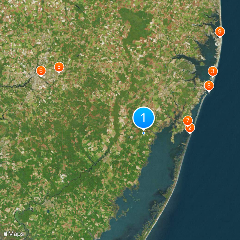
Worcester County, Administrative county in Maryland, US

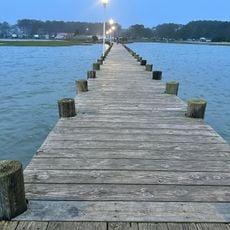
Worcester County spans the entire Maryland coastline, featuring ocean beaches, bays, and barrier islands with varied natural landscapes. The territory encompasses wetlands, forests, and waterways that support diverse ecosystems across its geography.

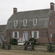
The county was established in 1742 when Somerset County was divided, and it took its name from Mary Arundell, wife of Sir John Somerset. This early founding shaped its trajectory as a regional administrative area.

The area maintains deep roots in farming and fishing, with seasonal festivals celebrating local crops and seafood that reflect how people here connect to the land and water. These traditions shape daily life and community identity throughout the year.

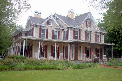
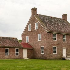
Snow Hill serves as the county seat, centralizing government services and administrative offices across seven electoral districts. This hub makes it a logical starting point for visitors exploring the broader region.

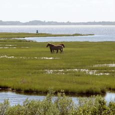
The territory includes Assateague Island, home to a wild horse population, and represents Maryland's only oceanfront access point. This combination of untamed wildlife and coastal exposure sets it apart.

The community of curious travelers

AroundUs brings together thousands of curated places, local tips, and hidden gems, enriched daily by 60,000 contributors worldwide.

Start exploring
Location
Inception
1742
Capital city
Snow Hill
Shares border with
Accomack County, Somerset County, Sussex County, Wicomico County
GPS coordinates
38.23000,-75.28000
Latest update
December 20, 2025 12:01
Around this place
Assateague State Park
United States of America

Assateague State Park

11.9 km
Jolly Roger Amusement Park
United States of America

Jolly Roger Amusement Park

22.9 km
Trimper's Rides
United States of America

Trimper's Rides

19.9 km
Arthur W. Perdue Stadium
United States of America

Arthur W. Perdue Stadium

26.8 km
Salisbury Zoo
United States of America

Salisbury Zoo

30.2 km
Verrazano Bridge
United States of America

Verrazano Bridge

11.5 km
Trimpers Rides
United States of America

Trimpers Rides

20 km
Fenwick Island Light
United States of America

Fenwick Island Light

31.5 km
Harry W. Kelley Memorial Bridge
United States of America

Harry W. Kelley Memorial Bridge

20 km
United States of America

Pocomoke River State Park

17.8 km
Assawoman Bay Bridge
United States of America

Assawoman Bay Bridge

24.4 km
Pemberton Hall
United States of America

Pemberton Hall

34.4 km
Poplar Hill Mansion
United States of America

Poplar Hill Mansion

31.7 km
United States of America

Furnace Town Living Heritage Museum

16.9 km
United States of America

Pocomoke State Forest

17.2 km
Rackliffe House
United States of America

Rackliffe House

11.3 km
Sun Outdoors Frontier Town
United States of America

Sun Outdoors Frontier Town

13.5 km
Calvin B. Taylor House
United States of America

Calvin B. Taylor House

12 km
Jolly Roger at The Pier
United States of America

Jolly Roger at The Pier

20.2 km
St. Martin's Episcopal Church
United States of America

St. Martin's Episcopal Church

19.3 km
Baja Amusements
United States of America

Baja Amusements

19.1 km
United States of America

Sturgis One Room School

30.7 km
Governor John Walter Smith House
United States of America

Governor John Walter Smith House

11.9 km
Merry Sherwood
United States of America

Merry Sherwood

9.8 km
United States of America

Julia A. Purnell Museum

11.9 km
Costen House
United States of America

Costen House

30.6 km
United States of America

Schumaker Pond

28.3 km
Burley Manor
United States of America

Burley Manor

11.3 km
Show the full map
« Worcester County - Administrative county in Maryland, US » is provided by Around Us (aroundus.com). Images and texts are derived from Wikimedia project under a Creative Commons license. You are allowed to copy, distribute, and modify copies of this page, under the conditions set by the license, as long as this note is clearly visible.

Discover hidden gems everywhere you go!

From secret cafés to breathtaking viewpoints, skip the crowded tourist spots and find places that match your style. Our app makes it easy with voice search, smart filtering, route optimization, and insider tips from travelers worldwide. Download now for the complete mobile experience.

Around Us App Screenshot

A unique approach to discovering new places

Le Figaro

All the places worth exploring

France Info

A tailor-made excursion in just a few clicks

20 Minutes

Around Us
Travel Guide & Maps
Download

Send to your phone

QR Code
1

Open the camera app on your mobile.

2

Point at the QR code with your camera. A notification will appear.

3

Tap the notification to open the link.