Crawford County

Log in to your account

AroundUs is a community-driven map of interesting places, built by curious explorers like you. It grows with every review, story, and photo you share.
Connect to save your favorite spots, contribute locations, and create personalized routes.
By continuing, you accept our Terms and Conditions and our Privacy Policy
Add to collection
Map
Suggest a change
Share

Crawford County, Rural county in southern Indiana, US
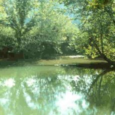
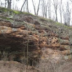
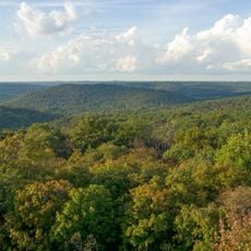
Crawford County encompasses 308 square miles of forested hills and waterways, with English serving as the administrative center of the region.

Established in January 1818, the county was named after William H. Crawford, who held the position of United States Treasury Secretary.

The Crawford County Community School Corporation maintains educational facilities across multiple townships, fostering connections among local communities through shared learning.

Interstate 64 and State Roads 37 and 62 connect Crawford County residents to neighboring regions, facilitating access to larger urban centers.

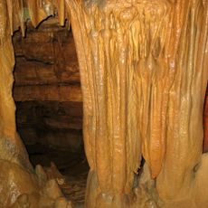
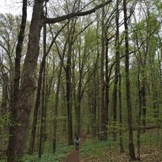
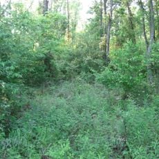
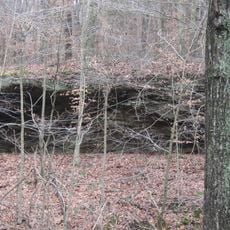
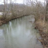
The county contains sections of the Hoosier National Forest, offering recreational spaces where visitors can explore natural landscapes throughout the seasons.

Location: Indiana

Inception: January 29, 1818

Capital city: English

Shares border with: Orange County, Washington County, Harrison County, Meade County, Perry County, Dubois County

Website: http://crawfordcountyindiana.com

GPS coordinates: 38.29000,-86.46000

Latest update: April 15, 2025 18:07

Around this place
Show the full map
Patoka Lake
United States of America

Patoka Lake

26.9 km
Marengo Cave
United States of America

Marengo Cave

14.2 km
French Lick Springs Hotel
United States of America

French Lick Springs Hotel

32.3 km
Wyandotte Caves
United States of America

Wyandotte Caves

15.9 km
Corydon Historic District
United States of America

Corydon Historic District

30.6 km
Indiana Railway Museum
United States of America

Indiana Railway Museum

32.5 km
O'Bannon Woods State Park
United States of America

O'Bannon Woods State Park

15.9 km
Harrison Spring
United States of America

Harrison Spring

21.2 km
Rockhouse Cliffs Rockshelters
United States of America

Rockhouse Cliffs Rockshelters

27.6 km
Harrison–Crawford State Forest
United States of America

Harrison–Crawford State Forest

17.2 km
Pioneer Mothers Memorial Forest
United States of America

Pioneer Mothers Memorial Forest

27.8 km
Swan's Landing Archeological Site
United States of America

Swan's Landing Archeological Site

24.3 km
First Baptist Church
United States of America

First Baptist Church

33.2 km
Orange County Courthouse
United States of America

Orange County Courthouse

29.7 km
Potts Creek Rockshelter
United States of America

Potts Creek Rockshelter

11.3 km
Corydon Battle Site
United States of America

Corydon Battle Site

30.6 km
Kintner-McGrain House
United States of America

Kintner-McGrain House

30.3 km
Jacob Rickenbaugh House
United States of America

Jacob Rickenbaugh House

17.5 km
Thomas Newby Braxtan House
United States of America

Thomas Newby Braxtan House

29.8 km
Lynd School
United States of America

Lynd School

33.1 km
Paoli Historic District
United States of America

Paoli Historic District

29.6 km
Newberry Friends Meeting House
United States of America

Newberry Friends Meeting House

30.8 km
William Proctor House
United States of America

William Proctor House

14.4 km
FLWB Indoor Karting
United States of America

FLWB Indoor Karting

32.9 km
Corydon Capitol State Historic Site
United States of America

Corydon Capitol State Historic Site

30.5 km
French Lick West Baden Museum
United States of America

French Lick West Baden Museum

32.1 km
Patoka Lake Nature Center
United States of America

Patoka Lake Nature Center

22.9 km
Lindley House
United States of America

Lindley House

29.8 km
Show the full map

Reviews

Visited this place? Tap the stars to rate it and share your experience / photos with the community! Try now! You can cancel it anytime.

Administrative divisions
« Crawford County - Rural county in southern Indiana, US » is provided by Around Us (aroundus.com). Images and texts are derived from Wikimedia project under a Creative Commons license. You are allowed to copy, distribute, and modify copies of this page, under the conditions set by the license, as long as this note is clearly visible.

Discover hidden gems everywhere you go!

From secret cafés to breathtaking viewpoints, skip the crowded tourist spots and find places that match your style. Our app makes it easy with voice search, smart filtering, route optimization, and insider tips from travelers worldwide. Download now for the complete mobile experience.

Around Us App Screenshot

A unique approach to discovering new places

Le Figaro

All the places worth exploring

France Info

A tailor-made excursion in just a few clicks

20 Minutes