Chest opened
+${chestReward.xp} XP
Explorer
NOUVEAU ×${chestReward.collectible.quantity}
tapez pour fermer
Chest locked

Open chests in the app

Around Us is built for your phone — chests unlock when you walk, explore and capture nearby places.

Enable Location

We need your location to show you interesting places around you

Discover nearby places

Find interesting locations and hidden gems around you

Precise directions

Get accurate directions and distances to places

Your location is never shared with other users. It's only used when you tap the location button.

Butner

Log in to your account

Start exploring — it's free

Trusted by 72,878 travelers worldwide

Continue with Google
Continue with Apple
or

We will send you a code to connect

By continuing, you accept our Terms and Conditions and our Privacy Policy

Check your inbox

We've sent a pincode in your inbox. Please enter the code below.

Discussion Reviews 1 Photos
25.2k Popularity

Butner, Town and administrative division in Granville County, North Carolina, United States.

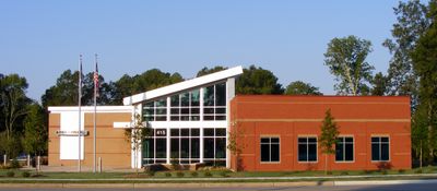
Butner is a town in Granville County in central North Carolina, located within the Durham metropolitan area. The community developed from a former military installation and now serves as both a residential and institutional hub for the region.

The town began as Camp Butner, a military installation named after Major General Henry W. Butner. After the Second World War, the base transitioned into civilian use with the establishment of state and federal facilities.

The racial composition reflects North Carolina's diversity, with the population distributed among White, African American, and other ethnic communities.

The town is accessible via Interstate 85 with several exits connecting to the Research Triangle region and surrounding areas. Visitors should understand that this is primarily an administrative and institutional hub rather than a typical tourist destination.

The area is home to multiple large correctional facilities at state and federal levels, making it a major hub in the criminal justice system. This presence has shaped the economic and social character of the entire community.

The community of curious travelers

AroundUs brings together thousands of curated places, local tips, and hidden gems, enriched daily by 60,000 contributors worldwide.

Start exploring
Location
Elevation above the sea
113 m
GPS coordinates
36.13830,-78.75890
Latest update
December 20, 2025 11:27
Around this place
Falls Lake
United States of America

Falls Lake

14.1 km
Stagville
United States of America

Stagville

7.5 km
Falls Lake State Recreation Area
United States of America

Falls Lake State Recreation Area

14.7 km
West Point on the Eno
United States of America

West Point on the Eno

15.5 km
Horton Grove
United States of America

Horton Grove

7.4 km
United States of America

Fairntosh Plantation

7.6 km
West Point Mill
United States of America

West Point Mill

15.5 km
United States of America

John P. Lawrence Plantation

15.2 km
United States of America

Cedar Creek Gallery

6.3 km
United States of America

Little River Reservoir, North Carolina

10.5 km
James Mangum House
United States of America

James Mangum House

13.9 km
United States of America

Allen-Mangum House

13.3 km
United States of America

Brassfield Baptist Church

16.7 km
Cozart-Coley House
United States of America

Cozart-Coley House

7.4 km
Xtreme Park Adventure
United States of America

Xtreme Park Adventure

18 km
United States of America

George Poland House

12.2 km
First National Bank Building
United States of America

First National Bank Building

6.8 km
United States of America

Museum of American Pottery

6.9 km
United States of America

Cannady-Brogden Farm

10.5 km
United States of America

Mount Energy Historic District

10.6 km
United States of America

Marcus Tilley House

7.6 km
United States of America

Adolphus W. Umstead House

10.1 km
United States of America

Lake Michie

7.9 km
Little River High School
United States of America

Little River High School

13.3 km
United States of America

Falls Village Golf Club

17.4 km
United States of America

Treyburn Country Club

9.6 km
United States of America

Airplane

17.7 km
United States of America

Historic Stagville

7.5 km
Show the full map
Reviews
Share your experience

No review yet

Discussions
Start a discussion...

No discussion yet

« Butner - Town and administrative division in Granville County, North Carolina, United States » is provided by Around Us (aroundus.com). Images and texts are derived from Wikimedia project under a Creative Commons license. You are allowed to copy, distribute, and modify copies of this page, under the conditions set by the license, as long as this note is clearly visible.

Discover hidden gems everywhere you go!

From secret cafés to breathtaking viewpoints, skip the crowded tourist spots and find places that match your style. Our app makes it easy with voice search, smart filtering, route optimization, and insider tips from travelers worldwide. Download now for the complete mobile experience.

Around Us App Screenshot

A unique approach to discovering new places

Le Figaro

All the places worth exploring

France Info

A tailor-made excursion in just a few clicks

20 Minutes

Around Us
Travel Guide & Maps
Download

Send to your phone

QR Code
1

Open the camera app on your mobile.

2

Point at the QR code with your camera. A notification will appear.

3

Tap the notification to open the link.