Enable Location

We need your location to show you interesting places around you

Discover nearby places

Find interesting locations and hidden gems around you

Precise directions

Get accurate directions and distances to places

Your location is never shared with other users. It's only used when you tap the location button.

Auburn Hills

Log in to your account

Start exploring — it's free

Trusted by 62,804 travelers worldwide

Continue with Google
Continue with Apple
or

We will send you a code to connect

By continuing, you accept our Terms and Conditions and our Privacy Policy

Check your inbox

We've sent a pincode in your inbox. Please enter the code below.

Auburn Hills, Suburban city in Oakland County, Michigan

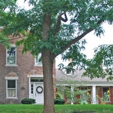
Auburn Hills is a city in Oakland County in the state of Michigan, located roughly 26 miles north of Detroit. The area includes gentle hills and is crossed by the Clinton River, which winds through woods and open ground.

The area was founded in 1821 as Pontiac Township and slowly developed from a rural community into a suburb. In 1983, the town adopted its current name and became an independent municipality.

The name Auburn came from the reddish-brown hills that early settlers noticed in the landscape back in 1821. Today, residents meet in the parks along the river or visit events on the university campus.

The city hall stands in a central location and is open for citizen inquiries on weekdays. The trail along the river remains accessible throughout the year and offers several entry points in different parts of town.

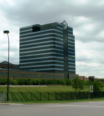
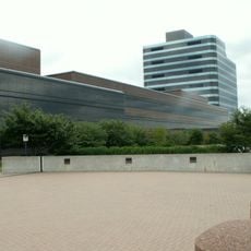
Several major car manufacturers have built their American headquarters here, giving the place a distinct business character. Test vehicles and prototypes can often be seen driving through town on the parking lots.

The community of curious travelers

AroundUs brings together thousands of curated places, local tips, and hidden gems, enriched daily by 60,000 contributors worldwide.

Start exploring
Location
Inception
1983
Elevation above the sea
293 m
Shares border with
Orion Township
GPS coordinates
42.68750,-83.23417
Latest update
December 13, 2025 16:59
Around this place
Pontiac Silverdome
United States of America

Pontiac Silverdome

4.9 km
Chrysler Headquarters and Technology Center
United States of America

Chrysler Headquarters and Technology Center

3.7 km
Clinton Valley Center
United States of America

Clinton Valley Center

8.6 km
United States of America

Parashakthi Temple

7.5 km
Athletics Center O'rena
United States of America

Athletics Center O'rena

2.3 km
Sea Life Michigan
United States of America

Sea Life Michigan

5.4 km
St. Vincent DePaul Catholic Church, Convent, and School
United States of America

St. Vincent DePaul Catholic Church, Convent, and School

7.5 km
Franklin Boulevard Historic District
United States of America

Franklin Boulevard Historic District

8.1 km
Elliott Tower
United States of America

Elliott Tower

2.2 km
United States of America

McMath–Hulbert Observatory

7 km
Myrick-Palmer House
United States of America

Myrick-Palmer House

7.9 km
Casa del Rey Apartments
United States of America

Casa del Rey Apartments

8.8 km
Eagle Theatre
United States of America

Eagle Theatre

7.4 km
United States of America

Pine Grove Historical Museum

7.3 km
Wisner House
United States of America

Wisner House

7.2 km
Gillespie Street-Clinton River Bridge
United States of America

Gillespie Street-Clinton River Bridge

8.6 km
Chrysler Technology Center
United States of America

Chrysler Technology Center

3.7 km
Horatio N. Howard House
United States of America

Horatio N. Howard House

6.7 km
Oak Hill Cemetery
United States of America

Oak Hill Cemetery

6.5 km
United States of America

Dawsons Millpond

9.8 km
United States of America

The Links at Crystal Lake

9.5 km
United States of America

Fieldstone Golf Club

1.8 km
United States of America

(some object projecting out of the water)

9.2 km
United States of America

Scenic viewpoint

9.1 km
United States of America

Scenic viewpoint

979 m
United States of America

Scenic viewpoint

5.5 km
United States of America

Scenic viewpoint

5.5 km
United States of America

Scenic viewpoint

5.5 km
Show the full map
« Auburn Hills - Suburban city in Oakland County, Michigan » is provided by Around Us (aroundus.com). Images and texts are derived from Wikimedia project under a Creative Commons license. You are allowed to copy, distribute, and modify copies of this page, under the conditions set by the license, as long as this note is clearly visible.

Discover hidden gems everywhere you go!

From secret cafés to breathtaking viewpoints, skip the crowded tourist spots and find places that match your style. Our app makes it easy with voice search, smart filtering, route optimization, and insider tips from travelers worldwide. Download now for the complete mobile experience.

Around Us App Screenshot

A unique approach to discovering new places

Le Figaro

All the places worth exploring

France Info

A tailor-made excursion in just a few clicks

20 Minutes

Around Us
Travel Guide & Maps
Download

Send to your phone

QR Code
1

Open the camera app on your mobile.

2

Point at the QR code with your camera. A notification will appear.

3

Tap the notification to open the link.