Chest opened
+${chestReward.xp} XP
Explorer
NOUVEAU ×${chestReward.collectible.quantity}
tapez pour fermer
Chest locked

Open chests in the app

Around Us is built for your phone — chests unlock when you walk, explore and capture nearby places.

Enable Location

We need your location to show you interesting places around you

Discover nearby places

Find interesting locations and hidden gems around you

Precise directions

Get accurate directions and distances to places

Your location is never shared with other users. It's only used when you tap the location button.

Mesabi Range

Log in to your account

Start exploring — it's free

Trusted by 72,879 travelers worldwide

Continue with Google
Continue with Apple
or

We will send you a code to connect

By continuing, you accept our Terms and Conditions and our Privacy Policy

Check your inbox

We've sent a pincode in your inbox. Please enter the code below.

Mesabi Range
Discussion Reviews 1 Photos
49k Popularity

Mesabi Range, Mining region in northeastern Minnesota, United States.

Mesabi Range is a mining region in northeastern Minnesota containing substantial iron ore deposits within the Biwabik Iron Formation. The ore-bearing rock formations define much of the landscape across the area.

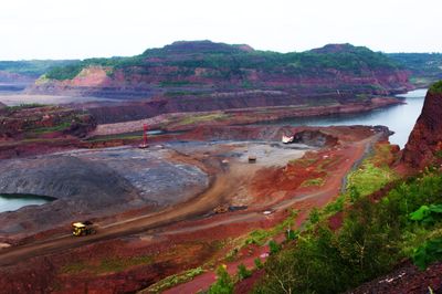
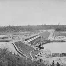
Iron ore mining began in the late 1800s using underground techniques before shifting to open pit methods during the 1900s. The final underground operation closed in 1960, marking the end of subsurface extraction.

The name comes from the Ojibwe word Misaabe-wajiw, meaning giant mountain, reflecting how Native peoples understood this landscape. Today, this terminology remains part of how locals describe the region.

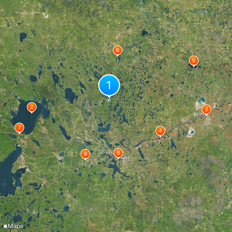
The region is accessible from towns like Grand Rapids and Babbitt, which serve as main entry points. Visitors should note that active mining operations and water bodies affect accessibility across different parts of the area.

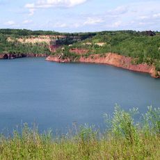
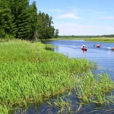
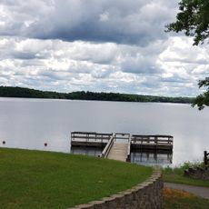
Mining operations transformed the landscape by creating an extensive network of depressions, pools, and lakes across the region. These water bodies are remnants of extraction activities rather than natural features.

The community of curious travelers

AroundUs brings together thousands of curated places, local tips, and hidden gems, enriched daily by 60,000 contributors worldwide.

Start exploring
Location
Location
Part of
Lake Superior Iron Ore Basin
GPS coordinates
47.51000,-93.63000
Latest update
December 14, 2025 19:01
Around this place
Lake Winnibigoshish
United States of America

Lake Winnibigoshish

41.9 km
Greyhound Bus Museum
United States of America

Greyhound Bus Museum

52.6 km
Hill Annex Mine State Park
United States of America

Hill Annex Mine State Park

33.5 km
McCarthy Beach State Park
United States of America

McCarthy Beach State Park

48.5 km
Scenic State Park
United States of America

Scenic State Park

24 km
United States of America

The Big Fish

51.1 km
Forest History Center
United States of America

Forest History Center

31.5 km
Schoolcraft State Park
United States of America

Schoolcraft State Park

34.2 km
Bowstring State Forest
United States of America

Bowstring State Forest

36.3 km
Hibbing City Hall
United States of America

Hibbing City Hall

53 km
Andrew G. Anderson House
United States of America

Andrew G. Anderson House

53.5 km
Marcell Ranger Station
United States of America

Marcell Ranger Station

10.5 km
Bigfork Village Hall
United States of America

Bigfork Village Hall

26.1 km
Sons of Italy Hall
United States of America

Sons of Italy Hall

53.2 km
East Howard Street Commercial Historic District
United States of America

East Howard Street Commercial Historic District

52.8 km
Coleraine Methodist Episcopal Church
United States of America

Coleraine Methodist Episcopal Church

29.1 km
Church of the Good Shepherd
United States of America

Church of the Good Shepherd

29.1 km
Mitchell–Tappan House
United States of America

Mitchell–Tappan House

52.9 km
Delvic Building
United States of America

Delvic Building

52.6 km
Emmett Butler House
United States of America

Emmett Butler House

52.6 km
Remer State Forest
United States of America

Remer State Forest

44.5 km
Minnesota Discovery Center
United States of America

Minnesota Discovery Center

55.3 km
Scenic State Park CCC/WPA/Rustic Style Historic Resources
United States of America

Scenic State Park CCC/WPA/Rustic Style Historic Resources

23.9 km
Tioga Pit Beach
United States of America

Tioga Pit Beach

31.9 km
Farley Hill Lookout Tower
United States of America

Farley Hill Lookout Tower

38.3 km
Side Lake Lookout Tower
United States of America

Side Lake Lookout Tower

50.1 km
Coleraine Fire Lookout Tower
United States of America

Coleraine Fire Lookout Tower

29 km
Ruby Lake Camp
United States of America

Ruby Lake Camp

6.2 km
Show the full map
Reviews
Share your experience

No review yet

Discussions
Start a discussion...

No discussion yet

« Mesabi Range - Mining region in northeastern Minnesota, United States » is provided by Around Us (aroundus.com). Images and texts are derived from Wikimedia project under a Creative Commons license. You are allowed to copy, distribute, and modify copies of this page, under the conditions set by the license, as long as this note is clearly visible.

Discover hidden gems everywhere you go!

From secret cafés to breathtaking viewpoints, skip the crowded tourist spots and find places that match your style. Our app makes it easy with voice search, smart filtering, route optimization, and insider tips from travelers worldwide. Download now for the complete mobile experience.

Around Us App Screenshot

A unique approach to discovering new places

Le Figaro

All the places worth exploring

France Info

A tailor-made excursion in just a few clicks

20 Minutes

Around Us
Travel Guide & Maps
Download

Send to your phone

QR Code
1

Open the camera app on your mobile.

2

Point at the QR code with your camera. A notification will appear.

3

Tap the notification to open the link.