Enable Location

We need your location to show you interesting places around you

Discover nearby places

Find interesting locations and hidden gems around you

Precise directions

Get accurate directions and distances to places

Your location is never shared with other users. It's only used when you tap the location button.

St. Louis County

Log in to your account

Start exploring — it's free

Trusted by 61,908 travelers worldwide

Continue with Google
Continue with Apple
or

We will send you a code to connect

By continuing, you accept our Terms and Conditions and our Privacy Policy

Check your inbox

We've sent a pincode in your inbox. Please enter the code below.

St. Louis County, Administrative county in northeastern Minnesota, US

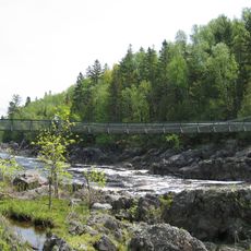
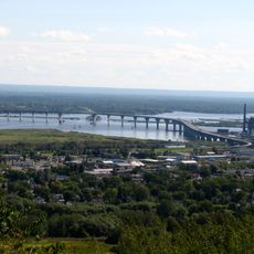
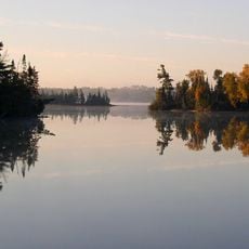
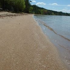
St. Louis County is a large administrative area in northeastern Minnesota that encompasses varied landscapes and natural features. The region is defined by hundreds of lakes, extensive forests, and the St. Louis River system flowing through it.

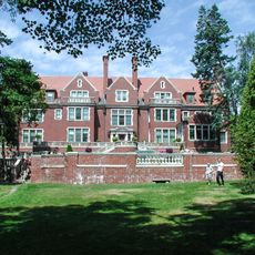
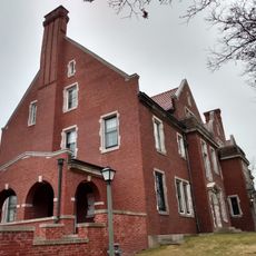
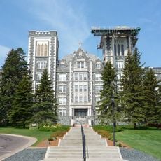
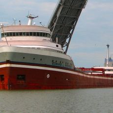
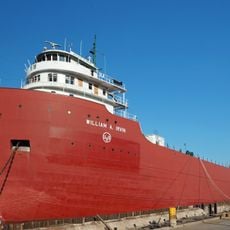
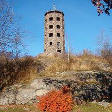
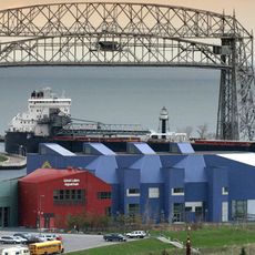
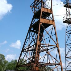
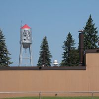
The Minnesota Legislature created the county in 1856, naming it after the St. Louis River flowing through the region. The area later became significant through timber operations and mining activities that shaped its development.

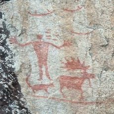
The county is home to the Bois Forte and Fond du Lac Indian Reservations, where Ojibwe communities maintain their traditions and deep connections to the land. Visitors can explore these cultural sites and learn about Native American heritage firsthand.

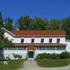
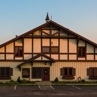
The area is quite large and benefits from advance planning when exploring its different regions and attractions. Summer and early fall offer the best conditions for visiting, when weather is mild and natural features are easily accessible.

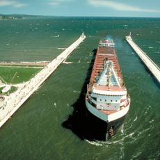
Most of the Boundary Waters Canoe Area Wilderness falls within this county and attracts paddlers and outdoor enthusiasts from across the region. At the same time, active taconite mining operations in the Iron Range demonstrate the contrast between wild nature and industrial heritage.

The community of curious travelers

AroundUs brings together thousands of curated places, local tips, and hidden gems, enriched daily by 60,000 contributors worldwide.

Start exploring
Location
Inception
March 1, 1856
Capital city
Duluth
Shares border with
Lake County, Aitkin County, Carlton County, Koochiching County, Itasca County, Douglas County
GPS coordinates
47.58000,-92.46000
Latest update
December 14, 2025 18:38
Around this place
Glensheen Historic Estate
United States of America

Glensheen Historic Estate

90.6 km
Glensheen - Historic Congdon Estate
United States of America

Glensheen - Historic Congdon Estate

90.6 km
Voyageurs National Park
United States of America

Voyageurs National Park

107.2 km
Aerial Lift Bridge
United States of America

Aerial Lift Bridge

93.4 km
College of St. Scholastica
United States of America

College of St. Scholastica

89.2 km
STR Edward L Ryerson
United States of America

STR Edward L Ryerson

97.5 km
Lake Vermilion
United States of America

Lake Vermilion

33.2 km
Jay Cooke State Park
United States of America

Jay Cooke State Park

104 km
United States Hockey Hall of Fame
United States of America

United States Hockey Hall of Fame

13.2 km
William A. Irvin
United States of America

William A. Irvin

92.9 km
SS Meteor
United States of America

SS Meteor

100 km
Enger Tower
United States of America

Enger Tower

93 km
Duluth Ship Canal
United States of America

Duluth Ship Canal

93.4 km
Richard I. Bong Memorial Bridge
United States of America

Richard I. Bong Memorial Bridge

97.5 km
Lake Superior Railroad Museum
United States of America

Lake Superior Railroad Museum

92.9 km
Great Lakes Aquarium
United States of America

Great Lakes Aquarium

93.2 km
John A. Blatnik Bridge
United States of America

John A. Blatnik Bridge

96.4 km
Thomas Rukavina Memorial Bridge
United States of America

Thomas Rukavina Memorial Bridge

8.8 km
Lake Vermilion-Soudan Underground Mine State Park
United States of America

Lake Vermilion-Soudan Underground Mine State Park

31.8 km
Bear Head Lake State Park
United States of America

Bear Head Lake State Park

37.8 km
Greyhound Bus Museum
United States of America

Greyhound Bus Museum

39.4 km
Hegman Lake Pictograph
United States of America

Hegman Lake Pictograph

67.2 km
Kettle Falls Hotel
United States of America

Kettle Falls Hotel

103.6 km
Lake Superior Zoo
United States of America

Lake Superior Zoo

97.2 km
Fitger Brewing Company
United States of America

Fitger Brewing Company

92 km
United States of America

Iron Man

33 km
McCarthy Beach State Park
United States of America

McCarthy Beach State Park

44 km
Lake Superior Maritime Visitor Center
United States of America

Lake Superior Maritime Visitor Center

93.3 km
Show the full map
« St. Louis County - Administrative county in northeastern Minnesota, US » is provided by Around Us (aroundus.com). Images and texts are derived from Wikimedia project under a Creative Commons license. You are allowed to copy, distribute, and modify copies of this page, under the conditions set by the license, as long as this note is clearly visible.

Discover hidden gems everywhere you go!

From secret cafés to breathtaking viewpoints, skip the crowded tourist spots and find places that match your style. Our app makes it easy with voice search, smart filtering, route optimization, and insider tips from travelers worldwide. Download now for the complete mobile experience.

Around Us App Screenshot

A unique approach to discovering new places

Le Figaro

All the places worth exploring

France Info

A tailor-made excursion in just a few clicks

20 Minutes

Around Us
Travel Guide & Maps
Download

Send to your phone

QR Code
1

Open the camera app on your mobile.

2

Point at the QR code with your camera. A notification will appear.

3

Tap the notification to open the link.