Chest opened
+${chestReward.xp} XP
Explorer
NOUVEAU ×${chestReward.collectible.quantity}
tapez pour fermer

See the monuments around you in AR Open chests in the app

Around Us is built for your phone — point your camera at the streets and discover the monuments and places around you in augmented reality. Around Us is built for your phone — chests unlock when you walk, explore and capture nearby places.

Enable Location

We need your location to show you interesting places around you

Discover nearby places

Find interesting locations and hidden gems around you

Precise directions

Get accurate directions and distances to places

Your location is never shared with other users. It's only used when you tap the location button.

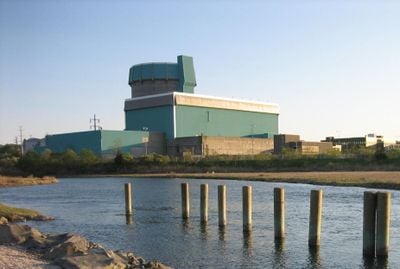
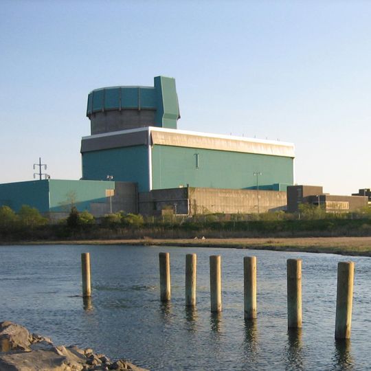
Shoreham Nuclear Power Plant

Log in to your account

Start exploring — it's free

Trusted by 87,030 travelers worldwide

Continue with Google
Continue with Apple
or

We will send you a code to connect

By continuing, you accept our Terms and Conditions and our Privacy Policy

Check your inbox

We've sent a pincode in your inbox. Please enter the code below.

Shoreham Nuclear Power Plant
Discussion Reviews 1 Photos
42.4k Popularity

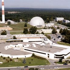
Shoreham Nuclear Power Plant, Decommissioned nuclear power plant in East Shoreham, United States

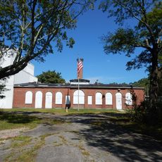
Shoreham Nuclear Power Plant is a decommissioned nuclear power station located on Long Island's South Shore near the waters of Long Island Sound. The facility was equipped with a General Electric boiling water reactor and contained extensive control rooms along with large containment structures.

Construction began in 1972 and the facility was completed in 1984, though it never operated commercially at full capacity. The plant was permanently shut down in 1989 amid public concerns about nuclear safety.

The nuclear power plant became a symbol of public resistance to nuclear energy following the Three Mile Island and Chernobyl incidents in the late 1970s.

The site is not open to the public for tours or visits. However, you can observe the facility from nearby roads and areas, and the surrounding landscape has been restored with environmental restoration projects.

Wind turbines were installed at the former power plant site to generate renewable energy. A gas turbine facility also uses the existing infrastructure on the grounds.

The community of curious travelers

AroundUs brings together thousands of curated places, local tips, and hidden gems, enriched daily by 60,000 contributors worldwide.
Start exploring
Location
GPS coordinates
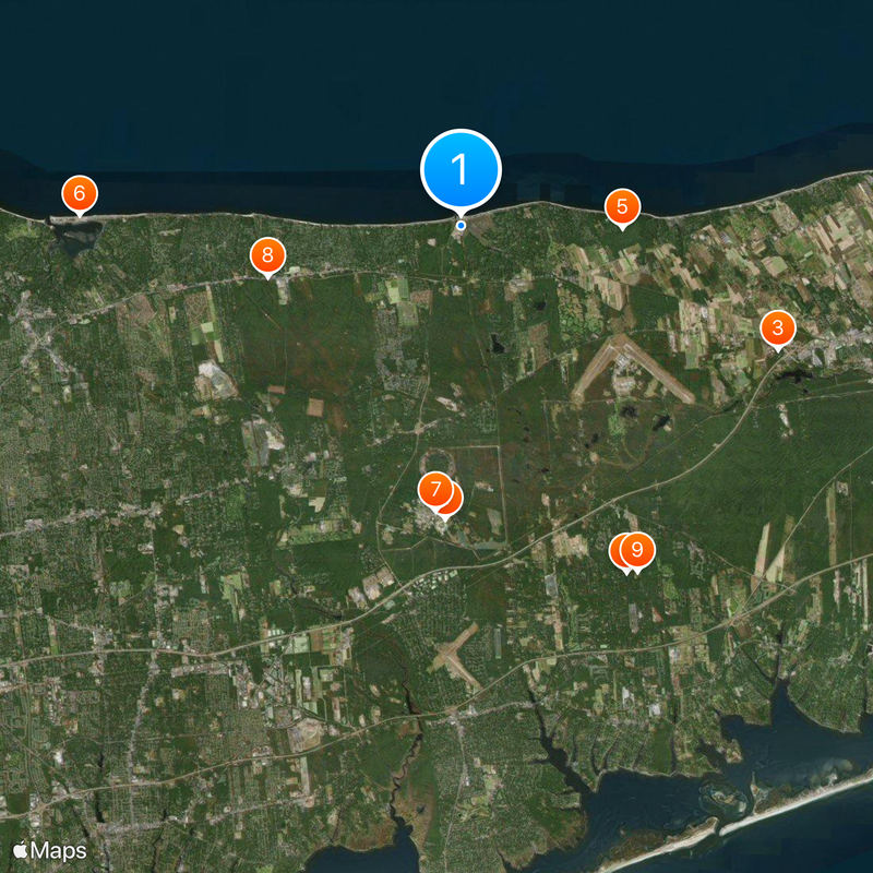
40.96110,-72.86500
Latest update
September 12, 2026 04:08
Around this place
Long Island Central Pine Barrens
United States of America

Long Island Central Pine Barrens

8.7 mi
Splish Splash
United States of America

Splish Splash

7.7 mi
National Synchrotron Light Source II
United States of America

National Synchrotron Light Source II

6.6 mi
Wildwood State Park
United States of America

Wildwood State Park

3.6 mi
Cedar Beach
United States of America

Cedar Beach

8.6 mi
National Synchrotron Light Source
United States of America

National Synchrotron Light Source

6.5 mi
United States of America

Paumanok Path

23.4 mi
Long Island Game Farm
United States of America

Long Island Game Farm

8.8 mi
Southaven County Park
United States of America

Southaven County Park

10 mi
Benson House
United States of America

Benson House

1.4 mi
Smith Estate
United States of America

Smith Estate

6.8 mi
Davis Town Meeting House
United States of America

Davis Town Meeting House

8.3 mi
Josiah Woodhull House
United States of America

Josiah Woodhull House

0.3 mi
Homan-Gerard House and Mills
United States of America

Homan-Gerard House and Mills

9.1 mi
Suffolk County Almshouse Barn
United States of America

Suffolk County Almshouse Barn

9.7 mi
Samuel Hopkins House
United States of America

Samuel Hopkins House

8.2 mi
Tuthill-Lapham House
United States of America

Tuthill-Lapham House

0.7 mi
Middle Island Presbyterian Church
United States of America

Middle Island Presbyterian Church

7.6 mi
Miller Place Historic District
United States of America

Miller Place Historic District

7 mi
Wading River Landing
United States of America

Wading River Landing

0.7 mi
Grumman Memorial Park
United States of America

Grumman Memorial Park

4.5 mi
Cedar Beach
United States of America

Cedar Beach

8.8 mi
Tesla Science Center
United States of America

Tesla Science Center

2 mi
Shoreham Beach
United States of America

Shoreham Beach

0.6 mi
Miller Place Beach
United States of America

Miller Place Beach

7.5 mi
Long Island Science Center
United States of America

Long Island Science Center

8.2 mi
Scotts Beach
United States of America

Scotts Beach

5.8 mi
Upper Lake
United States of America

Upper Lake

8.9 mi
Show the full map
Reviews
Share your experience

No review yet

Discussions
Start a discussion...

No discussion yet

« Shoreham Nuclear Power Plant - Decommissioned nuclear power plant in East Shoreham, United States » is provided by Around Us (aroundus.com). Images and texts are derived from Wikimedia project under a Creative Commons license. You are allowed to copy, distribute, and modify copies of this page, under the conditions set by the license, as long as this note is clearly visible.

Discover hidden gems everywhere you go!

From secret cafés to breathtaking viewpoints, skip the crowded tourist spots and find places that match your style. Our app makes it easy with voice search, smart filtering, route optimization, and insider tips from travelers worldwide. Download now for the complete mobile experience.
Around Us App Screenshot

A unique approach to discovering new places

Le Figaro

All the places worth exploring

France Info

A tailor-made excursion in just a few clicks

20 Minutes

Around Us
Travel Guide & Maps
Download

Send to your phone

QR Code
1

Open the camera app on your mobile.

2

Point at the QR code with your camera. A notification will appear.

3

Tap the notification to open the link.