International Falls, Border town in Koochiching County, Minnesota.
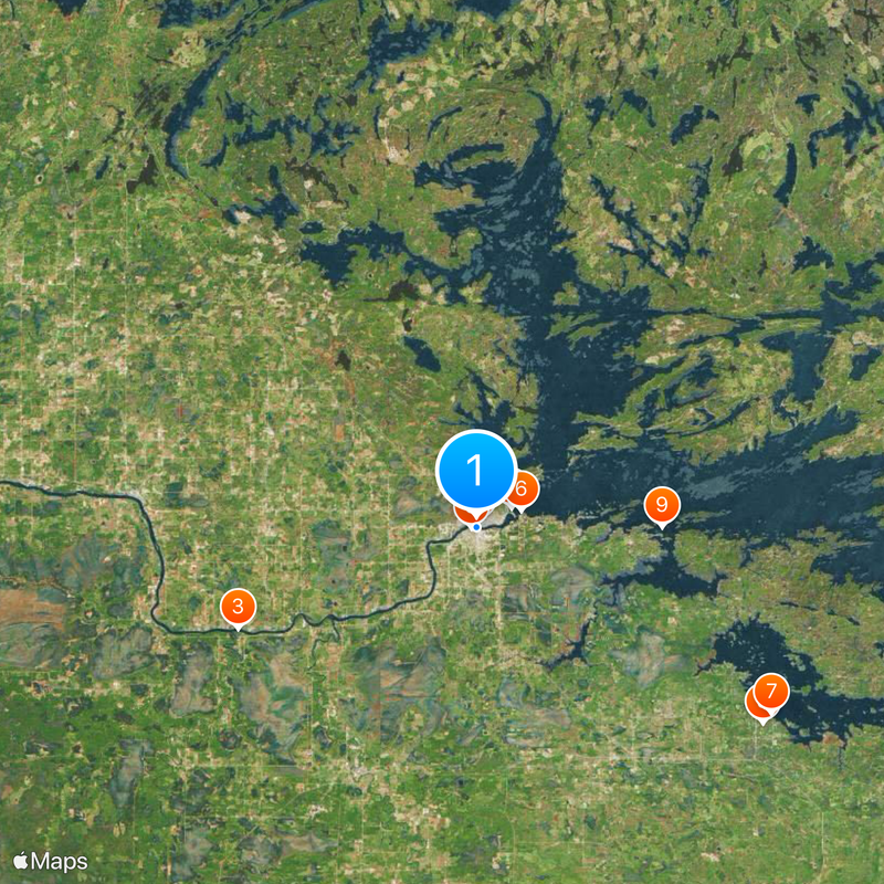
International Falls sits at the border between the United States and Canada along the Rainy River and serves as the administrative center of Koochiching County. The small town spreads along the riverbank and acts as a gateway to Voyageurs National Park and Rainy Lake.
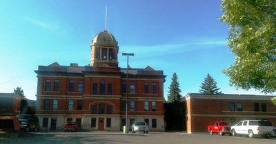
The settlement changed its name from Koochiching to International Falls in 1901 to acknowledge its location on the border between the US and Canada. The timber industry shaped the growth of the town during the early decades of the 20th century.
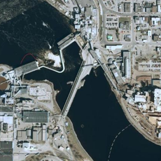
The bridge over the Rainy River links the town with Fort Frances in Ontario and both communities share emergency services and celebrations together. Residents from both sides often meet in shops, schools and events, shaping everyday life along this border.
Falls International Airport offers daily flights to Minneapolis–Saint Paul and the town sits close to Voyageurs National Park. Main streets run along the riverbank and make orientation in the small town straightforward.
Winter temperatures here regularly drop below freezing for more than 109 days each year, making the town a favored location for testing cold weather products. Manufacturers use the extreme climate to test vehicles, tires and other equipment under real conditions.
Location: Koochiching County
Elevation above the sea: 342 m
Shares border with: Fort Frances
Website: http://ci.international-falls.mn.us
GPS coordinates: 48.60167,-93.40368
Latest update: December 13, 2025 17:20
Fort Frances – International Falls International Bridge
631 m
Grand Mound
24.4 km
Fort Saint Pierre
3.7 km
Kabetogama State Forest
32.5 km
Finstad's Auto Marine Shop
4.4 km
Kabetogama Ranger Station District
32.7 km
Koochiching County Courthouse
502 m
Gold Mine Sites
17.3 kmSandpoint Island Provincial Park
22.1 kmFort Frances Museum and Cultural Centre
1 kmRainy Lake Islands Conservation Reserve
27.7 kmBrown's Inlet Conservation Reserve
20.6 kmJackfish Rapids
38.4 km
Rainy Lake Visitor Center
18 kmGoose Island Provincial Park
19 km
Kabetogama Lake Visitor Center
32.6 km
Black Bay Lookout Tower
16.9 kmManitou Rapids
37.9 kmLong Rapids
31.6 kmWhitehorse Rapids
32.1 kmSmokey Bear State Forest
25.2 kmThe River Golf Course, Inc.
4.9 kmLittle American Island Dock
17.3 kmMinnesota Welcomes You Sign
130 mRainy Lake Mermaid
18.4 kmEllsworth Rock Gardens
33.4 kmScenic viewpoint
28.4 kmScenic viewpoint
17.2 kmVisited this place? Tap the stars to rate it and share your experience / photos with the community! Try now! You can cancel it anytime.
Discover hidden gems everywhere you go!
From secret cafés to breathtaking viewpoints, skip the crowded tourist spots and find places that match your style. Our app makes it easy with voice search, smart filtering, route optimization, and insider tips from travelers worldwide. Download now for the complete mobile experience.
A unique approach to discovering new places❞
— Le Figaro
All the places worth exploring❞
— France Info
A tailor-made excursion in just a few clicks❞
— 20 Minutes