Enable Location

We need your location to show you interesting places around you

Discover nearby places

Find interesting locations and hidden gems around you

Precise directions

Get accurate directions and distances to places

Your location is never shared with other users. It's only used when you tap the location button.

Grand Mound

Log in to your account

Start exploring — it's free

Trusted by 64,818 travelers worldwide

Continue with Google
Continue with Apple
or

We will send you a code to connect

By continuing, you accept our Terms and Conditions and our Privacy Policy

Check your inbox

We've sent a pincode in your inbox. Please enter the code below.

Discussion Reviews 1 Photos
3.4k Popularity

Grand Mound, Burial site in Koochiching County, Minnesota, United States

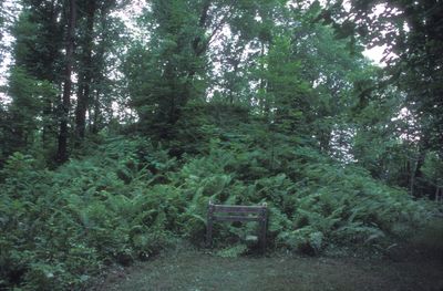
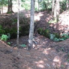
Grand Mound is a prehistoric earthwork site in Koochiching County, Minnesota, made up of one large central mound and four smaller surrounding mounds. The main mound has an elongated shape with a projecting tail and rises noticeably above the flat, wooded land along the Rainy River.

The site was used during the Woodland period, with burial and settlement activity going back to around 200 BCE. It was later designated a National Historic Landmark and is now managed by the Minnesota Historical Society.

Grand Mound is considered sacred by Indigenous communities, who use it for ceremonies tied to their ancestral traditions. The restricted access reflects the ongoing relationship between the site and the people whose history it holds.

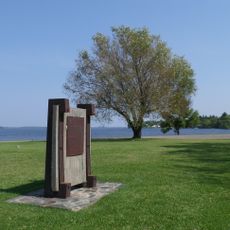
Access to the site is strictly limited, as it remains an active burial ground open only to Indigenous community members and authorized visitors. Anyone hoping to visit should contact the Minnesota Historical Society beforehand to ask about current possibilities.

The shape of the main mound, seen from above, resembles the outline of a muskrat, an animal that carries meaning in the traditions of the Ojibwe and other Woodland peoples. This animal form is rare among the earthworks that have survived in North America.

The community of curious travelers

AroundUs brings together thousands of curated places, local tips, and hidden gems, enriched daily by 60,000 contributors worldwide.

Start exploring
GPS coordinates
48.51679,-93.70862
Latest update
March 3, 2026 13:59
Around this place
Voyageurs National Park
United States of America

Voyageurs National Park

60.9 km
Big Bog State Recreation Area
United States of America

Big Bog State Recreation Area

69.5 km
Kettle Falls Hotel
United States of America

Kettle Falls Hotel

78.8 km
Kay-Nah-Chi-Wah-Nung
Canada

Kay-Nah-Chi-Wah-Nung

30.6 km
Scenic State Park
United States of America

Scenic State Park

89.1 km
Fort Saint Pierre
Canada

Fort Saint Pierre

28.1 km
Kabetogama State Forest
United States of America

Kabetogama State Forest

50.2 km
Franz Jevne State Park
United States of America

Franz Jevne State Park

30.5 km
Kettle Falls Historic District
United States of America

Kettle Falls Historic District

78.8 km
Jun Fujita Cabin
United States of America

Jun Fujita Cabin

61.8 km
Sts. Peter and Paul Russian Orthodox Church
United States of America

Sts. Peter and Paul Russian Orthodox Church

79.2 km
Finstad's Auto Marine Shop
United States of America

Finstad's Auto Marine Shop

28.8 km
Bigfork Village Hall
United States of America

Bigfork Village Hall

86.1 km
Kabetogama Ranger Station District
United States of America

Kabetogama Ranger Station District

50.8 km
Koochiching County Courthouse
United States of America

Koochiching County Courthouse

23.9 km
Orr Roadside Parking Area
United States of America

Orr Roadside Parking Area

82.6 km
Civilian Conservation Corps Camp S-52
United States of America

Civilian Conservation Corps Camp S-52

79 km
Gold Mine Sites
United States of America

Gold Mine Sites

41 km
Scenic State Park CCC/WPA/Rustic Style Historic Resources
United States of America

Scenic State Park CCC/WPA/Rustic Style Historic Resources

89.2 km
Ash River Lookout Tower
United States of America

Ash River Lookout Tower

69.1 km
Kabetogama Lookout Tower
United States of America

Kabetogama Lookout Tower

54.7 km
Ash River Visitor Center
United States of America

Ash River Visitor Center

64 km
Kabetogama Lake Visitor Center
United States of America

Kabetogama Lake Visitor Center

50.7 km
Elephant Lake Lookout Tower
United States of America

Elephant Lake Lookout Tower

80.2 km
Faunce Lookout Tower
United States of America

Faunce Lookout Tower

92.2 km
Rapid River Fire Tower
United States of America

Rapid River Fire Tower

61.2 km
Rainy Lake Visitor Center
United States of America

Rainy Lake Visitor Center

41 km
Black Bay Lookout Tower
United States of America

Black Bay Lookout Tower

40.5 km
Show the full map
Reviews
Share your experience

No review yet

Discussions
Start a discussion...

No discussion yet

« Grand Mound - Burial site in Koochiching County, Minnesota, United States » is provided by Around Us (aroundus.com). Images and texts are derived from Wikimedia project under a Creative Commons license. You are allowed to copy, distribute, and modify copies of this page, under the conditions set by the license, as long as this note is clearly visible.

Discover hidden gems everywhere you go!

From secret cafés to breathtaking viewpoints, skip the crowded tourist spots and find places that match your style. Our app makes it easy with voice search, smart filtering, route optimization, and insider tips from travelers worldwide. Download now for the complete mobile experience.

Around Us App Screenshot

A unique approach to discovering new places

Le Figaro

All the places worth exploring

France Info

A tailor-made excursion in just a few clicks

20 Minutes

Around Us
Travel Guide & Maps
Download

Send to your phone

QR Code
1

Open the camera app on your mobile.

2

Point at the QR code with your camera. A notification will appear.

3

Tap the notification to open the link.