Enable Location

We need your location to show you interesting places around you

Discover nearby places

Find interesting locations and hidden gems around you

Precise directions

Get accurate directions and distances to places

Your location is never shared with other users. It's only used when you tap the location button.

Kettle Falls Historic District

Log in to your account

Start exploring — it's free

Trusted by 62,373 travelers worldwide

Continue with Google
Continue with Apple
or

We will send you a code to connect

By continuing, you accept our Terms and Conditions and our Privacy Policy

Check your inbox

We've sent a pincode in your inbox. Please enter the code below.

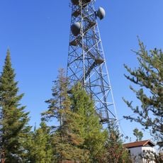
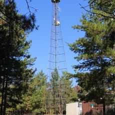
Kettle Falls Historic District, Historic district in Voyageurs National Park, Minnesota, United States

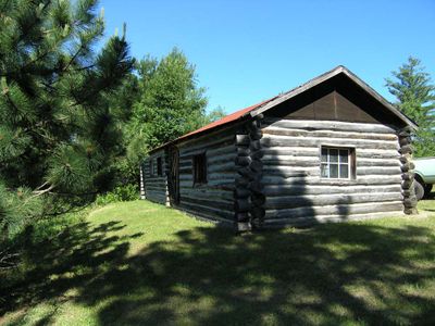
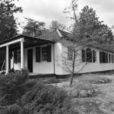
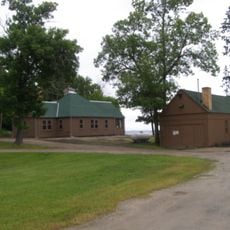
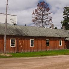
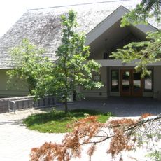
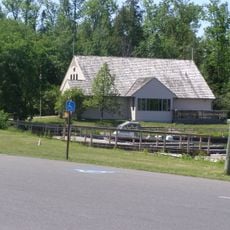
Kettle Falls Historic District sits where Namakan and Rainy Lakes meet, containing a hotel and several buildings from early commercial activities in the region. The structures date from the late 1800s and early 1900s, showing how people built and worked in this remote border area.

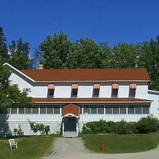
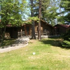
The area emerged in the 1890s as a vital stop for gold seekers, fur traders, and merchants traveling through the boundary waters. The hotel opened in 1913 and became a central point where people moving between Canada and the United States would meet and rest.

The Kettle Falls Hotel, constructed in 1913, served as a central gathering point for lumberjacks, traders, and travelers crossing between Canada and United States.

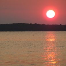
The site is accessible only by water, so visitors must bring a boat or join a boat tour to reach it. Accommodation in the hotel is available from late May through mid-September for those wishing to stay overnight and explore the surroundings.

The 1918 purchase of the original hotel involved an unusual payment that included four barrels of whiskey during prohibition times, alongside cash. This detail offers insight into the practical realities and trade customs of this remote border area during a complex legal period.

The community of curious travelers

AroundUs brings together thousands of curated places, local tips, and hidden gems, enriched daily by 60,000 contributors worldwide.

Start exploring
Location
Location
GPS coordinates
48.50139,-92.64028
Latest update
December 14, 2025 09:43
Around this place
Voyageurs National Park
United States of America

Voyageurs National Park

17.9 km
Lake Vermilion
United States of America

Lake Vermilion

76 km
Hegman Lake Pictograph
United States of America

Hegman Lake Pictograph

73.9 km
Kettle Falls Hotel
United States of America

Kettle Falls Hotel

190 m
Grand Mound
United States of America

Grand Mound

78.8 km
Fort Saint Pierre
Canada

Fort Saint Pierre

54.6 km
Kabetogama State Forest
United States of America

Kabetogama State Forest

30.3 km
Iron Range Off-Highway Vehicle State Recreation Area
United States of America

Iron Range Off-Highway Vehicle State Recreation Area

77.7 km
Stuntz Bay Boathouse Historic District
United States of America

Stuntz Bay Boathouse Historic District

80.9 km
Jun Fujita Cabin
United States of America

Jun Fujita Cabin

17.8 km
Sts. Peter and Paul Russian Orthodox Church
United States of America

Sts. Peter and Paul Russian Orthodox Church

77 km
Finstad's Auto Marine Shop
United States of America

Finstad's Auto Marine Shop

53.6 km
William Ingersoll Estate
United States of America

William Ingersoll Estate

20.5 km
Kabetogama Ranger Station District
United States of America

Kabetogama Ranger Station District

29.4 km
Koochiching County Courthouse
United States of America

Koochiching County Courthouse

57.8 km
Orr Roadside Parking Area
United States of America

Orr Roadside Parking Area

51.2 km
Civilian Conservation Corps Camp S-52
United States of America

Civilian Conservation Corps Camp S-52

47 km
Gold Mine Sites
United States of America

Gold Mine Sites

40.5 km
Sturgeon River State Forest
United States of America

Sturgeon River State Forest

76.9 km
Ash River Lookout Tower
United States of America

Ash River Lookout Tower

15.1 km
Kabetogama Lookout Tower
United States of America

Kabetogama Lookout Tower

31.8 km
Ash River Visitor Center
United States of America

Ash River Visitor Center

17.2 km
Rainy Lake Visitor Center
United States of America

Rainy Lake Visitor Center

39.5 km
Elephant Lake Lookout Tower
United States of America

Elephant Lake Lookout Tower

36.7 km
Kabetogama Lake Visitor Center
United States of America

Kabetogama Lake Visitor Center

29.4 km
Black Bay Lookout Tower
United States of America

Black Bay Lookout Tower

40.8 km
Gheen Hill Lookout Tower
United States of America

Gheen Hill Lookout Tower

59.9 km
Vermilion Dam Lookout Tower
United States of America

Vermilion Dam Lookout Tower

60.4 km
Show the full map
« Kettle Falls Historic District - Historic district in Voyageurs National Park, Minnesota, United States » is provided by Around Us (aroundus.com). Images and texts are derived from Wikimedia project under a Creative Commons license. You are allowed to copy, distribute, and modify copies of this page, under the conditions set by the license, as long as this note is clearly visible.

Discover hidden gems everywhere you go!

From secret cafés to breathtaking viewpoints, skip the crowded tourist spots and find places that match your style. Our app makes it easy with voice search, smart filtering, route optimization, and insider tips from travelers worldwide. Download now for the complete mobile experience.

Around Us App Screenshot

A unique approach to discovering new places

Le Figaro

All the places worth exploring

France Info

A tailor-made excursion in just a few clicks

20 Minutes

Around Us
Travel Guide & Maps
Download

Send to your phone

QR Code
1

Open the camera app on your mobile.

2

Point at the QR code with your camera. A notification will appear.

3

Tap the notification to open the link.