Fort Saint Pierre

Log in to your account

AroundUs is a community-driven map of interesting places, built by curious explorers like you. It grows with every review, story, and photo you share.
Connect to save your favorite spots, contribute locations, and create personalized routes.
Continue with Google
Continue with Apple
Continue with X
Continue with Facebook
Continue with email
By continuing, you accept our Terms and Conditions and our Privacy Policy
Create an account
Add to collection
Map
Suggest a change
Share

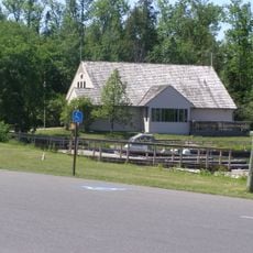
Fort Saint Pierre, Trading post at Pither's Point, Fort Frances, Canada.

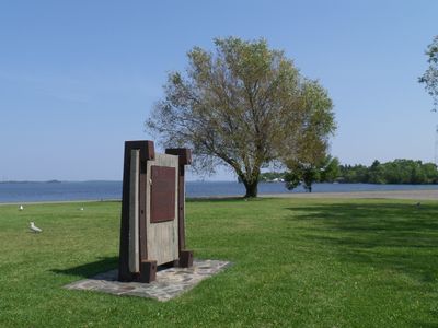
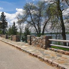
Fort Saint Pierre is a trading post built at the southwest edge of Rainy Lake near where the Rainy River flows in. The site sits within a park area and displays the remains of the original stone buildings and defensive structures from its operating years.

French explorer La Vérendrye founded this post in 1731 as the first French settlement west of Lake Superior. The site was abandoned in 1758 during the Seven Years War, marking a significant moment in the region's colonial history.

The fort supported trade connections between French settlers and Monsoni Ojibwe populations while managing territorial disputes with neighboring Sioux communities.

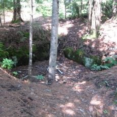
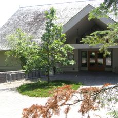
The site sits within a public park that is easy to reach and explore freely, though structures are not enclosed. Much of what remains lies below ground, so reading the on-site markers helps you understand what the original fort looked like.

This fort served as a hub for the fur trade between French merchants and local Ojibwe communities in a border region. Its position created a space where trade partnerships and territorial tensions coexisted in the daily life of the post.

Location: Fort Frances

GPS coordinates: 48.61839,-93.36010

Latest update: December 12, 2025 17:48

Photos
Around this place
Voyageurs National Park
United States of America

Voyageurs National Park

37.5 km
Big Bog State Recreation Area
United States of America

Big Bog State Recreation Area

97.4 km
Kettle Falls Hotel
United States of America

Kettle Falls Hotel

54.6 km
Grand Mound
United States of America

Grand Mound

28.1 km
Kay-Nah-Chi-Wah-Nung
Canada

Kay-Nah-Chi-Wah-Nung

52.6 km
Kabetogama State Forest
United States of America

Kabetogama State Forest

31.1 km
Franz Jevne State Park
United States of America

Franz Jevne State Park

52.8 km
Kettle Falls Historic District
United States of America

Kettle Falls Historic District

54.6 km
Jun Fujita Cabin
United States of America

Jun Fujita Cabin

36.8 km
Sts. Peter and Paul Russian Orthodox Church
United States of America

Sts. Peter and Paul Russian Orthodox Church

80.7 km
Finstad's Auto Marine Shop
United States of America

Finstad's Auto Marine Shop

980 m
William Ingersoll Estate
United States of America

William Ingersoll Estate

71.7 km
Kabetogama Ranger Station District
United States of America

Kabetogama Ranger Station District

31.1 km
Koochiching County Courthouse
United States of America

Koochiching County Courthouse

4.2 km
Orr Roadside Parking Area
United States of America

Orr Roadside Parking Area

73.5 km
Civilian Conservation Corps Camp S-52
United States of America

Civilian Conservation Corps Camp S-52

69.1 km
Gold Mine Sites
United States of America

Gold Mine Sites

14.2 km
Sturgeon River State Forest
United States of America

Sturgeon River State Forest

95.8 km
Ash River Lookout Tower
United States of America

Ash River Lookout Tower

48.4 km
Kabetogama Lookout Tower
United States of America

Kabetogama Lookout Tower

39.1 km
Ash River Visitor Center
United States of America

Ash River Visitor Center

42.7 km
Kabetogama Lake Visitor Center
United States of America

Kabetogama Lake Visitor Center

31.1 km
Rainy Lake Visitor Center
United States of America

Rainy Lake Visitor Center

15.1 km
Elephant Lake Lookout Tower
United States of America

Elephant Lake Lookout Tower

66.4 km
Rapid River Fire Tower
United States of America

Rapid River Fire Tower

86.5 km
Black Bay Lookout Tower
United States of America

Black Bay Lookout Tower

13.9 km
Gheen Hill Lookout Tower
United States of America

Gheen Hill Lookout Tower

81.3 km
Vermilion Dam Lookout Tower
United States of America

Vermilion Dam Lookout Tower

97.4 km
Show the full map
Reviews

Visited this place? Tap the stars to rate it and share your experience / photos with the community! Try now! You can cancel it anytime.

« Fort Saint Pierre - Trading post at Pither's Point, Fort Frances, Canada » is provided by Around Us (aroundus.com). Images and texts are derived from Wikimedia project under a Creative Commons license. You are allowed to copy, distribute, and modify copies of this page, under the conditions set by the license, as long as this note is clearly visible.

Discover hidden gems everywhere you go!

From secret cafés to breathtaking viewpoints, skip the crowded tourist spots and find places that match your style. Our app makes it easy with voice search, smart filtering, route optimization, and insider tips from travelers worldwide. Download now for the complete mobile experience.

Around Us App Screenshot

A unique approach to discovering new places

Le Figaro

All the places worth exploring

France Info

A tailor-made excursion in just a few clicks

20 Minutes