Enable Location

We need your location to show you interesting places around you

Discover nearby places

Find interesting locations and hidden gems around you

Precise directions

Get accurate directions and distances to places

Your location is never shared with other users. It's only used when you tap the location button.

Mohawk Trail

Log in to your account

Start exploring — it's free

Trusted by 61,410 travelers worldwide

Continue with Google
Continue with Apple
or

We will send you a code to connect

By continuing, you accept our Terms and Conditions and our Privacy Policy

Check your inbox

We've sent a pincode in your inbox. Please enter the code below.

Mohawk Trail, Historic road in Berkshire County, United States.

Description

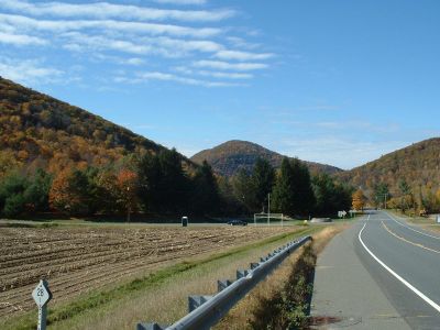
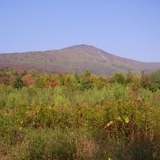
The Mohawk Trail is a historic road in western Massachusetts that runs through the Berkshire Mountains, linking the Hudson Valley to the Connecticut River Valley. The route winds for about 63 miles (101 kilometers) through dense forests, past waterfalls, and over steep mountain slopes.

History

Indigenous tribes originally established it centuries ago as a trading path between the coasts. In the 1910s, the state rebuilt the route as one of America's first official scenic highways.

Culture

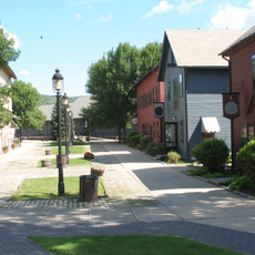
The name comes from the Mohawk people who used this route to trade furs and tools between settlements. Today, wooden cabins from the 1930s built by Civilian Conservation Corps workers still stand along the road and remain in use.

Practical

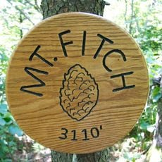
The best time to drive is early autumn when leaves change color and visibility across the valleys is clear. Several lookout points and trailheads along the way allow for short stops and walks.

Did you know?

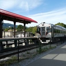
In 1915, 700 automobiles traveled this route in a single day, an extraordinary traffic volume for that era. This number shows how quickly the path transformed from an ancient footway into a popular driving route.

Location
GPS coordinates
42.64083,-72.95361
Latest update
December 5, 2025 22:28

AroundUs brings together thousands of curated places, local tips, and hidden gems, enriched daily by 60,000 contributors worldwide. Discover all places nearby (Berkshire County).

Around this place
Mount Greylock
United States of America

Mount Greylock

17.4 km
Mount Greylock State Reservation
United States of America

Mount Greylock State Reservation

18.7 km
Berkshire Scenic Railway Museum
United States of America

Berkshire Scenic Railway Museum

13.5 km
Western Gateway Heritage State Park
United States of America

Western Gateway Heritage State Park

14.5 km
Mount Fitch
United States of America

Mount Fitch

17 km
Anthony House
United States of America

Anthony House

12.5 km
Wells House
United States of America

Wells House

16.1 km
Blackinton Historic District
United States of America

Blackinton Historic District

13.4 km
Stafford Hill Memorial
United States of America

Stafford Hill Memorial

15.2 km
The Boardman
United States of America

The Boardman

13.7 km
Congregation Beth Israel
United States of America

Congregation Beth Israel

18.7 km
Pittsfield and North Adams Railroad
United States of America

Pittsfield and North Adams Railroad

13.7 km
Quaker Meetinghouse
United States of America

Quaker Meetinghouse

14.2 km
Hillside Cemetery
United States of America

Hillside Cemetery

15.4 km
Church Street Historic District
United States of America

Church Street Historic District

14 km
Five Corners Historic District
United States of America

Five Corners Historic District

23.7 km
Hoosac Street School
United States of America

Hoosac Street School

13.3 km
Freeman's Grove Historic District
United States of America

Freeman's Grove Historic District

14.2 km
St. Luke's Episcopal Church
United States of America

St. Luke's Episcopal Church

23.1 km
Charles Browne House
United States of America

Charles Browne House

12.5 km
Crowley House
United States of America

Crowley House

15.7 km
Eber Sherman Farm
United States of America

Eber Sherman Farm

18.9 km
Church Street-Caddy Hill Historic District
United States of America

Church Street-Caddy Hill Historic District

14 km
William B. Sherman Farm
United States of America

William B. Sherman Farm

19.2 km
Sykes House
United States of America

Sykes House

16 km
Summer Street Historic District
United States of America

Summer Street Historic District

13.6 km
Normal School Historic District
United States of America

Normal School Historic District

13.4 km
Monument Square-Eagle Street Historic District
United States of America

Monument Square-Eagle Street Historic District

14.3 km
Show the full map
« Mohawk Trail - Historic road in Berkshire County, United States » is provided by Around Us (aroundus.com). Images and texts are derived from Wikimedia project under a Creative Commons license. You are allowed to copy, distribute, and modify copies of this page, under the conditions set by the license, as long as this note is clearly visible.

Discover hidden gems everywhere you go!

From secret cafés to breathtaking viewpoints, skip the crowded tourist spots and find places that match your style. Our app makes it easy with voice search, smart filtering, route optimization, and insider tips from travelers worldwide. Download now for the complete mobile experience.

Around Us App Screenshot

A unique approach to discovering new places

Le Figaro

All the places worth exploring

France Info

A tailor-made excursion in just a few clicks

20 Minutes

Around Us
Travel Guide & Maps
Download

Send to your phone

QR Code
1

Open the camera app on your mobile.

2

Point at the QR code with your camera. A notification will appear.

3

Tap the notification to open the link.