Chest opened
+${chestReward.xp} XP
Explorer
NOUVEAU ×${chestReward.collectible.quantity}
tapez pour fermer
Chest locked

Open chests in the app

Around Us is built for your phone — chests unlock when you walk, explore and capture nearby places.

Enable Location

We need your location to show you interesting places around you

Discover nearby places

Find interesting locations and hidden gems around you

Precise directions

Get accurate directions and distances to places

Your location is never shared with other users. It's only used when you tap the location button.

St. Francis River

Log in to your account

Start exploring — it's free

Trusted by 72,888 travelers worldwide

Continue with Google
Continue with Apple
or

We will send you a code to connect

By continuing, you accept our Terms and Conditions and our Privacy Policy

Check your inbox

We've sent a pincode in your inbox. Please enter the code below.

St. Francis River
Discussion Reviews 1 Photos
12.6k Popularity

St. Francis River, River system in southeastern Missouri and northeastern Arkansas, United States.

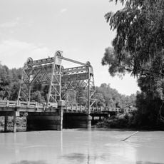
The St. Francis River is a river system in southeastern Missouri and northeastern Arkansas, flowing from the mountainous Ozark region toward the Mississippi. The waterway is managed by dams and water control structures that regulate its flow as it travels southward.

The waterway carried different names in earlier times, including references to it as Cholohollay and other indigenous designations. Settlement came later when both European colonists and Cherokee peoples used the river as a migration and settlement route.

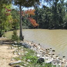
The river shaped local identity and settlement patterns as communities developed along its banks for drinking water and transport. People still recognize the waterway as a defining feature of the region's geography and daily life.

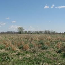
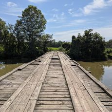
The river is accessible from multiple locations along its route through both states. Visitors should know that water conditions and flow vary considerably between seasons and upstream areas versus the lower reaches.

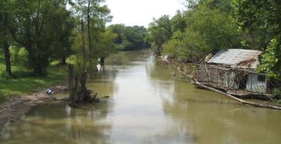
The river dramatically changes character as it travels south, starting as a clear mountain stream in the Ozarks and becoming a slow, silt-laden waterway in the Mississippi embayment. This transformation shows how a single river connects very different landscapes and geological zones.

The community of curious travelers

AroundUs brings together thousands of curated places, local tips, and hidden gems, enriched daily by 60,000 contributors worldwide.

Start exploring
GPS coordinates
36.11435,-90.29337
Latest update
December 7, 2025 20:44
Around this place
Big Lake National Wildlife Refuge
United States of America

Big Lake National Wildlife Refuge

27.2 km
Pfeiffer House and Carriage House
United States of America

Pfeiffer House and Carriage House

31.2 km
Eaker Site
United States of America

Eaker Site

36.4 km
Crowley's Ridge State Park
United States of America

Crowley's Ridge State Park

34.3 km
Paragould meteorite
United States of America

Paragould meteorite

24.4 km
Lake Frierson State Park
United States of America

Lake Frierson State Park

41.2 km
George Ray's Dragstrip
United States of America

George Ray's Dragstrip

14.7 km
United States Highway 61 Arch
United States of America

United States Highway 61 Arch

37.8 km
Herman Davis State Park
United States of America

Herman Davis State Park

29.2 km
St. Francis River Bridge
United States of America

St. Francis River Bridge

35 km
Greene County Courthouse
United States of America

Greene County Courthouse

18.6 km
National Bank of Commerce Building (Paragould, Arkansas)
United States of America

National Bank of Commerce Building (Paragould, Arkansas)

18.6 km
Mississippi County Courthouse
United States of America

Mississippi County Courthouse

40.7 km
Craighead County Road 513C Bridge
United States of America

Craighead County Road 513C Bridge

24.6 km
Paragould War Memorial
United States of America

Paragould War Memorial

18.7 km
Linwood Mausoleum
United States of America

Linwood Mausoleum

20.1 km
Jackson-Herget House
United States of America

Jackson-Herget House

18.9 km
Crowley's Ridge State Park-Comfort Station
United States of America

Crowley's Ridge State Park-Comfort Station

33.9 km
Crowley's Ridge State Park-Bathhouse
United States of America

Crowley's Ridge State Park-Bathhouse

34.2 km
Beisel-Mitchell House
United States of America

Beisel-Mitchell House

18.9 km
Highfill-McClure House
United States of America

Highfill-McClure House

19.1 km
Crowley's Ridge State Park-Dining Hall
United States of America

Crowley's Ridge State Park-Dining Hall

34.1 km
Crowley's Ridge State Park-Bridge
United States of America

Crowley's Ridge State Park-Bridge

34.1 km
West Main Street Residential Historic District
United States of America

West Main Street Residential Historic District

40 km
Knob School
United States of America

Knob School

23.3 km
Piggott National Guard Armory
United States of America

Piggott National Guard Armory

31.6 km
First National Bank Building
United States of America

First National Bank Building

25.2 km
Piggott Commercial Historic District
United States of America

Piggott Commercial Historic District

31.3 km
Show the full map
Reviews
Share your experience

No review yet

Discussions
Start a discussion...

No discussion yet

« St. Francis River - River system in southeastern Missouri and northeastern Arkansas, United States » is provided by Around Us (aroundus.com). Images and texts are derived from Wikimedia project under a Creative Commons license. You are allowed to copy, distribute, and modify copies of this page, under the conditions set by the license, as long as this note is clearly visible.

Discover hidden gems everywhere you go!

From secret cafés to breathtaking viewpoints, skip the crowded tourist spots and find places that match your style. Our app makes it easy with voice search, smart filtering, route optimization, and insider tips from travelers worldwide. Download now for the complete mobile experience.

Around Us App Screenshot

A unique approach to discovering new places

Le Figaro

All the places worth exploring

France Info

A tailor-made excursion in just a few clicks

20 Minutes

Around Us
Travel Guide & Maps
Download

Send to your phone

QR Code
1

Open the camera app on your mobile.

2

Point at the QR code with your camera. A notification will appear.

3

Tap the notification to open the link.