Chest opened
+${chestReward.xp} XP
Explorer
NOUVEAU ×${chestReward.collectible.quantity}
tapez pour fermer
Chest locked

Open chests in the app

Around Us is built for your phone — chests unlock when you walk, explore and capture nearby places.

Enable Location

We need your location to show you interesting places around you

Discover nearby places

Find interesting locations and hidden gems around you

Precise directions

Get accurate directions and distances to places

Your location is never shared with other users. It's only used when you tap the location button.

Neponset River

Log in to your account

Start exploring — it's free

Trusted by 72,886 travelers worldwide

Continue with Google
Continue with Apple
or

We will send you a code to connect

By continuing, you accept our Terms and Conditions and our Privacy Policy

Check your inbox

We've sent a pincode in your inbox. Please enter the code below.

Neponset River
Discussion Reviews 1 Photos
12.8k Popularity

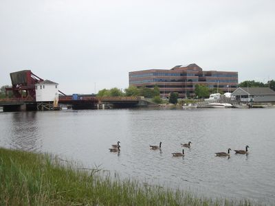
Neponset River, River from Foxborough to Dorchester Bay, United States.

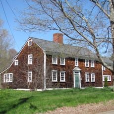
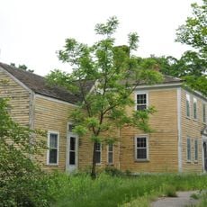
The Neponset River is a waterway in eastern Massachusetts that flows from inland towns toward the coast where it meets a bay. The river passes through forests and neighborhoods, serving as both a natural corridor and a gathering place for communities along its path.

The river served as a trade route for Native Americans long before European arrival in the early 1600s. Early contact between Indigenous traders and colonial settlers along the waterway shaped the region's development.

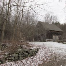
The river held deep significance for the Indigenous peoples who lived along its banks for thousands of years. Today, visitors walking near the water can sense the layers of history that connect past communities to this waterway.

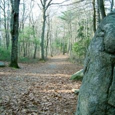
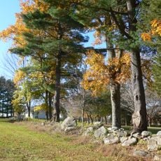
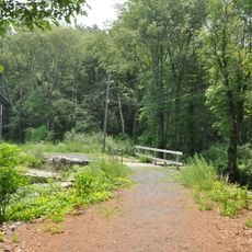
The river can be accessed at multiple points along its length for walking, paddling, and exploring the banks. Spring through fall offers the most comfortable conditions for spending time along the water and enjoying its landscape.

A polluted section of the river was placed on a national environmental cleanup list, spurring restoration projects in the area. This has transformed the location into a space where nature and community efforts are working to heal the waterway.

The community of curious travelers

AroundUs brings together thousands of curated places, local tips, and hidden gems, enriched daily by 60,000 contributors worldwide.

Start exploring
Location
GPS coordinates
42.08538,-71.25616
Latest update
December 7, 2025 20:43
Around this place
Gillette Stadium
United States of America

Gillette Stadium

917 m
United States of America

Foxboro Stadium

1.2 km
Wrentham State School
United States of America

Wrentham State School

5.2 km
Moose Hill Wildlife Sanctuary
United States of America

Moose Hill Wildlife Sanctuary

5.7 km
F. Gilbert Hills State Forest
United States of America

F. Gilbert Hills State Forest

3.8 km
Foxborough State Hospital
United States of America

Foxborough State Hospital

834 m
Moose Hill Farm
United States of America

Moose Hill Farm

6 km
Warner Trail
United States of America

Warner Trail

6.1 km
Memorial Hall
United States of America

Memorial Hall

2.4 km
Walpole Town Hall
United States of America

Walpole Town Hall

6.7 km
Warelands
United States of America

Warelands

7.1 km
Foxboro Grange Hall
United States of America

Foxboro Grange Hall

2.3 km
Norfolk Grange Hall
United States of America

Norfolk Grange Hall

7.5 km
Sharon Historic District
United States of America

Sharon Historic District

7.7 km
Amos Morse House
United States of America

Amos Morse House

188 m
Original Congregational Church of Wrentham
United States of America

Original Congregational Church of Wrentham

6.2 km
Stoughtonham Furnace Site
United States of America

Stoughtonham Furnace Site

3.6 km
Foxborough Pumping Station
United States of America

Foxborough Pumping Station

1.7 km
Seth Boyden House
United States of America

Seth Boyden House

3.4 km
Charles R. Wilber School
United States of America

Charles R. Wilber School

7.4 km
Ezra Carpenter House
United States of America

Ezra Carpenter House

3.7 km
Sullivan's Corner Historic District
United States of America

Sullivan's Corner Historic District

6 km
Otis Cary House
United States of America

Otis Cary House

4.5 km
Capt. Josiah Pratt House
United States of America

Capt. Josiah Pratt House

5.2 km
Rockwood Road Historic District
United States of America

Rockwood Road Historic District

7.1 km
Soldiers' Memorial Library
United States of America

Soldiers' Memorial Library

7.6 km
Deacon Willard Lewis House
United States of America

Deacon Willard Lewis House

6.6 km
Plimpton-Winter House
United States of America

Plimpton-Winter House

6.6 km
Show the full map
Reviews
Share your experience

No review yet

Discussions
Start a discussion...

No discussion yet

« Neponset River - River from Foxborough to Dorchester Bay, United States » is provided by Around Us (aroundus.com). Images and texts are derived from Wikimedia project under a Creative Commons license. You are allowed to copy, distribute, and modify copies of this page, under the conditions set by the license, as long as this note is clearly visible.

Discover hidden gems everywhere you go!

From secret cafés to breathtaking viewpoints, skip the crowded tourist spots and find places that match your style. Our app makes it easy with voice search, smart filtering, route optimization, and insider tips from travelers worldwide. Download now for the complete mobile experience.

Around Us App Screenshot

A unique approach to discovering new places

Le Figaro

All the places worth exploring

France Info

A tailor-made excursion in just a few clicks

20 Minutes

Around Us
Travel Guide & Maps
Download

Send to your phone

QR Code
1

Open the camera app on your mobile.

2

Point at the QR code with your camera. A notification will appear.

3

Tap the notification to open the link.