Enable Location

We need your location to show you interesting places around you

Discover nearby places

Find interesting locations and hidden gems around you

Precise directions

Get accurate directions and distances to places

Your location is never shared with other users. It's only used when you tap the location button.

Leech Lake Indian Reservation

Log in to your account

Start exploring — it's free

Trusted by 62,960 travelers worldwide

Continue with Google
Continue with Apple
or

We will send you a code to connect

By continuing, you accept our Terms and Conditions and our Privacy Policy

Check your inbox

We've sent a pincode in your inbox. Please enter the code below.

Discussion Reviews 1 Photos
15.5k Popularity

Leech Lake Indian Reservation, Indigenous reservation in north-central Minnesota, United States.

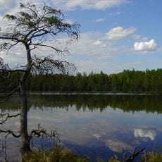
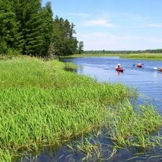
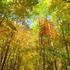
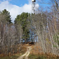
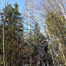
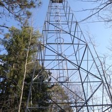
The Leech Lake Reservation spans lakes, forests, and waterways across north-central Minnesota and includes multiple connected areas. The land features natural water bodies, woodland regions, and diverse ecosystems that support hunting, fishing, and traditional resource use.

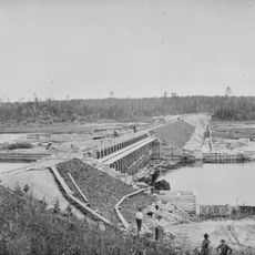
The reservation originated from the 1855 Treaty of Washington, which assigned land in this region to tribal groups. Over time, the community lost territory through various land transfers, shaping the relationship between the tribal nation and government.

The Anishinaabe community maintains traditions here through language education, powwow celebrations, and wild rice harvesting that shape daily life and community identity.

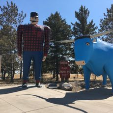
The area is accessible through multiple highways with information centers where visitors can learn about local culture. Fishing and hunting are popular activities but require following local guidelines and obtaining proper permits.

In 2020, Congress approved returning roughly 11,760 acres of forest to the reservation, correcting a historical injustice from earlier land transfers. This restoration represents a significant recovery of ancestral territory for the community.

The community of curious travelers

AroundUs brings together thousands of curated places, local tips, and hidden gems, enriched daily by 60,000 contributors worldwide.

Start exploring
Location
GPS coordinates
47.35530,-94.25690
Latest update
December 7, 2025 19:30
Around this place
Paul Bunyan and Babe the Blue Ox
United States of America

Paul Bunyan and Babe the Blue Ox

48.6 km
Lake Winnibigoshish
United States of America

Lake Winnibigoshish

12 km
Lake Bemidji State Park
United States of America

Lake Bemidji State Park

47.1 km
Waldsee
United States of America

Waldsee

42.8 km
Minnesota State Sanatorium for Consumptives
United States of America

Minnesota State Sanatorium for Consumptives

39.6 km
United States of America

The Big Fish

840 m
Rabideau CCC Camp
United States of America

Rabideau CCC Camp

38.5 km
Forest History Center
United States of America

Forest History Center

54 km
Schoolcraft State Park
United States of America

Schoolcraft State Park

37.5 km
Bowstring State Forest
United States of America

Bowstring State Forest

14.2 km
Bemidji Carnegie Library
United States of America

Bemidji Carnegie Library

48.6 km
Beltrami County Courthouse
United States of America

Beltrami County Courthouse

48.9 km
Nymore Bridge
United States of America

Nymore Bridge

48.4 km
Marcell Ranger Station
United States of America

Marcell Ranger Station

50.6 km
David Park House
United States of America

David Park House

48.7 km
Thunder Alley XL
United States of America

Thunder Alley XL

58.2 km
Remer State Forest
United States of America

Remer State Forest

40.6 km
Lake Bemidji State Park CCC/NYA/Rustic Style Historic Resources
United States of America

Lake Bemidji State Park CCC/NYA/Rustic Style Historic Resources

47.3 km
Sandtrap Golf Course
United States of America

Sandtrap Golf Course

27.9 km
Draper Lookout Tower
United States of America

Draper Lookout Tower

54 km
Cuba Hill Lookout Tower
United States of America

Cuba Hill Lookout Tower

17.6 km
Rabideau Civilian Conservation Corps Camp Picnic Shelter
United States of America

Rabideau Civilian Conservation Corps Camp Picnic Shelter

38.7 km
Farley Hill Lookout Tower
United States of America

Farley Hill Lookout Tower

26 km
Blackduck Lookout Tower
United States of America

Blackduck Lookout Tower

43.1 km
Kabekona Lookout Tower
United States of America

Kabekona Lookout Tower

49.4 km
Coleraine Fire Lookout Tower
United States of America

Coleraine Fire Lookout Tower

61.6 km
Pinewood Fire Tower
United States of America

Pinewood Fire Tower

52.3 km
Ruby Lake Camp
United States of America

Ruby Lake Camp

56.4 km
Show the full map
Reviews
Share your experience

No review yet

Discussions
Start a discussion...

No discussion yet

« Leech Lake Indian Reservation - Indigenous reservation in north-central Minnesota, United States » is provided by Around Us (aroundus.com). Images and texts are derived from Wikimedia project under a Creative Commons license. You are allowed to copy, distribute, and modify copies of this page, under the conditions set by the license, as long as this note is clearly visible.

Discover hidden gems everywhere you go!

From secret cafés to breathtaking viewpoints, skip the crowded tourist spots and find places that match your style. Our app makes it easy with voice search, smart filtering, route optimization, and insider tips from travelers worldwide. Download now for the complete mobile experience.

Around Us App Screenshot

A unique approach to discovering new places

Le Figaro

All the places worth exploring

France Info

A tailor-made excursion in just a few clicks

20 Minutes

Around Us
Travel Guide & Maps
Download

Send to your phone

QR Code
1

Open the camera app on your mobile.

2

Point at the QR code with your camera. A notification will appear.

3

Tap the notification to open the link.