Chest opened
+${chestReward.xp} XP
Explorer
NOUVEAU ×${chestReward.collectible.quantity}
tapez pour fermer
Chest locked

Open chests in the app

Around Us is built for your phone — chests unlock when you walk, explore and capture nearby places.

Enable Location

We need your location to show you interesting places around you

Discover nearby places

Find interesting locations and hidden gems around you

Precise directions

Get accurate directions and distances to places

Your location is never shared with other users. It's only used when you tap the location button.

Minerva

Log in to your account

Start exploring — it's free

Trusted by 72,887 travelers worldwide

Continue with Google
Continue with Apple
or

We will send you a code to connect

By continuing, you accept our Terms and Conditions and our Privacy Policy

Check your inbox

We've sent a pincode in your inbox. Please enter the code below.

Discussion Reviews 1 Photos
14.7k Popularity

Minerva, Administrative district in Ohio, United States

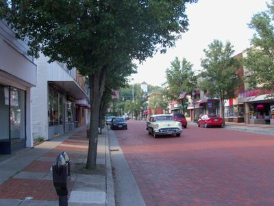
Minerva is an administrative district in northeastern Ohio that spans parts of Stark and Carroll Counties. The community includes residential areas and commercial zones organized around State Route 183.

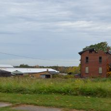
Settlement began in 1832 when pioneers established a community near the intersection of present-day Market Street and Line Street. These early beginnings shaped the foundation for today's administrative center.

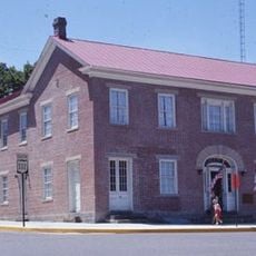
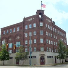
The community maintains regular town hall meetings in the municipal building, where residents participate in local governance and community planning discussions.

The area is easily accessible via State Route 183 and provides good connectivity for visitors. Municipal buildings and public services are centrally located and available during standard business hours.

Minerva operates through a council-manager government system, with six council members representing different geographic wards within the municipality.

The community of curious travelers

AroundUs brings together thousands of curated places, local tips, and hidden gems, enriched daily by 60,000 contributors worldwide.

Start exploring
GPS coordinates
40.72978,-81.10538
Latest update
December 7, 2025 20:20
Around this place
Clearview Golf Club
United States of America

Clearview Golf Club

12.9 km
Kendal, Ohio
United States of America

Kendal, Ohio

6.4 km
Carroll County Courthouse
United States of America

Carroll County Courthouse

17.6 km
Louisville Public Library
United States of America

Louisville Public Library

17.6 km
St. Louis Church
United States of America

St. Louis Church

17.8 km
Daniel McCook House
United States of America

Daniel McCook House

17.6 km
Old McKinley High School
United States of America

Old McKinley High School

24 km
Seven Ranges Terminus
United States of America

Seven Ranges Terminus

19.9 km
St. Mary of the Immaculate Conception Church
United States of America

St. Mary of the Immaculate Conception Church

15.7 km
Haines House
United States of America

Haines House

21.3 km
First Church of the Resurrection
United States of America

First Church of the Resurrection

23.6 km
Hanoverton Canal Town District
United States of America

Hanoverton Canal Town District

14.6 km
Alliance Bank Building
United States of America

Alliance Bank Building

21.4 km
John Herrington House and Herrington Bethel Church
United States of America

John Herrington House and Herrington Bethel Church

11.9 km
Middle Sandy Presbyterian Church
United States of America

Middle Sandy Presbyterian Church

12.4 km
Upper Downtown Canton Historic District
United States of America

Upper Downtown Canton Historic District

24 km
Alliance Clay Product Company
United States of America

Alliance Clay Product Company

19.4 km
Eagles Building-Strand Theater
United States of America

Eagles Building-Strand Theater

21.4 km
Eagles Temple
United States of America

Eagles Temple

23.9 km
First Methodist Episcopal Church
United States of America

First Methodist Episcopal Church

21.1 km
Patrick Hull House
United States of America

Patrick Hull House

5 km
Funtimes Fun Park
United States of America

Funtimes Fun Park

20.1 km
Canton Classic Car Museum
United States of America

Canton Classic Car Museum

24 km
Mohawk Theater
United States of America

Mohawk Theater

14.7 km
Haines House Underground Railroad Museum
United States of America

Haines House Underground Railroad Museum

21.3 km
Elson-Magnolia Flour Mill
United States of America

Elson-Magnolia Flour Mill

18.5 km
First Reformed and First Lutheran Churches
United States of America

First Reformed and First Lutheran Churches

23.3 km
Birthplace of Catholicism in Northern Ohio
United States of America

Birthplace of Catholicism in Northern Ohio

18.7 km
Show the full map
Reviews
Share your experience

No review yet

Discussions
Start a discussion...

No discussion yet

« Minerva - Administrative district in Ohio, United States » is provided by Around Us (aroundus.com). Images and texts are derived from Wikimedia project under a Creative Commons license. You are allowed to copy, distribute, and modify copies of this page, under the conditions set by the license, as long as this note is clearly visible.

Discover hidden gems everywhere you go!

From secret cafés to breathtaking viewpoints, skip the crowded tourist spots and find places that match your style. Our app makes it easy with voice search, smart filtering, route optimization, and insider tips from travelers worldwide. Download now for the complete mobile experience.

Around Us App Screenshot

A unique approach to discovering new places

Le Figaro

All the places worth exploring

France Info

A tailor-made excursion in just a few clicks

20 Minutes

Around Us
Travel Guide & Maps
Download

Send to your phone

QR Code
1

Open the camera app on your mobile.

2

Point at the QR code with your camera. A notification will appear.

3

Tap the notification to open the link.