Kendal, Ohio

Log in to your account

AroundUs is a community-driven map of interesting places, built by curious explorers like you. It grows with every review, story, and photo you share.
Connect to save your favorite spots, contribute locations, and create personalized routes.
Continue with Google
Continue with Apple
Continue with X
Continue with Facebook
Continue with email
By continuing, you accept our Terms and Conditions and our Privacy Policy
Create an account
Add to collection
Map
Suggest a change
Share

Kendal, Ohio, Historical settlement in Stark County, Ohio

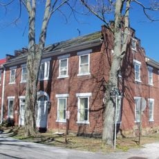
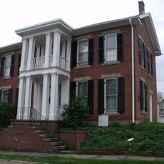
Kendal is a settlement in Stark County, Ohio that developed along Sippo Creek near the Tuscarawas River. The area contains residential neighborhoods and historical structures dating from the 1800s.

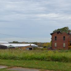
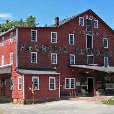
Thomas Rotch founded the settlement in 1812 and brought 400 merino sheep from Connecticut to establish a manufacturing center with a woolen factory. The community was later incorporated into Massillon in 1853.

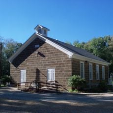
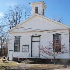
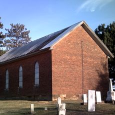
Quaker settlers shaped the community by building a Meeting House and founding institutions centered on shared values and collective responsibility. These principles were reflected in how residents organized their daily lives and supported one another.

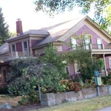
The area is now primarily a residential neighborhood within Massillon with accessible streets and local parks including Memorial Park. Visitors can explore the historical sites on foot by walking through the surrounding neighborhoods.

In 1826 an Owenite group purchased land and lots to establish a communal living experiment in the area. This project showed how the settlement attracted progressive social movements of the 1800s.

Location: Stark County

GPS coordinates: 40.67440,-81.08460

Latest update: December 14, 2025 11:00

Photos
Around this place
Atwood Lake
United States of America

Atwood Lake

23.6 km
Clearview Golf Club
United States of America

Clearview Golf Club

17.5 km
Leesville Lake
United States of America

Leesville Lake

24.8 km
Carroll County Courthouse
United States of America

Carroll County Courthouse

11.4 km
Louisville Public Library
United States of America

Louisville Public Library

23.4 km
St. Louis Church
United States of America

St. Louis Church

23.5 km
Daniel McCook House
United States of America

Daniel McCook House

11.4 km
Seven Ranges Terminus
United States of America

Seven Ranges Terminus

19.9 km
Teegarden-Centennial Covered Bridge
United States of America

Teegarden-Centennial Covered Bridge

27.2 km
Haines House
United States of America

Haines House

27.5 km
St. Mary of the Immaculate Conception Church
United States of America

St. Mary of the Immaculate Conception Church

14.1 km
First Church of the Resurrection
United States of America

First Church of the Resurrection

27.7 km
Hanoverton Canal Town District
United States of America

Hanoverton Canal Town District

15.3 km
Alliance Bank Building
United States of America

Alliance Bank Building

27.6 km
John Herrington House and Herrington Bethel Church
United States of America

John Herrington House and Herrington Bethel Church

6.7 km
Middle Sandy Presbyterian Church
United States of America

Middle Sandy Presbyterian Church

18.2 km
Kilgore Union Presbyterian Church
United States of America

Kilgore Union Presbyterian Church

24.9 km
Alliance Clay Product Company
United States of America

Alliance Clay Product Company

25.5 km
Eagles Building-Strand Theater
United States of America

Eagles Building-Strand Theater

27.6 km
First Methodist Episcopal Church
United States of America

First Methodist Episcopal Church

27.3 km
Patrick Hull House
United States of America

Patrick Hull House

6.4 km
Mohawk Theater
United States of America

Mohawk Theater

14.7 km
Haines House Underground Railroad Museum
United States of America

Haines House Underground Railroad Museum

27.5 km
Elson-Magnolia Flour Mill
United States of America

Elson-Magnolia Flour Mill

18.3 km
First Reformed and First Lutheran Churches
United States of America

First Reformed and First Lutheran Churches

27.5 km
Birthplace of Catholicism in Northern Ohio
United States of America

Birthplace of Catholicism in Northern Ohio

18.2 km
Clearview Golf Club, 1946
United States of America

Clearview Golf Club, 1946

17.6 km
Teegarden-Centennial Covered Bridge
United States of America

Teegarden-Centennial Covered Bridge

27.2 km
Show the full map
Reviews

Visited this place? Tap the stars to rate it and share your experience / photos with the community! Try now! You can cancel it anytime.

« Kendal, Ohio - Historical settlement in Stark County, Ohio » is provided by Around Us (aroundus.com). Images and texts are derived from Wikimedia project under a Creative Commons license. You are allowed to copy, distribute, and modify copies of this page, under the conditions set by the license, as long as this note is clearly visible.

Discover hidden gems everywhere you go!

From secret cafés to breathtaking viewpoints, skip the crowded tourist spots and find places that match your style. Our app makes it easy with voice search, smart filtering, route optimization, and insider tips from travelers worldwide. Download now for the complete mobile experience.

Around Us App Screenshot

A unique approach to discovering new places

Le Figaro

All the places worth exploring

France Info

A tailor-made excursion in just a few clicks

20 Minutes