Corozal

Log in to your account

AroundUs is a community-driven map of interesting places, built by curious explorers like you. It grows with every review, story, and photo you share.
Connect to save your favorite spots, contribute locations, and create personalized routes.
By continuing, you accept our Terms and Conditions and our Privacy Policy
Add to collection
Map
Suggest a change
Share

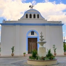
Corozal, Administrative district in central-eastern Puerto Rico.

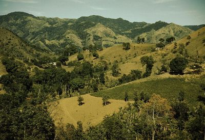
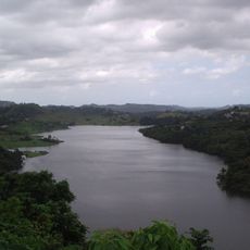
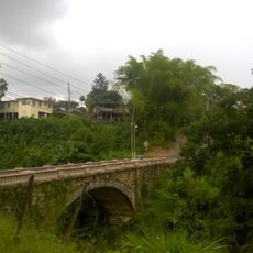
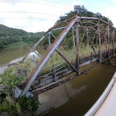
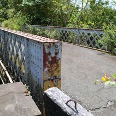
Corozal is an administrative division in the mountainous central-eastern region of Puerto Rico with two rivers flowing through its terrain. The municipality encompasses twelve administrative districts and a central pueblo, organized across hilly landscapes.

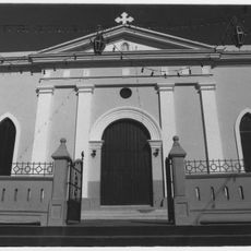
The municipality was founded in 1795 by Francisco de Neve and achieved official municipal status in 1804. Administrative changes followed in 1898 when the region came under different governance.

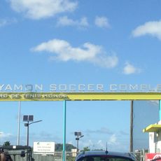
The town has built a strong reputation around volleyball, with its teams becoming symbols of local pride over many decades. This sporting tradition shapes how residents and visitors alike perceive the community.

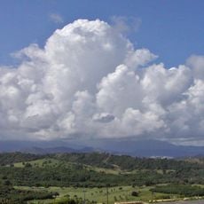
The area experiences tropical weather with heavy rainfall between May and December throughout the year. Visitors should prepare for humid conditions and bring waterproof gear when exploring the region.

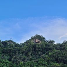
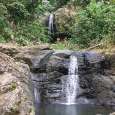
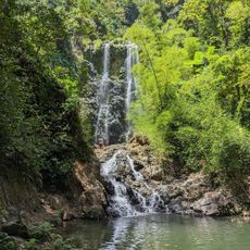
The area contains the Monte Choca Natural Reserve and several landmarks including the Tres Cruces monuments. A large mural depicting local heritage adds an artistic dimension to the community's identity.

GPS coordinates: 18.34063,-66.31723

Latest update: December 7, 2025 20:22

Photos
Around this place
Show the full map
El Yunque National Forest
United States of America

El Yunque National Forest

56.5 km
Puerto Rico National Cemetery
United States of America

Puerto Rico National Cemetery

17.8 km
Mar Bella Beach
United States of America

Mar Bella Beach

18.9 km
La Plata Lake
United States of America

La Plata Lake

9.1 km
Nuestra Señora de la Candelaria y San Matías Church
United States of America

Nuestra Señora de la Candelaria y San Matías Church

21 km
Bayamón Soccer Complex
United States of America

Bayamón Soccer Complex

16.2 km
Mavilla Bridge
United States of America

Mavilla Bridge

2.5 km
Los Tres Picachos State Forest
United States of America

Los Tres Picachos State Forest

27 km
Old Plata Bridge
United States of America

Old Plata Bridge

11.8 km
Inmaculada Concepción Church
United States of America

Inmaculada Concepción Church

8.3 km
Museo de Vida Silvestre
United States of America

Museo de Vida Silvestre

22.4 km
Manatí Bridge at Mata de Plátano
United States of America

Manatí Bridge at Mata de Plátano

17.3 km
Vega State Forest
United States of America

Vega State Forest

9.1 km
Museum of Transportation of Puerto Rico
United States of America

Museum of Transportation of Puerto Rico

21.4 km
Cerro El Bolo
United States of America

Cerro El Bolo

27 km
Dr. Agustín Stahl Stamm House
United States of America

Dr. Agustín Stahl Stamm House

18.3 km
Bayamón City Hall
United States of America

Bayamón City Hall

18.2 km
Puente de las Calabazas
United States of America

Puente de las Calabazas

28.1 km
Casa Alonso
United States of America

Casa Alonso

13.6 km
José Celso Barbosa House Museum
United States of America

José Celso Barbosa House Museum

18.4 km
Casa Natal de Luis Muñoz Rivera
United States of America

Casa Natal de Luis Muñoz Rivera

16.9 km
Río Hondo Bridge
United States of America

Río Hondo Bridge

16.6 km
Las Delicias Waterfall
Puerto Rico

Las Delicias Waterfall

26.5 km
Al-Faruq Mosque
United States of America

Al-Faruq Mosque

10.8 km
Cascada Charco Prieto
Puerto Rico

Cascada Charco Prieto

15.4 km
Jesús Izcoa Moure Bridge
United States of America

Jesús Izcoa Moure Bridge

11.6 km
Carretera Central historic district
United States of America

Carretera Central historic district

24.2 km
Place des Halles
United States of America

Place des Halles

14.2 km
Show the full map
Reviews

Visited this place? Tap the stars to rate it and share your experience / photos with the community! Try now! You can cancel it anytime.

« Corozal - Administrative district in central-eastern Puerto Rico » is provided by Around Us (aroundus.com). Images and texts are derived from Wikimedia project under a Creative Commons license. You are allowed to copy, distribute, and modify copies of this page, under the conditions set by the license, as long as this note is clearly visible.

Discover hidden gems everywhere you go!

From secret cafés to breathtaking viewpoints, skip the crowded tourist spots and find places that match your style. Our app makes it easy with voice search, smart filtering, route optimization, and insider tips from travelers worldwide. Download now for the complete mobile experience.

Around Us App Screenshot

A unique approach to discovering new places

Le Figaro

All the places worth exploring

France Info

A tailor-made excursion in just a few clicks

20 Minutes