Booneville

Log in to your account

AroundUs is a community-driven map of interesting places, built by curious explorers like you. It grows with every review, story, and photo you share.
Connect to save your favorite spots, contribute locations, and create personalized routes.
By continuing, you accept our Terms and Conditions and our Privacy Policy
Add to collection
Map
Suggest a change
Share

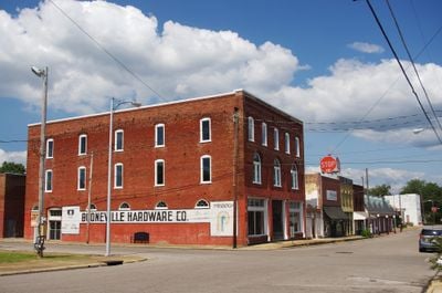
Booneville, Administrative center in Prentiss County, Mississippi, US
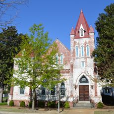
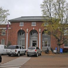
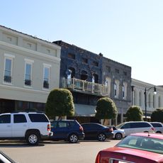
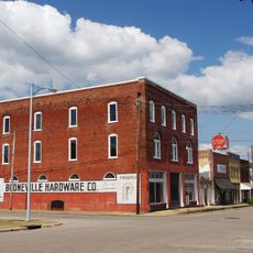
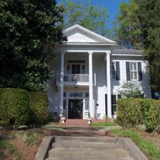
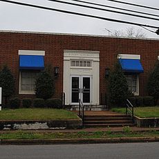
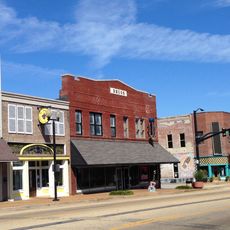
The municipality spans across 25.81 square miles of land in northern Mississippi, positioned 30 miles north of Tupelo and 100 miles southeast of Memphis.

The settlement, established in 1858 and incorporated in 1861, received its name from Colonel Reuben Holman Boone, a relative of pioneer Daniel Boone.

Northeast Mississippi Community College enrolls 6,000 students annually, making Booneville an educational center for multiple surrounding counties in the region.

The administrative offices at City Hall, located at 203 North Main Street, provide services to residents and handle municipal operations for 8,625 citizens.

The Booneville Armory incident of December 22, 1950, marked the first domestic casualties of the Korean War when seven National Guard members perished.

Location: Prentiss County

Elevation above the sea: 158 m

Website: http://booneville-ms.gov

GPS coordinates: 34.66110,-88.56140

Latest update: May 27, 2025 13:13

Around this place
Show the full map
Elvis Presley Birthplace
United States of America

Elvis Presley Birthplace

46 km
Woodall Mountain
United States of America

Woodall Mountain

32.5 km
Natchez Trace Trail
United States of America

Natchez Trace Trail

43.3 km
Tishomingo State Park
United States of America

Tishomingo State Park

34.6 km
Tupelo Automobile Museum
United States of America

Tupelo Automobile Museum

46.5 km
Pharr Mounds
United States of America

Pharr Mounds

25.4 km
Bay Springs Lake
United States of America

Bay Springs Lake

24.6 km
Big Hill Pond State Park
United States of America

Big Hill Pond State Park

45.9 km
Siege and Battle of Corinth Sites
United States of America

Siege and Battle of Corinth Sites

32.8 km
Tombigbee State Park
United States of America

Tombigbee State Park

47.7 km
Jamie Whitten Lock and Dam
United States of America

Jamie Whitten Lock and Dam

26.7 km
Fairpark
United States of America

Fairpark

46.8 km
Veranda House
United States of America

Veranda House

30.9 km
Fulton Lock
United States of America

Fulton Lock

46.6 km
Midtown Corinth Historic District
United States of America

Midtown Corinth Historic District

30.9 km
G. V. Montgomery Lock
United States of America

G. V. Montgomery Lock

28.5 km
Ripley Historic District
United States of America

Ripley Historic District

35 km
Pocahontas School
United States of America

Pocahontas School

48.4 km
Church of Our Saviour
United States of America

Church of Our Saviour

37.9 km
North Broadway Historic District
United States of America

North Broadway Historic District

46.5 km
First Methodist Church
United States of America

First Methodist Church

46.9 km
Downtown Corinth Historic District
United States of America

Downtown Corinth Historic District

30.6 km
Downtown Booneville Historic District
United States of America

Downtown Booneville Historic District

612 m
Stewart-Anderson House
United States of America

Stewart-Anderson House

46.4 km
Old U.S. Post Office
United States of America

Old U.S. Post Office

36.4 km
Shiloh Chennault Bed and Breakfast - Plantation - West Tennessee - Boutique Hotel
United States of America

Shiloh Chennault Bed and Breakfast - Plantation - West Tennessee - Boutique Hotel

45.7 km
Downtown Tupelo Historic District
United States of America

Downtown Tupelo Historic District

46.9 km
Tishomingo State Park Historic District
United States of America

Tishomingo State Park Historic District

35.3 km
Show the full map

Reviews

Visited this place? Tap the stars to rate it and share your experience / photos with the community! Try now! You can cancel it anytime.

« Booneville: Administrative center in Prentiss County, Mississippi, US » is provided by Around Us (aroundus.com). Images and texts are derived from Wikimedia project under a Creative Commons license. You are allowed to copy, distribute, and modify copies of this page, under the conditions set by the license, as long as this note is clearly visible.

Discover hidden gems everywhere you go!

From secret cafés to breathtaking viewpoints, skip the crowded tourist spots and find places that match your style. Our app makes it easy with voice search, smart filtering, route optimization, and insider tips from travelers worldwide. Download now for the complete mobile experience.

Around Us App Screenshot

A unique approach to discovering new places

Le Figaro

All the places worth exploring

France Info

A tailor-made excursion in just a few clicks

20 Minutes