Chest opened
+${chestReward.xp} XP
Explorer
NOUVEAU ×${chestReward.collectible.quantity}
tapez pour fermer
Chest locked

Open chests in the app

Around Us is built for your phone — chests unlock when you walk, explore and capture nearby places.

Enable Location

We need your location to show you interesting places around you

Discover nearby places

Find interesting locations and hidden gems around you

Precise directions

Get accurate directions and distances to places

Your location is never shared with other users. It's only used when you tap the location button.

Lisbon Falls

Log in to your account

Start exploring — it's free

Trusted by 72,888 travelers worldwide

Continue with Google
Continue with Apple
or

We will send you a code to connect

By continuing, you accept our Terms and Conditions and our Privacy Policy

Check your inbox

We've sent a pincode in your inbox. Please enter the code below.

Discussion Reviews 1 Photos
12.7k Popularity

Lisbon Falls, Census-designated place in Androscoggin County, Maine

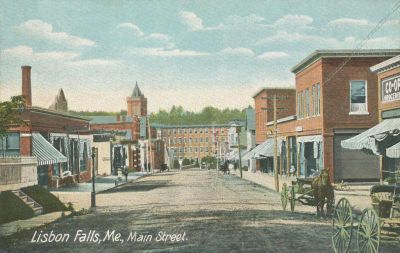
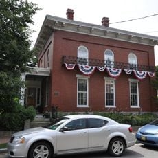
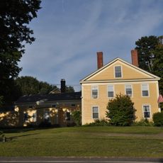
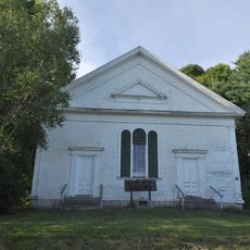
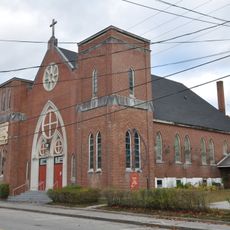
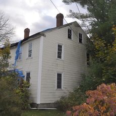
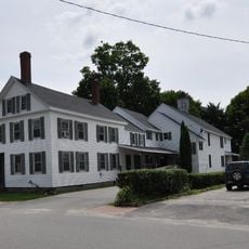
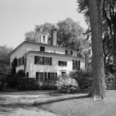
Lisbon Falls is a census-designated place in Androscoggin County, Maine, situated along the Androscoggin River with residential neighborhoods and a downtown core. The community includes local businesses, schools, and the typical buildings and infrastructure found in a rural New England town.

The settlement began as Little River Plantation and was renamed Thompsonborough in 1799, then received its current name in 1802 with a reference to Lisbon, Portugal. This naming change reflected how communities adopted new identities during America's early growth.

The annual Moxie Festival draws visitors to celebrate a soft drink invented locally, which has become woven into how residents see themselves and their community. This deep connection to a regional beverage sets the town apart from other places and shapes how people gather and mark the seasons.

The town sits close to Bath Iron Works, a major local employer, and offers connections to the Lewiston-Auburn metropolitan area for shopping and services. Visitors will find the facilities and infrastructure typical of a rural New England community with convenient regional access.

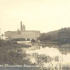
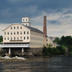
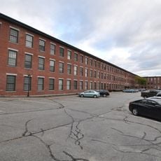
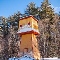
The Worumbo Mill was once a textile factory that operated until 1987 and gained national attention during the Eisenhower era for producing fine vicuña wool garments. This industrial chapter remains part of the town's identity, though the mill no longer operates.

The community of curious travelers

AroundUs brings together thousands of curated places, local tips, and hidden gems, enriched daily by 60,000 contributors worldwide.

Start exploring
Elevation above the sea
34 m
GPS coordinates
44.00220,-70.06000
Latest update
December 7, 2025 20:44
Around this place
Frank J. Wood Bridge
United States of America

Frank J. Wood Bridge

11.8 km
Fort Andross
United States of America

Fort Andross

12.1 km
Shiloh Temple
United States of America

Shiloh Temple

2.6 km
Brunswick Falls
United States of America

Brunswick Falls

11.7 km
Androscoggin Swinging Bridge
United States of America

Androscoggin Swinging Bridge

11.6 km
Bangor Air Defense Sector
United States of America

Bangor Air Defense Sector

10.1 km
Worumbo Mill
United States of America

Worumbo Mill

1.2 km
Curtis Memorial Library
United States of America

Curtis Memorial Library

12.4 km
Fort George
United States of America

Fort George

12.1 km
Pejepscot Paper Company
United States of America

Pejepscot Paper Company

11.8 km
Richardson House
United States of America

Richardson House

12.4 km
Bagley-Bliss House
United States of America

Bagley-Bliss House

7.8 km
St. Paul's Episcopal Church
United States of America

St. Paul's Episcopal Church

12.3 km
Growstown School
United States of America

Growstown School

12.4 km
John Dunlap House
United States of America

John Dunlap House

11.9 km
West Durham Methodist Church
United States of America

West Durham Methodist Church

9.3 km
St. Cyril and St. Methodius Church
United States of America

St. Cyril and St. Methodius Church

355 m
Cushman Tavern
United States of America

Cushman Tavern

6.8 km
Farwell Mill
United States of America

Farwell Mill

4.8 km
Historic district in Maine, United States
United States of America

Historic district in Maine, United States

12.2 km
Union Church
United States of America

Union Church

6 km
Lincoln Street Historic District
United States of America

Lincoln Street Historic District

12.1 km
Topsham Historic District
United States of America

Topsham Historic District

11.5 km
Cathance Water Tower
United States of America

Cathance Water Tower

11.8 km
Topsham Fairgrounds Grandstand
United States of America

Topsham Fairgrounds Grandstand

11.9 km
Clough Meeting House
United States of America

Clough Meeting House

9.8 km
Nathaniel Osgood House
United States of America

Nathaniel Osgood House

8.9 km
Free-Black Bridge
United States of America

Free-Black Bridge

11.7 km
Show the full map
Reviews
Share your experience

No review yet

Discussions
Start a discussion...

No discussion yet

« Lisbon Falls - Census-designated place in Androscoggin County, Maine » is provided by Around Us (aroundus.com). Images and texts are derived from Wikimedia project under a Creative Commons license. You are allowed to copy, distribute, and modify copies of this page, under the conditions set by the license, as long as this note is clearly visible.

Discover hidden gems everywhere you go!

From secret cafés to breathtaking viewpoints, skip the crowded tourist spots and find places that match your style. Our app makes it easy with voice search, smart filtering, route optimization, and insider tips from travelers worldwide. Download now for the complete mobile experience.

Around Us App Screenshot

A unique approach to discovering new places

Le Figaro

All the places worth exploring

France Info

A tailor-made excursion in just a few clicks

20 Minutes

Around Us
Travel Guide & Maps
Download

Send to your phone

QR Code
1

Open the camera app on your mobile.

2

Point at the QR code with your camera. A notification will appear.

3

Tap the notification to open the link.