Vega Baja

Log in to your account

AroundUs is a community-driven map of interesting places, built by curious explorers like you. It grows with every review, story, and photo you share.
Connect to save your favorite spots, contribute locations, and create personalized routes.
By continuing, you accept our Terms and Conditions and our Privacy Policy
Add to collection
Map
Suggest a change
Share

Vega Baja, Coastal municipality in northern Puerto Rico

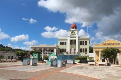
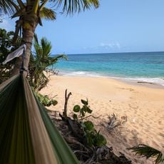
Vega Baja is a municipality along Puerto Rico's northern coast, stretching across plains and limestone terrain with natural formations. The area divides into 14 barrios and combines beaches, forest patches, and neighborhoods throughout its landscape.

Spanish colonial authorities established this municipality on October 7, 1776, originally calling it Vega-baxa del Naranjal de Nuestra Señora del Rosario. The lengthy name referenced the area's orange groves and its religious significance to the settlers.

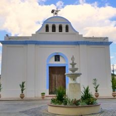
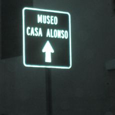
The Casa Alonso Museum displays Puerto Rican music and literature through its collected works and artifacts. You can walk through rooms that show how these creative traditions took root and developed here.

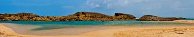
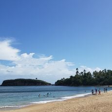
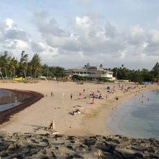
Puerto Nuevo Beach holds Blue Flag certification and provides facilities for people with disabilities, staying open and welcoming year-round. The coastal location makes it straightforward to reach and enjoy at any time.

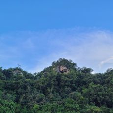
The Cibuco River banks hold Taíno rock carvings showing that indigenous peoples used this area for fishing and daily tasks. These ancient markings stand as reminders that the region was an important hub for indigenous communities long before European arrival.

Location: Puerto Rico

Inception: October 7, 1776

Capital city: Vega Baja

Elevation above the sea: 35 m

Shares border with: Vega Alta, Morovis, Manatí

Website: http://vegabaja.gov.pr

GPS coordinates: 18.44611,-66.38750

Latest update: December 6, 2025 22:05

Around this place
Show the full map
Birth of the New World
United States of America

Birth of the New World

25.7 km
Puerto Rico National Cemetery
United States of America

Puerto Rico National Cemetery

23.6 km
El Cañuelo
United States of America

El Cañuelo

26.6 km
Mar Bella Beach
United States of America

Mar Bella Beach

5.3 km
Cueva del Indio
United States of America

Cueva del Indio

27.3 km
La Plata Lake
United States of America

La Plata Lake

21.2 km
Nuestra Señora de la Candelaria y San Matías Church
United States of America

Nuestra Señora de la Candelaria y San Matías Church

11.2 km
Cambalache State Forest
United States of America

Cambalache State Forest

22.1 km
Bayamón Soccer Complex
United States of America

Bayamón Soccer Complex

25 km
Tres Picachos
United States of America

Tres Picachos

30.5 km
Mavilla Bridge
United States of America

Mavilla Bridge

14.2 km
Los Tres Picachos State Forest
United States of America

Los Tres Picachos State Forest

30.1 km
Old Plata Bridge
United States of America

Old Plata Bridge

24.3 km
Inmaculada Concepción Church
United States of America

Inmaculada Concepción Church

7.1 km
Museo de Vida Silvestre
United States of America

Museo de Vida Silvestre

24.5 km
Manatí Bridge at Mata de Plátano
United States of America

Manatí Bridge at Mata de Plátano

13.6 km
Vega State Forest
United States of America

Vega State Forest

5.1 km
Dr. Agustín Stahl Stamm House
United States of America

Dr. Agustín Stahl Stamm House

25.1 km
Bayamón City Hall
United States of America

Bayamón City Hall

25.1 km
Casa Alonso
United States of America

Casa Alonso

273 m
José Celso Barbosa House Museum
United States of America

José Celso Barbosa House Museum

25.2 km
Rafael Balseiro Maceira School
United States of America

Rafael Balseiro Maceira School

16 km
Casa Natal de Luis Muñoz Rivera
United States of America

Casa Natal de Luis Muñoz Rivera

29.8 km
Las Delicias Waterfall
Puerto Rico

Las Delicias Waterfall

29 km
Al-Faruq Mosque
United States of America

Al-Faruq Mosque

4.8 km
Cascada Charco Prieto
Puerto Rico

Cascada Charco Prieto

28.1 km
Jesús Izcoa Moure Bridge
United States of America

Jesús Izcoa Moure Bridge

23.3 km
Place des Halles
United States of America

Place des Halles

2.6 km
Show the full map

Reviews

Visited this place? Tap the stars to rate it and share your experience / photos with the community! Try now! You can cancel it anytime.

« Vega Baja - Coastal municipality in northern Puerto Rico » is provided by Around Us (aroundus.com). Images and texts are derived from Wikimedia project under a Creative Commons license. You are allowed to copy, distribute, and modify copies of this page, under the conditions set by the license, as long as this note is clearly visible.

Discover hidden gems everywhere you go!

From secret cafés to breathtaking viewpoints, skip the crowded tourist spots and find places that match your style. Our app makes it easy with voice search, smart filtering, route optimization, and insider tips from travelers worldwide. Download now for the complete mobile experience.

Around Us App Screenshot

A unique approach to discovering new places

Le Figaro

All the places worth exploring

France Info

A tailor-made excursion in just a few clicks

20 Minutes