Enable Location

We need your location to show you interesting places around you

Discover nearby places

Find interesting locations and hidden gems around you

Precise directions

Get accurate directions and distances to places

Your location is never shared with other users. It's only used when you tap the location button.

Balneario Cerro Gordo

Log in to your account

Start exploring — it's free

Trusted by 63,229 travelers worldwide

Continue with Google
Continue with Apple
or

We will send you a code to connect

By continuing, you accept our Terms and Conditions and our Privacy Policy

Check your inbox

We've sent a pincode in your inbox. Please enter the code below.

Balneario Cerro Gordo
Discussion Reviews 1 Photos
1.4k Popularity

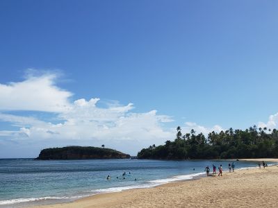
Balneario Cerro Gordo, Public beach in Vega Alta, Puerto Rico

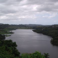
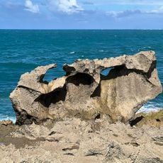
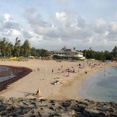
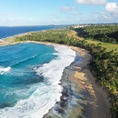
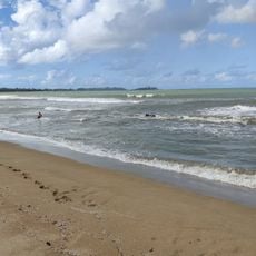
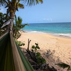
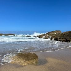
Balneario Cerro Gordo sits along the northern coast with light beige sand, clear waters, and rock formations at its eastern edge. The beach is well-maintained and equipped for swimming, relaxing, and enjoying coastal views.

The beach was established through Puerto Rican legislation to ensure public access and upkeep. This legal framework made it a significant recreational destination for the northern region.

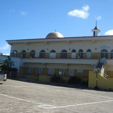
Local food vendors near the shore offer traditional Puerto Rican seafood and snacks, serving as a gathering place where families and friends celebrate together.

The beach has ample parking, bathrooms, and shaded areas for sun protection. It helps to arrive early, especially on weekends, when crowds build up quickly.

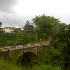
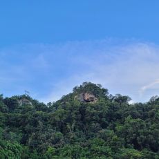
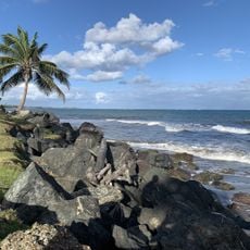
Hiking and biking trails run through the adjacent Bosque de Breas forest, linking the shoreline to elevated camping grounds. These woodland paths allow visitors to explore inland nature while enjoying coastal views.

The community of curious travelers

AroundUs brings together thousands of curated places, local tips, and hidden gems, enriched daily by 60,000 contributors worldwide.

Start exploring
Location
Operator
Municipio de Vega Alta
Address
Balneario Cerro Gordo, Vega Alta 00692, Puerto Rico
GPS coordinates
18.48186,-66.33991
Latest update
December 14, 2025 17:00
Around this place
Playa Mar Chiquita
United States of America

Playa Mar Chiquita

15.1 km
Puerto Rico National Cemetery
United States of America

Puerto Rico National Cemetery

19.9 km
El Cañuelo
United States of America

El Cañuelo

21.6 km
Parque de las Ciencias
United States of America

Parque de las Ciencias

20.6 km
United States of America

Mar Bella Beach

6.2 km
La Plata Lake
United States of America

La Plata Lake

20.9 km
Nuestra Señora de la Candelaria y San Matías Church
United States of America

Nuestra Señora de la Candelaria y San Matías Church

17.1 km
Mavilla Bridge
United States of America

Mavilla Bridge

15.1 km
Inmaculada Concepción Church
United States of America

Inmaculada Concepción Church

7.6 km
Manatí Bridge at Mata de Plátano
United States of America

Manatí Bridge at Mata de Plátano

19.9 km
Vega State Forest
United States of America

Vega State Forest

7.3 km
Dr. Agustín Stahl Stamm House
United States of America

Dr. Agustín Stahl Stamm House

21.6 km
Casa Alonso
United States of America

Casa Alonso

6.4 km
José Celso Barbosa House Museum
United States of America

José Celso Barbosa House Museum

21.6 km
Playa Puerto Nuevo
United States of America

Playa Puerto Nuevo

6.7 km
Jacinto Lopez Martinez Grammar School
United States of America

Jacinto Lopez Martinez Grammar School

8.5 km
Rafael Balseiro Maceira School
United States of America

Rafael Balseiro Maceira School

21.3 km
El Ojo del Buey
United States of America

El Ojo del Buey

8.7 km
Playa de Vega Baja
United States of America

Playa de Vega Baja

5.5 km
Al-Faruq Mosque
United States of America

Al-Faruq Mosque

5.3 km
Playa Las Palmas
United States of America

Playa Las Palmas

17 km
Playa del Dorado
United States of America

Playa del Dorado

8.7 km
Playa de los Tocones
United States of America

Playa de los Tocones

2.3 km
Playa de Levittown
United States of America

Playa de Levittown

17.6 km
Playa de Sardinera
United States of America

Playa de Sardinera

5.3 km
Playa Tortuguero
United States of America

Playa Tortuguero

12.6 km
La Poza de las Mujeres
United States of America

La Poza de las Mujeres

17.6 km
Place des Halles
United States of America

Place des Halles

9 km
Show the full map
Reviews
Share your experience

No review yet

Discussions
Start a discussion...

No discussion yet

« Balneario Cerro Gordo - Public beach in Vega Alta, Puerto Rico » is provided by Around Us (aroundus.com). Images and texts are derived from Wikimedia project under a Creative Commons license. You are allowed to copy, distribute, and modify copies of this page, under the conditions set by the license, as long as this note is clearly visible.

Discover hidden gems everywhere you go!

From secret cafés to breathtaking viewpoints, skip the crowded tourist spots and find places that match your style. Our app makes it easy with voice search, smart filtering, route optimization, and insider tips from travelers worldwide. Download now for the complete mobile experience.

Around Us App Screenshot

A unique approach to discovering new places

Le Figaro

All the places worth exploring

France Info

A tailor-made excursion in just a few clicks

20 Minutes

Around Us
Travel Guide & Maps
Download

Send to your phone

QR Code
1

Open the camera app on your mobile.

2

Point at the QR code with your camera. A notification will appear.

3

Tap the notification to open the link.