Enable Location

We need your location to show you interesting places around you

Discover nearby places

Find interesting locations and hidden gems around you

Precise directions

Get accurate directions and distances to places

Your location is never shared with other users. It's only used when you tap the location button.

Jasper

Log in to your account

Start exploring — it's free

Trusted by 61,874 travelers worldwide

Continue with Google
Continue with Apple
or

We will send you a code to connect

By continuing, you accept our Terms and Conditions and our Privacy Policy

Check your inbox

We've sent a pincode in your inbox. Please enter the code below.

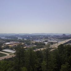
Jasper, Administrative division in Tennessee, United States.

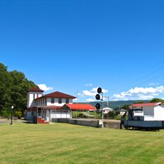
Jasper is an administrative division in southeastern Tennessee that manages municipal services and governmental functions for its residents. The town serves as a local administrative center coordinating various public services and community affairs.

Administrative structures emerged from early county systems established during Tennessee's development in the late 1700s. These governmental organizations grew and adapted as the region's population and needs expanded over time.

Local government offices in Jasper facilitate community engagement through regular town hall meetings and municipal service programs for residents.

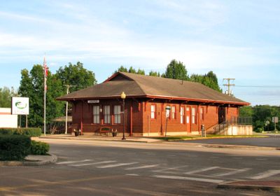
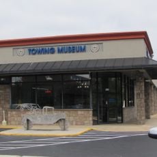
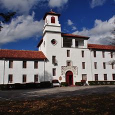
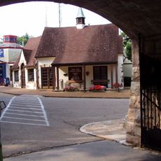
Administrative offices are located in the downtown area where local services and information are accessible to the public. It helps to identify the main municipal buildings and their locations before planning a visit.

Jasper's administrative boundaries extend across multiple postal code regions, creating a complex network of jurisdictional responsibilities.

The community of curious travelers

AroundUs brings together thousands of curated places, local tips, and hidden gems, enriched daily by 60,000 contributors worldwide.

Start exploring
GPS coordinates
35.07424,-85.62608
Latest update
December 7, 2025 20:24
Around this place
Ruby Falls
United States of America

Ruby Falls

26.8 km
Rock City
United States of America

Rock City

27.7 km
Interstate 24
United States of America

Interstate 24

10 km
Cloudland Canyon State Park
United States of America

Cloudland Canyon State Park

29.1 km
Nickajack Cave
United States of America

Nickajack Cave

9.5 km
RyeMabee
United States of America

RyeMabee

26.1 km
Fiery Gizzard Trail
United States of America

Fiery Gizzard Trail

16.4 km
Nickajack Lake
United States of America

Nickajack Lake

7.8 km
South Cumberland State Park
United States of America

South Cumberland State Park

25.4 km
United States of America

Lost Cove Cave

26.4 km
International Towing and Recovery Hall of Fame and Museum
United States of America

International Towing and Recovery Hall of Fame and Museum

28.3 km
P. R. Olgiati Bridge
United States of America

P. R. Olgiati Bridge

28.3 km
DuBose Conference Center
United States of America

DuBose Conference Center

26.1 km
Tennessee River Blueway
United States of America

Tennessee River Blueway

19.3 km
Marion Memorial Bridge
United States of America

Marion Memorial Bridge

9.1 km
Bridgeport Depot Museum
United States of America

Bridgeport Depot Museum

16 km
Bridgeport Historic District
United States of America

Bridgeport Historic District

15.9 km
McKendree Methodist Episcopal Church
United States of America

McKendree Methodist Episcopal Church

397 m
Col. A.M. Shook House
United States of America

Col. A.M. Shook House

23 km
Dade County Courthouse
United States of America

Dade County Courthouse

24.9 km
Ochs Memorial Museum
United States of America

Ochs Memorial Museum

26.6 km
Russell Cave
United States of America

Russell Cave

20 km
Moccasin Bend
United States of America

Moccasin Bend

26.7 km
Gilbert H. Grosvenor Visitor Center
United States of America

Gilbert H. Grosvenor Visitor Center

19.8 km
Lookout Mountain Battlefield Visitor Center
United States of America

Lookout Mountain Battlefield Visitor Center

26.7 km
Point Park (Lookout Mountain)
United States of America

Point Park (Lookout Mountain)

26.7 km
Bridgeport Swing Bridge
United States of America

Bridgeport Swing Bridge

14.5 km
Danny Cove
United States of America

Danny Cove

10.5 km
Show the full map
« Jasper - Administrative division in Tennessee, United States » is provided by Around Us (aroundus.com). Images and texts are derived from Wikimedia project under a Creative Commons license. You are allowed to copy, distribute, and modify copies of this page, under the conditions set by the license, as long as this note is clearly visible.

Discover hidden gems everywhere you go!

From secret cafés to breathtaking viewpoints, skip the crowded tourist spots and find places that match your style. Our app makes it easy with voice search, smart filtering, route optimization, and insider tips from travelers worldwide. Download now for the complete mobile experience.

Around Us App Screenshot

A unique approach to discovering new places

Le Figaro

All the places worth exploring

France Info

A tailor-made excursion in just a few clicks

20 Minutes

Around Us
Travel Guide & Maps
Download

Send to your phone

QR Code
1

Open the camera app on your mobile.

2

Point at the QR code with your camera. A notification will appear.

3

Tap the notification to open the link.