Chest opened
+${chestReward.xp} XP
Explorer
NOUVEAU ×${chestReward.collectible.quantity}
tapez pour fermer
Chest locked

Open chests in the app

Around Us is built for your phone — chests unlock when you walk, explore and capture nearby places.

Enable Location

We need your location to show you interesting places around you

Discover nearby places

Find interesting locations and hidden gems around you

Precise directions

Get accurate directions and distances to places

Your location is never shared with other users. It's only used when you tap the location button.

Terra Alta

Log in to your account

Start exploring — it's free

Trusted by 72,887 travelers worldwide

Continue with Google
Continue with Apple
or

We will send you a code to connect

By continuing, you accept our Terms and Conditions and our Privacy Policy

Check your inbox

We've sent a pincode in your inbox. Please enter the code below.

Discussion Reviews 1 Photos
10.3k Popularity

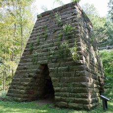
Terra Alta, Administrative town in Preston County, West Virginia, US

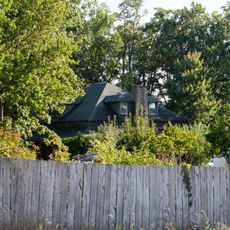
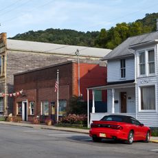
Terra Alta is a small administrative town located in Preston County, West Virginia, in the eastern part of the state. It sits at a high elevation and functions as a local center for the surrounding rural community with basic municipal services and buildings.

The settlement was founded in the 1850s under the name Portland and later changed its designation. The Baltimore and Ohio Railroad brought a station to the area, which helped the community grow.

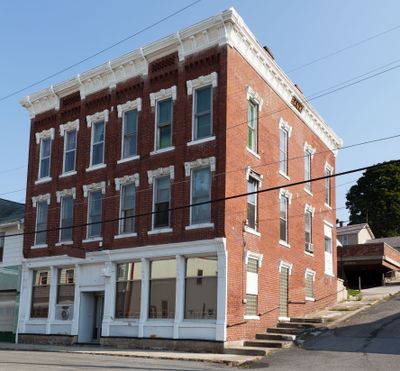
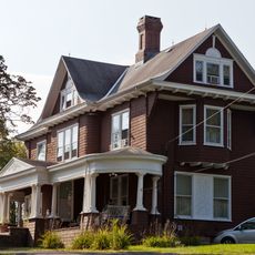
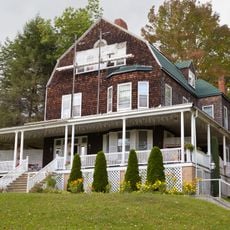
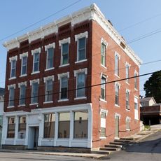
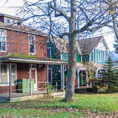
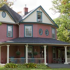
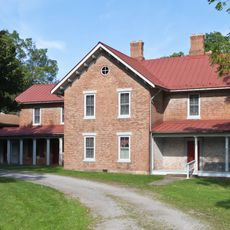
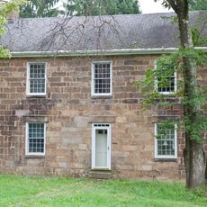
The town maintains two structures on the National Register of Historic Places: the James S. Lakin House and the Terra Alta Bank building.

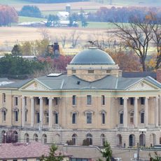
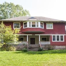
The municipal building and local bank offices are located at the heart of the town for residents and visitors. Walking is the easiest way to get around since everything is within a reasonable distance.

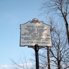
The name comes from Latin words meaning high land, a reference to its geographical position. The town sits at one of the highest elevations in Preston County.

The community of curious travelers

AroundUs brings together thousands of curated places, local tips, and hidden gems, enriched daily by 60,000 contributors worldwide.

Start exploring
GPS coordinates
39.44571,-79.54656
Latest update
December 10, 2025 15:54
Around this place
Deep Creek Lake
United States of America

Deep Creek Lake

15.1 km
Hoye-Crest
United States of America

Hoye-Crest

23.8 km
Swallow Falls State Park
United States of America

Swallow Falls State Park

11.9 km
Deep Creek Lake State Park
United States of America

Deep Creek Lake State Park

22.6 km
Cathedral State Park
United States of America

Cathedral State Park

13.3 km
West Virginia Zoo
United States of America

West Virginia Zoo

17.8 km
Cranesville Swamp Preserve
United States of America

Cranesville Swamp Preserve

11 km
Potomac-Garrett State Forest
United States of America

Potomac-Garrett State Forest

9.2 km
Virginia Furnace
United States of America

Virginia Furnace

11.9 km
James S. Lakin House
United States of America

James S. Lakin House

299 m
Pennington Cottage
United States of America

Pennington Cottage

18.6 km
Deep Creek Lake State Park
United States of America

Deep Creek Lake State Park

22.9 km
Oakland Historic District
United States of America

Oakland Historic District

12.8 km
Terra Alta Bank
United States of America

Terra Alta Bank

119 m
Mountain Lake Park Historic District
United States of America

Mountain Lake Park Historic District

15.2 km
Garrett County Courthouse
United States of America

Garrett County Courthouse

12.8 km
Old Hemlock
United States of America

Old Hemlock

23.4 km
Creedmore
United States of America

Creedmore

15 km
Brookside Historic District
United States of America

Brookside Historic District

13.4 km
Indian Rocks Dining Hall
United States of America

Indian Rocks Dining Hall

20.1 km
James Clark McGrew House
United States of America

James Clark McGrew House

12.4 km
Gaymont
United States of America

Gaymont

13.4 km
United States of America

Gormania Presbyterian Church

24.3 km
Ralphsnyder Decagonal Barn
United States of America

Ralphsnyder Decagonal Barn

22.1 km
Col. Thomas Brown House
United States of America

Col. Thomas Brown House

23 km
Downtown Rowlesburg Historic District
United States of America

Downtown Rowlesburg Historic District

15.3 km
Kingwood Historic District
United States of America

Kingwood Historic District

12.4 km
Arthurdale Historic District
United States of America

Arthurdale Historic District

23.7 km
Show the full map
Reviews
Share your experience

No review yet

Discussions
Start a discussion...

No discussion yet

« Terra Alta - Administrative town in Preston County, West Virginia, US » is provided by Around Us (aroundus.com). Images and texts are derived from Wikimedia project under a Creative Commons license. You are allowed to copy, distribute, and modify copies of this page, under the conditions set by the license, as long as this note is clearly visible.

Discover hidden gems everywhere you go!

From secret cafés to breathtaking viewpoints, skip the crowded tourist spots and find places that match your style. Our app makes it easy with voice search, smart filtering, route optimization, and insider tips from travelers worldwide. Download now for the complete mobile experience.

Around Us App Screenshot

A unique approach to discovering new places

Le Figaro

All the places worth exploring

France Info

A tailor-made excursion in just a few clicks

20 Minutes

Around Us
Travel Guide & Maps
Download

Send to your phone

QR Code
1

Open the camera app on your mobile.

2

Point at the QR code with your camera. A notification will appear.

3

Tap the notification to open the link.