Chest opened
+${chestReward.xp} XP
Explorer
NOUVEAU ×${chestReward.collectible.quantity}
tapez pour fermer
Chest locked

Open chests in the app

Around Us is built for your phone — chests unlock when you walk, explore and capture nearby places.

Enable Location

We need your location to show you interesting places around you

Discover nearby places

Find interesting locations and hidden gems around you

Precise directions

Get accurate directions and distances to places

Your location is never shared with other users. It's only used when you tap the location button.

Log in to your account

Start exploring — it's free

Trusted by 72,878 travelers worldwide

Continue with Google
Continue with Apple
or

We will send you a code to connect

By continuing, you accept our Terms and Conditions and our Privacy Policy

Check your inbox

We've sent a pincode in your inbox. Please enter the code below.

Discussion Reviews Photo
12.4k Popularity

Kentucky County, Former administrative territory in Virginia, United States.

Kentucky County was an administrative territory covering western Virginia, encompassing multiple settlements and frontier outposts during its existence from 1776 to 1780. The region served as the governmental seat for organized expansion into newly settled lands west of the established colonies.

The Virginia General Assembly created Kentucky County from Fincastle County in 1776, establishing organized territorial governance in the western frontier. The county was dissolved in 1780 and divided into three separate counties as population growth made division necessary.

Settlers in Kentucky County built new communities and government institutions while maintaining contact with Native American peoples on this frontier land. These early groups shaped the social patterns that would define the region for generations to come.

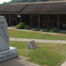
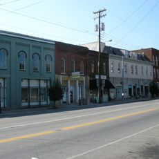
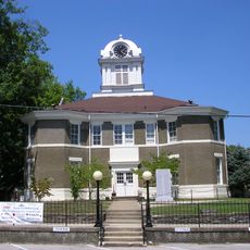
Harrodsburg, originally called Harrodstown, served as the administrative center during the four years this territory functioned as a Virginia county. Those interested in exploring historical sites from this frontier period should focus on locations around this central settlement.

The territory experienced remarkable population growth in just four years, transforming from a sparsely settled frontier zone into an established community requiring administrative division. This rapid expansion forced officials to split the growing region into three separate counties to better manage its affairs.

The community of curious travelers

AroundUs brings together thousands of curated places, local tips, and hidden gems, enriched daily by 60,000 contributors worldwide.

Start exploring
GPS coordinates
37.61670,-83.45000
Latest update
March 5, 2026 18:17
Around this place
Red River Gorge
United States of America

Red River Gorge

27.9 km
United States of America

Eastern Kentucky Coal Field region

35.5 km
Cave Run Lake
United States of America

Cave Run Lake

51.9 km
Furnace Mountain
United States of America

Furnace Mountain

38.5 km
Kentucky Reptile Zoo
United States of America

Kentucky Reptile Zoo

29.8 km
Robinson Forest
United States of America

Robinson Forest

31.4 km
Magoffin County Pioneer Village and Museum
United States of America

Magoffin County Pioneer Village and Museum

36.8 km
Clifty Wilderness
United States of America

Clifty Wilderness

25.7 km
Salyersville National Bank
United States of America

Salyersville National Bank

36.8 km
Buckhorn Presbyterian Church and the Greer Gymnasium
United States of America

Buckhorn Presbyterian Church and the Greer Gymnasium

30 km
Jackson Post Office
United States of America

Jackson Post Office

9 km
Ravenna Motor Vehicle Service Building
United States of America

Ravenna Motor Vehicle Service Building

44.9 km
St. Thomas Episcopal Church
United States of America

St. Thomas Episcopal Church

23.4 km
Breathitt County Jail
United States of America

Breathitt County Jail

9.2 km
M.E. Church, South
United States of America

M.E. Church, South

9.2 km
William L. Hurst Law Office
United States of America

William L. Hurst Law Office

15.7 km
St. Therese Catholic Church
United States of America

St. Therese Catholic Church

29.3 km
Wooton Presbyterian Center
United States of America

Wooton Presbyterian Center

50.3 km
Hindman Historic District
United States of America

Hindman Historic District

51.9 km
Irvine Historic Business District
United States of America

Irvine Historic Business District

47.2 km
Irvine Grade School
United States of America

Irvine Grade School

46.6 km
Judge John E. Cooper House
United States of America

Judge John E. Cooper House

38.1 km
Beattyville Grade School
United States of America

Beattyville Grade School

23 km
Clay City National Bank Building
United States of America

Clay City National Bank Building

49.6 km
Bolen Building
United States of America

Bolen Building

51.9 km
Jackson Commercial District
United States of America

Jackson Commercial District

9.1 km
Morgan County Courthouse
United States of America

Morgan County Courthouse

37.9 km
Natural Bridge State Resort Park
United States of America

Natural Bridge State Resort Park

27.9 km
Show the full map
Reviews
Share your experience

No review yet

Discussions
Start a discussion...

No discussion yet

« Kentucky County - Former administrative territory in Virginia, United States » is provided by Around Us (aroundus.com). Images and texts are derived from Wikimedia project under a Creative Commons license. You are allowed to copy, distribute, and modify copies of this page, under the conditions set by the license, as long as this note is clearly visible.

Discover hidden gems everywhere you go!

From secret cafés to breathtaking viewpoints, skip the crowded tourist spots and find places that match your style. Our app makes it easy with voice search, smart filtering, route optimization, and insider tips from travelers worldwide. Download now for the complete mobile experience.

Around Us App Screenshot

A unique approach to discovering new places

Le Figaro

All the places worth exploring

France Info

A tailor-made excursion in just a few clicks

20 Minutes

Around Us
Travel Guide & Maps
Download

Send to your phone

QR Code
1

Open the camera app on your mobile.

2

Point at the QR code with your camera. A notification will appear.

3

Tap the notification to open the link.