Raritan Township

Log in to your account

AroundUs is a community-driven map of interesting places, built by curious explorers like you. It grows with every review, story, and photo you share.
Connect to save your favorite spots, contribute locations, and create personalized routes.
Continue with Google
Continue with Apple
Continue with X
Continue with Facebook
Continue with email
By continuing, you accept our Terms and Conditions and our Privacy Policy
Create an account
Add to collection
Map
Suggest a change
Share

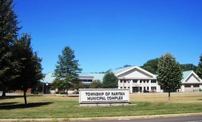
Raritan Township, Administrative division in Hunterdon County, New Jersey, United States.

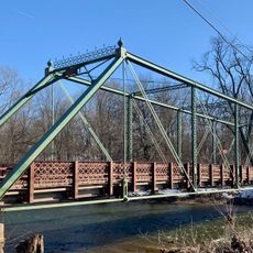
Raritan Township is an administrative division in Hunterdon County, New Jersey, covering a substantial land area divided between valley regions. The South Branch Raritan River flows through the township, shaping much of its natural geography and drainage patterns.

The township was established in 1838, carved out from portions of Amwell Township in the region. In 1910, Flemington incorporated as an independent municipality, yet it remained surrounded by Raritan Township's boundaries.

The township takes its name from the Raritan people, a branch of the Lenape nation who lived in this region before European arrival. This Native American heritage remains woven into the local landscape and community identity.

This is primarily a residential and agricultural area without a central commercial hub, so visitors should plan to explore its dispersed neighborhoods and natural features. Spring and fall offer the most pleasant conditions for touring the township's landscapes and rural character.

Raritan Township completely surrounds the city of Flemington in a ring-like formation known as a doughnut town, one of only 21 such municipal configurations in New Jersey. This unusual geographic and administrative arrangement means that Flemington sits entirely within the township's boundaries while maintaining separate governance.

GPS coordinates: 40.51052,-74.89952

Latest update: December 10, 2025 15:53

Photos
Around this place
United States of America

Round Valley Reservoir

13.2 km
Northlandz
United States of America

Northlandz

6.8 km
Green Sergeant's Covered Bridge
United States of America

Green Sergeant's Covered Bridge

9.3 km
Fink-Type Truss Bridge
United States of America

Fink-Type Truss Bridge

10.4 km
Neshanic Mills
United States of America

Neshanic Mills

14.7 km
Neshanic Station Lenticular Truss Bridge
United States of America

Neshanic Station Lenticular Truss Bridge

14.6 km
Rockafellows Mill Bridge
United States of America

Rockafellows Mill Bridge

6.8 km
Flemington Historic District
United States of America

Flemington Historic District

3.3 km
Dart's Mill Historic District
United States of America

Dart's Mill Historic District

6.3 km
Covered Bridge Historic District
United States of America

Covered Bridge Historic District

9.1 km
Quaker Meeting House
United States of America

Quaker Meeting House

7.3 km
Huff House and Farmstead
United States of America

Huff House and Farmstead

15 km
Case-Dvoor Farmstead
United States of America

Case-Dvoor Farmstead

2.7 km
John Reading Farmstead
United States of America

John Reading Farmstead

5.5 km
Lansdown
United States of America

Lansdown

10.7 km
Raritan-Readington South Branch Historic District
United States of America

Raritan-Readington South Branch Historic District

5.4 km
Charles Eversole House
United States of America

Charles Eversole House

14.3 km
Locktown Baptist Church
United States of America

Locktown Baptist Church

6.8 km
Neshanic Reformed Church
United States of America

Neshanic Reformed Church

15.3 km
Quakertown Methodist Episcopal Church
United States of America

Quakertown Methodist Episcopal Church

7 km
Clover Hill Reformed Church
United States of America

Clover Hill Reformed Church

10.3 km
Quakertown Historic District
United States of America

Quakertown Historic District

7.1 km
Reaville Historic District
United States of America

Reaville Historic District

7.5 km
Headquarters Historic District
United States of America

Headquarters Historic District

8 km
Clover Hill Historic District
United States of America

Clover Hill Historic District

10.1 km
Pittstown Historic District
United States of America

Pittstown Historic District

9.4 km
Neshanic Historic District
United States of America

Neshanic Historic District

15.3 km
Neshanic Station Historic District
United States of America

Neshanic Station Historic District

14.2 km
Show the full map
Reviews

Visited this place? Tap the stars to rate it and share your experience / photos with the community! Try now! You can cancel it anytime.

« Raritan Township - Administrative division in Hunterdon County, New Jersey, United States » is provided by Around Us (aroundus.com). Images and texts are derived from Wikimedia project under a Creative Commons license. You are allowed to copy, distribute, and modify copies of this page, under the conditions set by the license, as long as this note is clearly visible.

Discover hidden gems everywhere you go!

From secret cafés to breathtaking viewpoints, skip the crowded tourist spots and find places that match your style. Our app makes it easy with voice search, smart filtering, route optimization, and insider tips from travelers worldwide. Download now for the complete mobile experience.

Around Us App Screenshot

A unique approach to discovering new places

Le Figaro

All the places worth exploring

France Info

A tailor-made excursion in just a few clicks

20 Minutes