Enable Location

We need your location to show you interesting places around you

Discover nearby places

Find interesting locations and hidden gems around you

Precise directions

Get accurate directions and distances to places

Your location is never shared with other users. It's only used when you tap the location button.

Readington Township

Log in to your account

Start exploring — it's free

Trusted by 62,420 travelers worldwide

Continue with Google
Continue with Apple
or

We will send you a code to connect

By continuing, you accept our Terms and Conditions and our Privacy Policy

Check your inbox

We've sent a pincode in your inbox. Please enter the code below.

Readington Township

Readington Township, Administrative division in Hunterdon County, New Jersey, US.

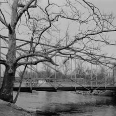
Readington Township is an administrative division in Hunterdon County, New Jersey, sprawling across roughly 48 square miles. The area mixes residential communities with open natural spaces positioned between two major metro regions.

The area received its Royal charter in 1730, taking its name from John Reading, the first native-born governor of the British Province of New Jersey. This early foundation tied it to the colonial period when the region was being settled and organized.

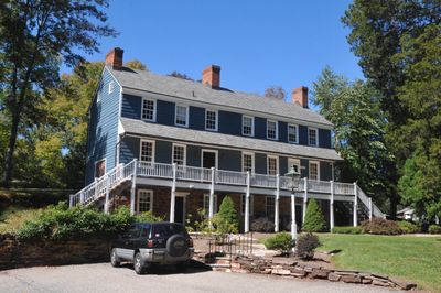
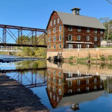
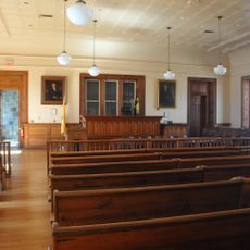
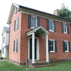
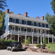
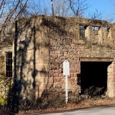
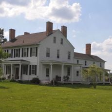
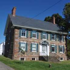
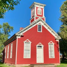
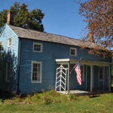
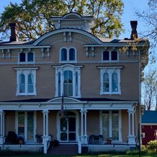
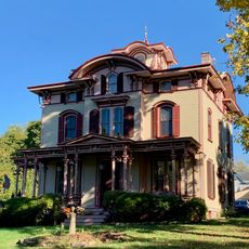
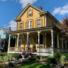
Local landmarks like the Bouman-Stickney Homestead reflect how families established roots here over generations. These preserved buildings tell the story of what mattered to people who built communities in this region.

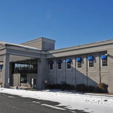
The township office located on Route 523 in Whitehouse Station serves as the main point of contact for administrative needs and permit inquiries. Visiting during regular business hours ensures you can speak with staff who handle various municipal services.

Solberg-Hunterdon Airport hosts North America's largest summertime hot air balloon festival, with hundreds of balloons launching together in a spectacular display. This annual gathering draws crowds from across the region and creates an unforgettable scene in the sky.

The community of curious travelers

AroundUs brings together thousands of curated places, local tips, and hidden gems, enriched daily by 60,000 contributors worldwide.

Start exploring
GPS coordinates
40.56871,-74.73766
Latest update
December 7, 2025 19:29
Around this place
United States of America

Round Valley Reservoir

8.8 km
Northlandz
United States of America

Northlandz

9 km
Merck headquarters
United States of America

Merck headquarters

8.7 km
Pennsylvania Railroad 4877
United States of America

Pennsylvania Railroad 4877

11.3 km
Fink-Type Truss Bridge
United States of America

Fink-Type Truss Bridge

14.5 km
Neshanic Mills
United States of America

Neshanic Mills

6.8 km
Neshanic Station Lenticular Truss Bridge
United States of America

Neshanic Station Lenticular Truss Bridge

6.7 km
Rockafellows Mill Bridge
United States of America

Rockafellows Mill Bridge

8.8 km
Flemington Historic District
United States of America

Flemington Historic District

12.3 km
Andrew Ten Eyck House
United States of America

Andrew Ten Eyck House

4.1 km
Dart's Mill Historic District
United States of America

Dart's Mill Historic District

8.9 km
North Branch Historic District
United States of America

North Branch Historic District

6.3 km
Taylor's Mill Historic District
United States of America

Taylor's Mill Historic District

10.7 km
Bartles House
United States of America

Bartles House

10.7 km
Lamington Historic District
United States of America

Lamington Historic District

10.4 km
Huff House and Farmstead
United States of America

Huff House and Farmstead

5.9 km
Case-Dvoor Farmstead
United States of America

Case-Dvoor Farmstead

13.1 km
Whitehouse-Mechanicsville Historic District
United States of America

Whitehouse-Mechanicsville Historic District

6.1 km
John Reading Farmstead
United States of America

John Reading Farmstead

9.7 km
Raritan-Readington South Branch Historic District
United States of America

Raritan-Readington South Branch Historic District

9.8 km
South Branch Schoolhouse
United States of America

South Branch Schoolhouse

3.9 km
Charles Eversole House
United States of America

Charles Eversole House

4.8 km
South Branch Reformed Church
United States of America

South Branch Reformed Church

4.4 km
Readington Village Historic District
United States of America

Readington Village Historic District

74 m
Neshanic Station Historic District
United States of America

Neshanic Station Historic District

6.7 km
South Branch Historic District
United States of America

South Branch Historic District

4.4 km
Lebanon Historic District
United States of America

Lebanon Historic District

11.5 km
Potterstown Rural Historic District
United States of America

Potterstown Rural Historic District

9.5 km
Show the full map
« Readington Township - Administrative division in Hunterdon County, New Jersey, US » is provided by Around Us (aroundus.com). Images and texts are derived from Wikimedia project under a Creative Commons license. You are allowed to copy, distribute, and modify copies of this page, under the conditions set by the license, as long as this note is clearly visible.

Discover hidden gems everywhere you go!

From secret cafés to breathtaking viewpoints, skip the crowded tourist spots and find places that match your style. Our app makes it easy with voice search, smart filtering, route optimization, and insider tips from travelers worldwide. Download now for the complete mobile experience.

Around Us App Screenshot

A unique approach to discovering new places

Le Figaro

All the places worth exploring

France Info

A tailor-made excursion in just a few clicks

20 Minutes

Around Us
Travel Guide & Maps
Download

Send to your phone

QR Code
1

Open the camera app on your mobile.

2

Point at the QR code with your camera. A notification will appear.

3

Tap the notification to open the link.