Enable Location

We need your location to show you interesting places around you

Discover nearby places

Find interesting locations and hidden gems around you

Precise directions

Get accurate directions and distances to places

Your location is never shared with other users. It's only used when you tap the location button.

Log in to your account

Start exploring — it's free

Trusted by 64,623 travelers worldwide

Continue with Google
Continue with Apple
or

We will send you a code to connect

By continuing, you accept our Terms and Conditions and our Privacy Policy

Check your inbox

We've sent a pincode in your inbox. Please enter the code below.

Knobs region
Discussion Reviews Photo
11.4k Popularity

Knobs region, Geological area in Kentucky, US

The Knobs region is a geological area in Kentucky that curves around the Bluegrass region in a horseshoe shape. Hundreds of isolated conical hills rise above the surrounding plains, creating a distinctive landscape of rolling peaks and valleys.

This landscape formed over millions of years as erosion worked the edges of the Pennyroyal Plateau and Cumberland Plateau. The remaining rocky formations became the distinctive hills that define the region today.

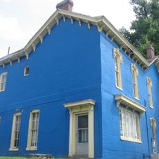
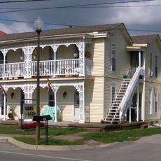
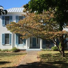
The region holds significance for local communities that have settled into the rolling terrain over generations. People here maintain strong ties to the landscape through farming and outdoor traditions that shape daily life.

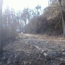
The region has many trails and paths for hiking, especially within Knobs State Forest, suitable for different skill levels. Wear sturdy footwear since the terrain is hilly and can be slippery, particularly after rain.

Many hills in the region have caps of Harrodsburg Limestone that create hard rock cliffs at their summits. These stone crowns make certain hills easy to spot and add distinct visual features to the landscape.

The community of curious travelers

AroundUs brings together thousands of curated places, local tips, and hidden gems, enriched daily by 60,000 contributors worldwide.

Start exploring
Location
GPS coordinates
37.88139,-85.67639
Latest update
December 8, 2025 13:40
Around this place
United States Bullion Depository
United States of America

United States Bullion Depository

25.4 km
My Old Kentucky Home State Park
United States of America

My Old Kentucky Home State Park

21.2 km
Basilica of St. Joseph Proto-Cathedral
United States of America

Basilica of St. Joseph Proto-Cathedral

19.6 km
Louisville and Nashville Railroad 152
United States of America

Louisville and Nashville Railroad 152

26.1 km
Civil War Museum
United States of America

Civil War Museum

20.4 km
Rooster Run
United States of America

Rooster Run

11.1 km
Wickland
United States of America

Wickland

21.1 km
Bardstown Historic District
United States of America

Bardstown Historic District

20.1 km
Louisville and Nashville Combine Car Number 665
United States of America

Louisville and Nashville Combine Car Number 665

26.1 km
Ben Johnson House
United States of America

Ben Johnson House

19.9 km
Oscar Getz Museum of Whiskey History
United States of America

Oscar Getz Museum of Whiskey History

19.7 km
United States of America

Knobs State Forest

2 m
Cobblestone Path
United States of America

Cobblestone Path

20.4 km
Bardstown Historical Museum
United States of America

Bardstown Historical Museum

19.7 km
Brown Pusey House Community Center
United States of America

Brown Pusey House Community Center

26.2 km
Helm Place
United States of America

Helm Place

25.7 km
St. Thomas Roman Catholic Church and Howard-Flaget House
United States of America

St. Thomas Roman Catholic Church and Howard-Flaget House

21.2 km
Confederate Monument of Bardstown
United States of America

Confederate Monument of Bardstown

19.9 km
James M. Lloyd House
United States of America

James M. Lloyd House

22.1 km
Fort DeWolf
United States of America

Fort DeWolf

12 km
Bank of the Commonwealth
United States of America

Bank of the Commonwealth

12.3 km
William Bush House
United States of America

William Bush House

22 km
Christ Episcopal Church
United States of America

Christ Episcopal Church

26.2 km
Larue-Layman House
United States of America

Larue-Layman House

26.2 km
Henry J. Barnes House
United States of America

Henry J. Barnes House

22 km
Solomon Neill Brooks House
United States of America

Solomon Neill Brooks House

19.1 km
Kentucky Railway Museum
United States of America

Kentucky Railway Museum

26 km
Nelson County Jail
United States of America

Nelson County Jail

20 km
Show the full map
Reviews
Share your experience

No review yet

Discussions
Start a discussion...

No discussion yet

« Knobs region - Geological area in Kentucky, US » is provided by Around Us (aroundus.com). Images and texts are derived from Wikimedia project under a Creative Commons license. You are allowed to copy, distribute, and modify copies of this page, under the conditions set by the license, as long as this note is clearly visible.

Discover hidden gems everywhere you go!

From secret cafés to breathtaking viewpoints, skip the crowded tourist spots and find places that match your style. Our app makes it easy with voice search, smart filtering, route optimization, and insider tips from travelers worldwide. Download now for the complete mobile experience.

Around Us App Screenshot

A unique approach to discovering new places

Le Figaro

All the places worth exploring

France Info

A tailor-made excursion in just a few clicks

20 Minutes

Around Us
Travel Guide & Maps
Download

Send to your phone

QR Code
1

Open the camera app on your mobile.

2

Point at the QR code with your camera. A notification will appear.

3

Tap the notification to open the link.