Enable Location

We need your location to show you interesting places around you

Discover nearby places

Find interesting locations and hidden gems around you

Precise directions

Get accurate directions and distances to places

Your location is never shared with other users. It's only used when you tap the location button.

Esopus Creek

Log in to your account

Start exploring — it's free

Trusted by 64,588 travelers worldwide

Continue with Google
Continue with Apple
or

We will send you a code to connect

By continuing, you accept our Terms and Conditions and our Privacy Policy

Check your inbox

We've sent a pincode in your inbox. Please enter the code below.

Esopus Creek
Discussion Reviews 1 Photos
17.4k Popularity

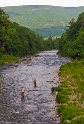
Esopus Creek, River system in Catskill Mountains, United States

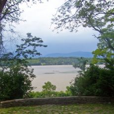
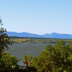
Esopus Creek is a river system flowing through the Catskill Mountains with a network of tributaries and streams throughout the watershed. It originates in the highlands and flows toward the Hudson River, serving as a major water source for the surrounding region.

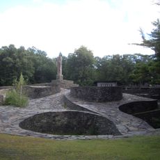
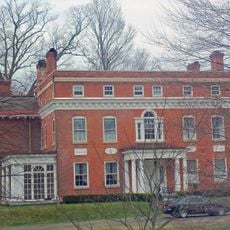
The Lenape people originally inhabited this area and called the waterway Atkarkaton before it later became known by the name of the Esopus tribe. The region gained importance as a water resource and recreational destination during the development of the Catskill area in the 19th century.

The waterway took its name from the Esopus people who settled along its banks and shaped the region's character. Today, the surrounding forests and mountains continue to attract those seeking outdoor recreation and connection with nature.

The area is best explored on foot, especially during warmer months when trails are accessible and conditions are ideal for outdoor activities. The terrain can be uneven in places, and weather can change quickly at higher elevations.

The Ashokan Reservoir along the creek supplies drinking water to millions of residents and represents a remarkable example of large-scale water engineering. This infrastructure has shaped the landscape and demonstrates how human systems and natural spaces intersect in this region.

The community of curious travelers

AroundUs brings together thousands of curated places, local tips, and hidden gems, enriched daily by 60,000 contributors worldwide.

Start exploring
Location
GPS coordinates
42.07140,-73.92920
Latest update
December 7, 2025 19:24
Around this place
Opus 40
United States of America

Opus 40

8.8 km
Rokeby
United States of America

Rokeby

9.3 km
Richard B. Fisher Center for the Performing Arts
United States of America

Richard B. Fisher Center for the Performing Arts

5 km
Clermont State Historic Site
United States of America

Clermont State Historic Site

1.8 km
Montgomery Place
United States of America

Montgomery Place

6.4 km
United States of America

Bard College Campus

5.7 km
Edgewater
United States of America

Edgewater

8.3 km
Saugerties Light
United States of America

Saugerties Light

85 m
Maizefield
United States of America

Maizefield

9.1 km
St. Christopher's Church
United States of America

St. Christopher's Church

9.7 km
Wynkoop House
United States of America

Wynkoop House

4.1 km
Stone Jug
United States of America

Stone Jug

4.5 km
Kiersted house
United States of America

Kiersted house

1.9 km
German Reformed Sanctity Church Parsonage
United States of America

German Reformed Sanctity Church Parsonage

8.7 km
Loerzel Beer Hall
United States of America

Loerzel Beer Hall

1.9 km
St. Luke's Church
United States of America

St. Luke's Church

8.7 km
Watts De Peyster Fireman's Hall
United States of America

Watts De Peyster Fireman's Hall

2 km
Trinity Episcopal Church Complex
United States of America

Trinity Episcopal Church Complex

1.7 km
Coons House
United States of America

Coons House

3.7 km
Hendrick Martin House
United States of America

Hendrick Martin House

9 km
Clarkson Chapel
United States of America

Clarkson Chapel

3.7 km
Heermance Farmhouse
United States of America

Heermance Farmhouse

6.3 km
Thomas Brodhead House
United States of America

Thomas Brodhead House

9.1 km
Clermont Academy
United States of America

Clermont Academy

8.7 km
Tuscarora Club Bridge
United States of America

Tuscarora Club Bridge

7.1 km
Main–Partition Streets Historic District
United States of America

Main–Partition Streets Historic District

2 km
Clermont Civic Historic District
United States of America

Clermont Civic Historic District

8.7 km
Barringer–Overbaugh–Lasher House
United States of America

Barringer–Overbaugh–Lasher House

7.9 km
Show the full map
Reviews
Share your experience

No review yet

Discussions
Start a discussion...

No discussion yet

« Esopus Creek - River system in Catskill Mountains, United States » is provided by Around Us (aroundus.com). Images and texts are derived from Wikimedia project under a Creative Commons license. You are allowed to copy, distribute, and modify copies of this page, under the conditions set by the license, as long as this note is clearly visible.

Discover hidden gems everywhere you go!

From secret cafés to breathtaking viewpoints, skip the crowded tourist spots and find places that match your style. Our app makes it easy with voice search, smart filtering, route optimization, and insider tips from travelers worldwide. Download now for the complete mobile experience.

Around Us App Screenshot

A unique approach to discovering new places

Le Figaro

All the places worth exploring

France Info

A tailor-made excursion in just a few clicks

20 Minutes

Around Us
Travel Guide & Maps
Download

Send to your phone

QR Code
1

Open the camera app on your mobile.

2

Point at the QR code with your camera. A notification will appear.

3

Tap the notification to open the link.