Enable Location

We need your location to show you interesting places around you

Discover nearby places

Find interesting locations and hidden gems around you

Precise directions

Get accurate directions and distances to places

Your location is never shared with other users. It's only used when you tap the location button.

Log in to your account

Start exploring — it's free

Trusted by 61,430 travelers worldwide

Continue with Google
Continue with Apple
or

We will send you a code to connect

By continuing, you accept our Terms and Conditions and our Privacy Policy

Check your inbox

We've sent a pincode in your inbox. Please enter the code below.

Acadia Cliffs State Nature Preserve

Acadia Cliffs State Nature Preserve, Protected natural area in Washington County, Ohio, United States.

Description

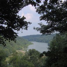
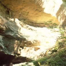
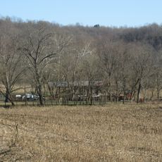
Acadia Cliffs State Nature Preserve is a protected natural area spanning about 273 acres in Washington County, Ohio, with steep sandstone bluffs and dense forest interspersed with winding streams. The site features distinctive geological formations with rock outcrops rising above creek valleys in a diverse forest setting.

History

The preserve was established in 1994 by the Ohio Department of Natural Resources to protect its natural features. Management transferred to the Wildlife Division in 1998 to better oversee the site's conservation goals.

Culture

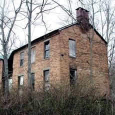
The former millstone quarry visible within the preserve tells the story of local craftsmanship and resource use from earlier times. Walking through the area, you can see how people once shaped the landscape to meet their practical needs.

Practical

The preserve is accessible via County Road 3 from State Route 555, with parking near the entrance. Sturdy footwear is recommended for the steep and rocky trails, especially after rain or wet conditions.

Did you know?

The preserve is home to Bradley's spleenwort, a rare fern species that grows only on the rocky cliffs within the area. This specialized plant makes the site an important refuge for this uncommon species in the region.

Location
Inception
1994
GPS coordinates
39.32100,-81.84500
Latest update
December 14, 2025 14:22

AroundUs brings together thousands of curated places, local tips, and hidden gems, enriched daily by 60,000 contributors worldwide. Discover all places nearby (Ohio).

Around this place
Athens Lunatic Asylum
United States of America

Athens Lunatic Asylum

22.8 km
Peden Stadium
United States of America

Peden Stadium

22.2 km
Blennerhassett Island Historical State Park
United States of America

Blennerhassett Island Historical State Park

19.8 km
Convocation Center
United States of America

Convocation Center

22.4 km
Strouds Run State Park
United States of America

Strouds Run State Park

15.6 km
Blennerhassett Island Bridge
United States of America

Blennerhassett Island Bridge

17.8 km
Manasseh Cutler Hall
United States of America

Manasseh Cutler Hall

22 km
United States of America

Marie J. Desonier State Nature Preserve

9.4 km
John Calhoun Baker University Center
United States of America

John Calhoun Baker University Center

22.1 km
College Green of Ohio University
United States of America

College Green of Ohio University

22 km
W. H. Bickel Estate
United States of America

W. H. Bickel Estate

23.6 km
Athens Governmental Buildings
United States of America

Athens Governmental Buildings

22 km
Mound Cemetery Mound
United States of America

Mound Cemetery Mound

24.1 km
Athens State Hospital Cow Barn
United States of America

Athens State Hospital Cow Barn

23.3 km
Captain Jonathan Stone House
United States of America

Captain Jonathan Stone House

23.8 km
Charles Rice Ames House
United States of America

Charles Rice Ames House

21 km
Sawyer-Curtis House
United States of America

Sawyer-Curtis House

14.4 km
Bell Covered Bridge
United States of America

Bell Covered Bridge

19 km
Athens Downtown Historic District
United States of America

Athens Downtown Historic District

22.1 km
Walter Curtis House
United States of America

Walter Curtis House

16 km
Shinn Covered Bridge
United States of America

Shinn Covered Bridge

17.4 km
Root Covered Bridge
United States of America

Root Covered Bridge

8.2 km
Blackwood Covered Bridge
United States of America

Blackwood Covered Bridge

17.7 km
Strouds Ridge Preserve
United States of America

Strouds Ridge Preserve

19.3 km
Barkhurst Mill Covered Bridge
United States of America

Barkhurst Mill Covered Bridge

20.3 km
Savage-Stewart House
United States of America

Savage-Stewart House

11.3 km
Henry Covered Bridge
United States of America

Henry Covered Bridge

8.6 km
Kennedy Museum of Art
United States of America

Kennedy Museum of Art

22.8 km
Show the full map
« Acadia Cliffs State Nature Preserve - Protected natural area in Washington County, Ohio, United States » is provided by Around Us (aroundus.com). Images and texts are derived from Wikimedia project under a Creative Commons license. You are allowed to copy, distribute, and modify copies of this page, under the conditions set by the license, as long as this note is clearly visible.

Discover hidden gems everywhere you go!

From secret cafés to breathtaking viewpoints, skip the crowded tourist spots and find places that match your style. Our app makes it easy with voice search, smart filtering, route optimization, and insider tips from travelers worldwide. Download now for the complete mobile experience.

Around Us App Screenshot

A unique approach to discovering new places

Le Figaro

All the places worth exploring

France Info

A tailor-made excursion in just a few clicks

20 Minutes

Around Us
Travel Guide & Maps
Download

Send to your phone

QR Code
1

Open the camera app on your mobile.

2

Point at the QR code with your camera. A notification will appear.

3

Tap the notification to open the link.