Enable Location

We need your location to show you interesting places around you

Discover nearby places

Find interesting locations and hidden gems around you

Precise directions

Get accurate directions and distances to places

Your location is never shared with other users. It's only used when you tap the location button.

Log in to your account

Start exploring — it's free

Trusted by 68,034 travelers worldwide

Continue with Google
Continue with Apple
or

We will send you a code to connect

By continuing, you accept our Terms and Conditions and our Privacy Policy

Check your inbox

We've sent a pincode in your inbox. Please enter the code below.

Adel Mountains Volcanic Field
Discussion Reviews Photo
3.4k Popularity

Adel Mountains Volcanic Field, Volcanic field in west-central Montana, United States.

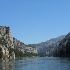
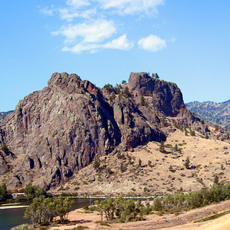
Adel Mountains Volcanic Field is a large volcanic area in central Montana with many vents, lava flows, and rock formations that shape the landscape. The dark basalt fields alternate with lighter rock outcrops, creating a patchwork of varied geological structures across the terrain.

This volcanic area formed about 75 million years ago during the Cretaceous period and shaped Montana's geology significantly. Scientists began systematic geological studies of the formations only in the middle of the 20th century.

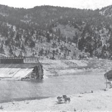
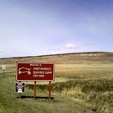
The landscape was long used as a hunting ground by Native American tribes following bison herds across the open terrain. Today, walking through these spaces offers a sense of how important movement and migration were to life in this region.

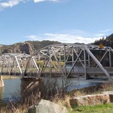
Interstate 15 crosses through the area and provides several viewpoints and access areas for exploring the landscape. Good preparation for walking on uneven ground and changing weather is important for a visit here.

The area contains significant deposits of shonkinite, a rare rock type found mainly in Montana and Ontario. This particular stone composition is a feature that geology enthusiasts encounter in very few places around the world.

The community of curious travelers

AroundUs brings together thousands of curated places, local tips, and hidden gems, enriched daily by 60,000 contributors worldwide.

Start exploring
Location
GPS coordinates
47.07610,-111.70700
Latest update
December 12, 2025 07:59
Around this place
Hauser Dam
United States of America

Hauser Dam

37.2 km
Gates of the Mountains Wilderness
United States of America

Gates of the Mountains Wilderness

29.2 km
First Peoples Buffalo Jump State Park
United States of America

First Peoples Buffalo Jump State Park

48 km
Holter Dam
United States of America

Holter Dam

24.6 km
Canyon Ferry Dam
United States of America

Canyon Ferry Dam

47.6 km
St. Peter's Mission Church and Cemetery
United States of America

St. Peter's Mission Church and Cemetery

29.8 km
Hardy Bridge
United States of America

Hardy Bridge

14 km
Tower Rock State Park
United States of America

Tower Rock State Park

14.8 km
Helena Montana Temple
United States of America

Helena Montana Temple

54.6 km
J. C. Adams Stone Barn
United States of America

J. C. Adams Stone Barn

51.7 km
Black Sandy State Park
United States of America

Black Sandy State Park

39.2 km
St. Ann's Cathedral
United States of America

St. Ann's Cathedral

57.3 km
Montana ExpoPark
United States of America

Montana ExpoPark

56.9 km
Dearborn River High Bridge
United States of America

Dearborn River High Bridge

56.5 km
Kluge House
United States of America

Kluge House

56.8 km
Cascade County Courthouse
United States of America

Cascade County Courthouse

57.1 km
Timothy Edwards Collins Mansion
United States of America

Timothy Edwards Collins Mansion

56.1 km
Masonic Temple
United States of America

Masonic Temple

57.2 km
Lewis and Clark County Hospital Historic District
United States of America

Lewis and Clark County Hospital Historic District

56.4 km
Lee M. Ford House
United States of America

Lee M. Ford House

57.3 km
Margaret Block
United States of America

Margaret Block

56.9 km
Electric City Water Park
United States of America

Electric City Water Park

56.3 km
Mann Gulch Wildfire Historic District
United States of America

Mann Gulch Wildfire Historic District

27 km
First English Evangelical Lutheran Church (Great Falls)
United States of America

First English Evangelical Lutheran Church (Great Falls)

57.2 km
Great Falls Central Business Historic District
United States of America

Great Falls Central Business Historic District

56.9 km
Liberty Theatre
United States of America

Liberty Theatre

56.4 km
Trinity Lutheran Church (Great Falls)
United States of America

Trinity Lutheran Church (Great Falls)

57.5 km
Craig Bridge
United States of America

Craig Bridge

19.3 km
Show the full map
Reviews
Share your experience

No review yet

Discussions
Start a discussion...

No discussion yet

« Adel Mountains Volcanic Field - Volcanic field in west-central Montana, United States » is provided by Around Us (aroundus.com). Images and texts are derived from Wikimedia project under a Creative Commons license. You are allowed to copy, distribute, and modify copies of this page, under the conditions set by the license, as long as this note is clearly visible.

Discover hidden gems everywhere you go!

From secret cafés to breathtaking viewpoints, skip the crowded tourist spots and find places that match your style. Our app makes it easy with voice search, smart filtering, route optimization, and insider tips from travelers worldwide. Download now for the complete mobile experience.

Around Us App Screenshot

A unique approach to discovering new places

Le Figaro

All the places worth exploring

France Info

A tailor-made excursion in just a few clicks

20 Minutes

Around Us
Travel Guide & Maps
Download

Send to your phone

QR Code
1

Open the camera app on your mobile.

2

Point at the QR code with your camera. A notification will appear.

3

Tap the notification to open the link.